Saturday, January 30, 2016

Fabulous Fotos From Fatcycling

We`ve been having a great time riding for the past few weeks with Dan and Gina. As a bonus, because Dan is a legitimate photographer, we now have some sweet photos of us! Check them out below.

Danny at El Tromen

Tam and Gina squaring off (Tam on Gina`s fatbike)

Danny carrying up Copahue

Smoky volcano singletrack

Helping out with a horse

Sometimes you gotta push

Kickin` up some dust

Tam shredding up some singletrack

Tam making up her own carry method to cross this river

Beautiful trails

Arm workout for the day

More beautiful trails

We bought pasta in a small shop to try out the stove thing for a few days... Tam`s face says it all

Danny and Gina cruising up near a volcano

Some crazy people in front of Volcan Lonquimay

Gotta love the vistas of Patagonia

Monkey Puzzles and Mudslides, January 26th-29th

Lonquimay-Quinquén-Melipeuco-Cunco-Trafanpulli-Caburgua-Pucón

It`s sad to say goodbye to our wonderful little cabaña in Lonquimay and the cute lady who runs the place, but we're always excited to get on the road again. Soon we`re back on a remote dirt track that, unfortunately, has a lot of traffic. I guess that's what happens when you're traveling during summer vacation in a country where poeople can afford personal cars. In many ways, in Chile, I feel like we're back in North America.

Happily, we lose the traffic when we turn onto an even smaller dirt road that takes us through tunnels of monkey puzzle trees, along gentle meadows, and across muddy streams. In the afternoon we reach a section of forest that has been recently burnt, giving the impression that it's autumn.

Riding through monkey puzzle tree forest

The textured bark of the araucaria

As we descend through a striking granite canyon, we are surprised to encounter a group of guys with a large rifle set up on a tripod. It seems to be aimed at a coke bottle on the bridge? We're not sure what to make of them, but they turn out to be a funny and helpful bunch. They recommend a camp spot, and we find an even better one: soft pine needles blanketing the flat banks of a clear-flowing river, and a big log to sit on.

It's tough to start the next day when everything seems to be going wrong. I notice that some creature seems to have chewed a large hole in the side of my plastic bowl overnight, one of our stakes is so stuck in the ground that it takes five minutes to get it out, and my bottle cage is falling off my bike. Luckily, the day turns around for the better as we begin to bike and spot a double rainbow arching over the sky. As we get the camera out to take a photo, it vanishes again into the mist.

The mysterious hole in Tam`s bowl

It's not long before we're in our first small town. When we see a post office, we stop to mail my journal home and Danny's postcard.  The "post office" is a tiny room scattered with papers and envelopes. I imagine that if you looked under some of these stacks, you could find things from hundreds of years ago. I'm honestly a bit apprehensive to mail anything here, especially because the elderly man hunched behind the counter doesn't appear to hear me when I say "buenos dias." My fears subside, however, when he comes over to the counter and looks up at me with twinkling eyes behind tiny round glasses. He helps me mail my stuff and makes me laugh at every step of the process. What a funny character.

It's been spitting rain all day, but it makes up its mind to really pour in the afternoon. We splash through another town and then down to Lago Colico, where we find a delightful covered pavilion.  None of us likes to pay for camping, but a covered dry area to set up the tents is worth it today. Plus, it's a beautiful setting.

The chainlink railing at Colico showing off newly acquired water droplets

The dock at Puerto Puma. Taken by Tam

A blue-and-white swallow in the rain

Picturesque little house near our campsite

We wake up to clearing fog and some nice views of the lake. The main road is a bit trafficked, so we're happy to turn off onto a smaller route, and discover some blackberries along the way! Not many are black and ripe, but we still immensely enjoy the few we find. It seems so weird to me that it's the beginning of blackberry season here, and it's January. The reversed seasons are still throwing me for a loop, but after being in the tropics for almost the whole last year, we`re happy to have any seasons.

Lago Colico in the morning light


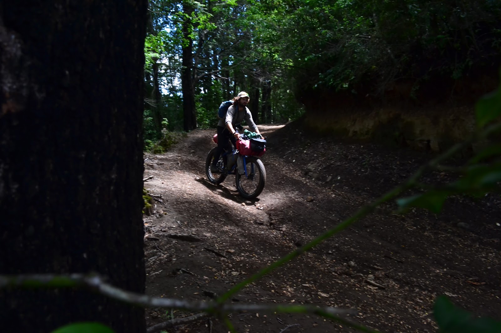
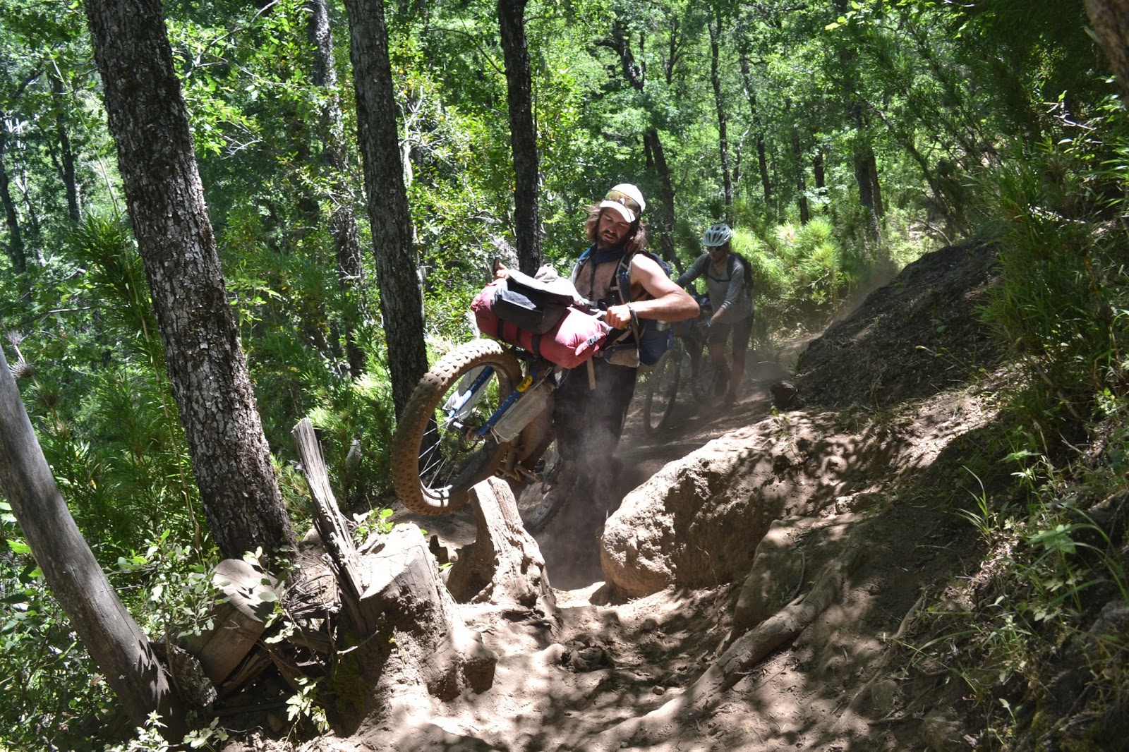
Late morning we turn onto a trail. We've heard that this route is transitable by jeep and it's the most direct route south to Pucon. How bad can it be? It seems that, again, our information sources were unreliable. The track is wide enough for a vehicle but certainly untransitable due to its extreme 4x4 nature. We traverse deep mud pits, piles of large logs, wide rivers, and steep rocky hills. We do our best to stay motivated by singing songs, but it's still a long and exhausting climb to the top of the pass. Just before the top, we find a grassy area to stop and collapse for the night.

The morning brings us blue skies and better riding. We have a big descent, and although our trail is still extraordinarily muddy, it's mostly ridable with numerous sections of incredible mountain biking. Woohoo!

Tam choosing the best line

Dan descending through the forest

A picturesque little house we came across

How you know you`ve chosen a good route: lots of mud on the bike

A dirt back road brings us to the outskirts of Pucon where we pick up a bike lane.  Immediately we are overwhelmed by touristy chaos. After the tranquility of where we`ve been, the traffic, the crowds, the hubbub of enormous supermarkets, everything much more expensive than it has been, it`s a lot to take in. We hang out in front of the library using the wi-fi, eating lots of fruit, people-watching, and trying to figure out where to stay the night. All the hotel rates are comparable to what you`d find in North America, aka too expensive, and we have a hard time explaining to people that we can afford to head to a campground but would rather not; why pay an arm and a leg to stay in a noisy place with no amenities?
People continually brush us off until a nice German lady comes to our rescue, directing us to a river a few fence hops away, a peaceful public tract of land amidst a checkerboard of private plots. Unfortunately, while chatting with us, her backpack is stolen out of her car just a few feet away. The first friendly person we`ve met, and this is what she gets. It`s safe to say that Pucon is not our favorite place, but it sure is scenic!

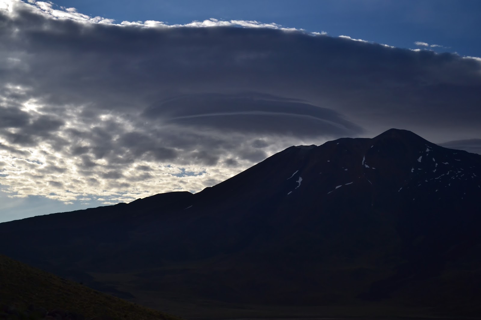
Volcan Villarrica overlooking Pucon

Route Notes:
- Lonquimay to Melipeuco: Perhaps the nicest bit of riding on the Monkey Puzzle Trail through the China Muerte Reserve: beautiful, quiet, smooth dirt roads. Melipeuco is a decent-sized town with all amenities and open wi-fi in the plaza.
- Melipeuco to Trafanpulli: We continued on the pavement to Cunco then headed south to Puerto Puma. The tarmac turns to smooth ripio at Lago Colico. Some traffic, most appeared to be tourists. Probably a very quiet route in winter. Trafanpulli, on the northeast side of Lago Colico, is not really a place, just a few houses here and there, but it marked our turnoff.
- Trafanpulli to Pucon: We took an adventurous shortcut directly to Lago Caburgua rather than staying on the main road through Reigolil and Curarrehue. It`s marked as a trail on Open Maps and is easy to find and follow (with GPS). There is a solid climb from 350 meters to 1140 over 14 kilometers, of which maybe 2/3 is ridable, the rest being too steep, too rocky, too muddy, or all three. The 6 km descent to Lago Caburgua is about 90% ridable, more for a strong rider. Expect mud if it has rained in the past few days.
With no views, this route may be less scenic than the long way on the road, but it certainly was more interesting! We began the ascent around lunchtime and reached the top around camp time, so the whole thing, Colico to Caburgua, is definitely doable in a day.
Once at Caburgua, there is a great dirt alternative to the congested, narrow highway into Pucon. Turn right before the turnoff to Ojos del Caburgua, and ignore the signs directing you back to the main road. Best to have a GPS, as there are lots of little tracks going nowhere.
Contact us for information on a free, quiet camp spot just a few kilometers from Pucon. I`d rather not post it here, as it`s probably illegal.

Bodega Calle

Welcome to the most beautiful place in Mendoza

A Fortunate Meeting
Last year while hiking near Bend, Oregon, Danny met a friendly guy named Kirk who happened to be hiking at the same pace. Kirk owns a winery just south of Mendoza and invited us to visit if we ever made it there. We love unexpected connections, and over a year later we finally got the chance to take Kirk up on his generous offer. We're far south of Mendoza now, but we wanted to put up this special post to commemorate our restful, happy few days at the winery.

154 Alberti: the street address of the winery and the name of their award-winning Malbec
An oak barrel, a frequent sight in these parts


The Story
When we arrive outside the gates of Bodega Calle, we are greeted by stylish Romina who welcomes us like we are old friends. The winery is spectacularly beautiful. The main room of the chalet has a long table under large windows overlooking grapes growing in the backyard. A side room has a bar for tasting and an excellent stereo. Next to the house is the bodega, where the wine is produced. The moment we walk inside our noses fill with the smell of aged wine. Walking the the medieval-looking passageways, we admire the oak barrels filled with wine then head upstairs to poke our heads inside giant concrete tanks where the grapes are added after the harvest. How do you know when the wine has aged sufficiently to move it to the barrels downstairs? You just know. Some sort of wine magic takes place here.

We spend two fantastic days in this little paradise, using the kitchen to cook up gourmet meals and then enjoying them with fine wines. We know nothing about wine, but the stuff they produce here tastes amazing.
Everything starts with these beautiful grapes...

...which are brought in here...

...with the help of some fancy machinery...

...to enjoy some time in lovely oak barrels...

...and then even more time in more lovely oak barrels...


...before making their way into stylish bottles...

...and finally providing the perfect complement to gourmet, homemade pizza.

The most important lesson we learned

 We can't give enough thanks to Kirk and Romina for sharing this incredible space and their tasty fine wines!

Gracias, Romina!

Monday, January 25, 2016

When Bikes Become Backpacks: Bushwhacking Our Way Into Chile. January6th-25th

Chos Malal-El Cholar-El Huecú-Copahue-Trapa Trapa (Chile)-Chequenco-Lolco-Malalcahuello

We decide that it's not worth it to cycle out of Mendoza. The next section along the 40 is dry, hot, and flat, and we don't feel like we would get much out of it. The challenge we are looking for lies down south in the Lakes District and Patagonia. We're not sure how things are going to work out, because not a single bus company wants to let us take our bikes on a bus, but we finagle our way onto a bus that eventually dumps us out on a dark street corner in a tiny town at 4:30 am.

In Mendoza, the dilemma of our room being too hot with the window closed or having too many bugs with it open leaves us with the natural solution: our airy, mesh tent set up on the floor
The next morning we spot an ancient-looking RV that has pulled up along the plaza. When we walk by we are greeted by Jaime and Myrna, who quickly become our new best friends. A couple of octogenarians from the coast of Argentina, they've been traveling around for years in this RV and happen to be heading the same way we are. Soon our bikes are loaded up inside and we're cruising (very, very slowly) to Chos Malal.

With Myrna in front of the classy old rig

We realize when we arrive in Chos Malal that our friends Dan and Gina are currently out at a nearby provincial park, El Tromen. With the help of the fantastic park rangers, soon we are out there as well, enjoying the scenic landscape and reuniting with old friends.

Looking out at El Tromen Volcano

At the top of Cerro Wayle, the peak across the way from El Tromen. With vistas of snowy peaks all around, this hike made for a grand entrance to northern Patagonia.


Finally we find Dan and Gina!
Danny playing with Dan´s camera

Alpenglow on El Tromen

Gina enjoying her morning soup outside our refugio

Lenticular clouds loom ominously over the volcano as we head out

The beautiful ride back down to Chos Malal. In the background is Cerro Wayle.
We stop at a local bike shop to replace our severely worn disc rotors before heading out. As we work on the bikes we pass around a mug of mate (pronounced MA-tay), a bitter, tea-like drink that's a requisite for any Argentinian morning. Chos Malal is also home to a bakery that sells huge brownies. And a cyclist in a bakery is always a dangerous thing...

My exhausted front disc rotor. Note how narrow the outer part is where the pads have worn it away

The days we spend riding from Chos Malal to the town of Copahue are not as nice as we expect. The road is washboardy and sandy in many places, and frequent cars bathe us in clouds of dust. But of course every boring ride has its fun moments.


An interesting road sign. Fortunately it wasn´t that steep, and no one got shot!

Dan and Gina ride fatbikes with 4¨ tires, making our 2.1¨ mountain bike tires look like toys.

Dan cresting a hill

This little guy joined us at camp one night


Outside of an artesanal brewery with a lovable Saint Bernard

A relic of the past

As we approach the town and the Chilean border, we are surprised to observe giant grey clouds of ash blossoming out of Volcan Copahue. At first we are nervous that the pass will be closed, but apparently this is normal. Our initial apprehensiveness turns to wonder as we approach the smoking beast and admire the blue lakes and thermals at its base.

Copahue is a small, rather touristy town known by many older Argentinians as the best place to retire. (I think this is due to the hot springs and not the extremely sulfurous air.) We arrive in town at just the right time: the lady who can give us our exit stamps isn't here every day and will be leaving in ten minutes! We rush into the local shopping mall where we find the tiny barebones office we need. In minutes we are officially out of the country and ready to head to Chile!

Immediately after the town of Copahue the road ends and turns to a trail. Dan and Gina have a lot of experience with what they call hike-a-bikes, and we're excited to learn from them as we undertake this one. Things start off with a bang as Dan shows us how to load the bikes on our backs and we hike up the first steep hill. The trail we follow into Chile is a horse track with various challenges along the way. But it's beautiful, and working together, we make steady progress.


Tam riding under smoking Copahue

Dan carrying up the first bit of trail, to the surprise of some tourists


Tam and Copahue in the reflection of Gina´s sunglasses

Trail decorations

Gina fording a river

Bikes become backpacks at Paso Copahue

Dan pushing up a sketchy section of trail

Bubbling volcanic fumaroles lend interesting colors to the dirt and a sulfurous smell to the air

Roaring waterfalls on a sunset stroll

As we reach our first road in Chile, we are stopped in our tracks by a close-up sighting of a condor cruising through the valley below. Silent, regal, white-ruffed monster of the skies, it circles and then soars away.

Our biggest question is, can we enter Chile legally through this border crossing? We know that other cyclists have done it, but there is no official immigration office. We roll up to the Chilean police, known here as the Carabineros, and hope for the best.
Although initially skeptical, the guy at the office calls his boss to see if he is authorized to stamp us in, and soon he's checking our passports and we are good to go!

Patagonia, trees, streams, finally we're in the land of green that we've been dreaming about! But before heading out for the next adventure in this paradise, we need to stock up for the next few days at the local store. Unfortunately, it has an abysmal selection of foodstuffs. We leave with our bags full of cheap cookies and pickled vegetables. Yum.


The good kind of traffic

A peruvian meadowlark adds some red to the greens of the landscape

We've decided to take a "shortcut," a route that cuts through the mountains and will avoid a detour out to the town of Ralco. The friendly officer from the Carabineros told us that it was mostly flat and passable by bike. The road turns into a trail and then turns a lot more interesting than we expected.
Not too happy with this road, although it was certainly easier than what was ahead

Not as smooth as we had hoped

Dusty tires

This colorful reptile, a thin tree lizard, popped in to check out the intruders while we were eating lunch

Through a tunnel of plants

The next morning we realize that our trail is going to take us up and over a much steeper climb than we had expected. Looking ahead, it's clear that we can't continue with the limited amount of food we have.

Luckily, there are a lot of "puestos" in this small river valley. What our map refers to as a puesto is a small shack, often with sheep or other animals nearby and a few people who are out here to take care of them. After asking around quite a bit we find two families who are willing to make us bread. It's the simplest kind, a huge round loaf from flour and water, nothing more, cooked in the coals of the fire. Here this style of bread is called a tortilla, a far cry from the flatbread of Mexico or the potato-and-egg omelette of Spain, both also known in the local jargon as tortillas. While we wait for them to bake it fresh I play soccer with some young kids who are clearly super excited to see a foreigner visiting their house.
With the knowledge that we´ll have food for the next few days, that bread tasted soooo good.

Finally, bellies full of deliciousness, we start battling our way up the hill. Long stalks of bamboo and spiky plants block the trail and hamper our progress. The four of us work together to push, carry, and bushwack our bikes up the hill. Almost four hours later, what a feeling of relief and achievement to finally reach the top!


My body aches everywhere in the morning from the battering it took yesterday. But what a beautiful wilderness we are in. You can't help but smile when you wake up in the shadow of majestic monkey puzzle trees and a view of a smoking volcano.

There's not much more to the climb, and when we reach the top there's a surprise waiting! A group of horsemen from the Chilean army is taking a break in the shade. They give us helpful info on the trail ahead and then fill our bottles with some Gatorade and our bags with tasty snacks. What nice guys!

Turns out that the trail does get better ahead. We find some scenic single track that looks rideable! There are some tricky sections that make me nervous, but both Dan and Danny help me learn how to ride through them, and soon I have a big smile on my face. Turns out that singletrack can actually be fun!


The classic araucaria, or monkey puzzle tree
Battling our way through some brush


Even just a couple of days with limited food makes you appreciate the smallest stores. The places we pass through on the descent are so small that they can hardly be called towns, but the food we find is enough to rejuvenate us for the next section of our ride.
The pushing isn't over yet. We start the next day with a long, steep and dusty uphill from the river. Finally at the top of the climb we're on our bikes and riding again. Unfortunately the roads ahead aren't the easy ride we're dreaming of. We spend a hot and dusty afternoon winding our way up and down steep inclines, finally collapsing by the banks of a clear river. Everyone is grateful to wash off in the cool water and enjoy giant pasta dinners.

The following day presents us with spectacular scenery as we pedal up through giant monkey puzzle tree forests and then along the side of an enormous volcano.


Just before lunch things grind to a halt as Danny's back wheel seizes up and refuses to turn. It seems that his rear hub has completely failed, a rare occurrence that it happened with no warning. Luckily we are at the top of the climb and near enough to civilization that it's an easy coast downhill into the nearest town.

Where do we go from here? Gina has to hitchhike to a nearby town to pick up some bike tires that she and Dan mailed to themselves before their trip. We decide to go with her and see if the bigger town will have the parts we need to fix Danny's wheel. Hitchhiking is easier than we expect. We walk up to the road, stick out our thumbs and the first car picks us up. Awesome.

So begins a fruitless search for bike parts and mechanics, and a lovely evening at the house of our warmshowers hosts. We learn enough to see that we will need to go to a bigger city to get the parts we need.


The following day, Danny and I zip off via bus to the city of Temuco where we easily find a shop where we can rebuild Danny's wheel, not to mention a supermarket with couscous! The glory of big supermarkets, real bike stores, and the general hustle and bustle of the city is exciting and exhausting at the same time. We are both happy to bus and hitchhike our way back to the town of Malalcahuello where Dan and Gina are now waiting with our bikes.


We're facing a dilemma. We could ride on the dirt road we were planning on taking to Lonquimay, but there's a big climb and we haven't had a rest day in ten strenuous days. The other option is to ride the paved road, but this would take us through a long, narrow tunnel that bikes are not allowed to pass through. We decide to try and hitchhike. Although, who's going to pick up 4 cyclists?

We're more than surprised when, just a few minutes later, all four of our bikes are strapped to the back of a pickup truck and we're laughing our way down the highway with some new friends. We're stopped at a police checkpoint where they are unhappy about the number of people in the car, but it turns out that our driver has a close relative who is an army colonel- so we're clear to pass! As we unload the bikes in Lonquimay, the family who drove us gifts us a bottle of wine! We feel like it's us that should be thanking them! What wonderful people we meet. I never stop being amazed.

It's time for a true rest day, so we splurge a bit and decide to share the cost of a cabaña- our own little house for this afternoon and tomorrow. Time to cook up some good food and drink some wine! Cheers to Chile!

To Jaime and Myrna, Rody and Coco, Kate, Andy and the other folks at the ski/bike shop in Malalcahuello, Pascal and Viviana, and so many others who helped us through in some way or other; thank you all so much!


Route Notes:
- Chos Malal to Copahue, 3 days: Chos Malal has accommodation, camping, restaurants, shops, internet, ATMs, and a decent bike shop. We took Ruta 40 south out of town, veering west onto ripio after about six kilometers. El Cholar has shops and basic accommodation. El Huecu has shops, restaurants, accommodation, internet (though it wasn't working when we passed through), and ATMs. Very little water en route, although streams become more frequent as you progress west. Strong westerly winds in the afternoon. Road surface is generally good but not great, and the traffic, much more in many sections than we had anticipated, made going somewhat frustrating.
Copahue is a very touristy little town with hot springs, expensive shops, camping, ATMs, internet, and restaurants.

- Paso Copahue, 1 day: There is one woman in Copahue who stamps travelers out of the country. Her office is in the shopping mall next to the hot springs in the center of town; ask for migracion. She seems to have odd work hours, so be prepared to wait around.
The trail up to the pass begins next to the campground on the southwest end of town and switchbacks steeply and obviously up the hill. Follow it down the next valley into Chile. Much of the roughly 7 km of trail is rideable, although there are numerous sections where pushing is necessary due to jumbles of volcanic bowling balls. The trail follows a river almost the whole time, so water is easy to find. Near the end of the trail is a sandy, narrow traverse where a light bike is a boon. Pannier travelers may have to shuttle gear.
The trail turns to road near some hot pools and drops steeply for a few rocky kilometers before flattening out and bringing you to Trapa Trapa. The Chilean carabineros are located a few kilometers before the scattered houses that represent the town, and though the friendly guys there may not know it, they can stamp your passport for entry (other documents are not accepted). Ask them to call their boss if they initially refuse. About 3 km after the carabineros is a little store on the right with very basic items. Ask around, as it's unmarked.

- Trapa Trapa to Chequenco, 2.5 days: Instead of continuing on the road to Ralco, we followed Section 5 of the Greater Patagonia Trail up the canyon south of Trapa Trapa and past Laguna El Barco. The turn is just about across the road from the shop.
At first the trail follows a narrow river valley south and uphill. Lots of steep undulations. After about 10 km the valley widens and flattens out while passing the occasional ranch house; almost all of this part is rideable, and there are tons of fantastic camp spots. We were also able to buy bread from local families. There are many trails in this area, the main one crossing the river a few times then climbing steeply up the right (west) side of the valley to an obvious notch. There's plenty of water for the first bit but no water from about halfway up this climb until the trail begins to descend on the other side of the pass when it nears Laguna El Barco (although you never actually see the lake). Our six liters each was sufficient.
There were three more climbs after the big one, but they were always shorter and pushable rather than necessitating carrying. Once over the top, after all the climbs, the trail trends consistently downhill, eventually meeting a road near Laguna El Barco that takes you to the main road at Chequenco. There are numerous streams along the road and a couple of stores, the biggest one in the area being a few hundred meters west of the junction with the main road at Chequenco (where our route meets the Monkey Puzzle Trail). For info on and a GPX track for the Greater Patagonia Trail, see here
Note: do not underestimate this route! We were able to cycle maybe half of the distance, and when the trail was good it was great: singletrack through shady Monkey Puzzle Tree forest or out on open subalpine plains. But it was also frequently difficult and slow, including a hot, dusty carry up a very steep horse trail that took us numerous hours. Expect little daily progress with a lot of effort.

- Chequenco to Malalcahuello, 1.5 days: We followed the Monkey Puzzle Trail towards Lonquimay, diverging to Malalcahuello and eventually Temuco to fix a bike issue. Notes here and here.
Malalcahuello has a small ski/kayak/bike shop with general tools and basic parts. Curacautin has a poor shop near the plaza, Casa Llaima, and an energetic mechanic who works out of his house on the west end of town; ask around for Rambo. Temuco has plenty of bike shops along Lautaro between Mackenna and Manuel Antonio Matta.

For Dan and Gina's take on all our shenanigans and this route, check out their blog here.