Lago Verde-La Tapera
Used only by a handful of cattle ranchers, the track connecting the northern Patagonian hamlets of Lago Verde and La Tapera remained for centuries no more than a difficult horse track. In 2009 it was cleared and revitalized in efforts to create the country-traversing Sendero de Chile, and then in 2016 was given another facelift, connecting these two villages with a road for the first time. We were fortunate to be some of the first to traverse this new track, undoubtedly the first on bicycle; the 80 kilometers took us two days. Though rarely smooth and never easy, the rewards were ample: solitude, fantastic technical riding, and a challenge unlike anything else in the area.
We´ve divided the ride into nine sections, each distinct from the last in its own way. Distances are approximate, and rideable estimates are based on us: fit riders on light bikes, but not particularly strong technical riders.
Section 1: Pastures and Forest. About 18 km, 100% rideable, smooth dirt surfaces.
 |
| Smooth two-track |
 |
| Go ahead! |
 |
| The cows are coming! We obliged and quickly got off the road |
 |
| Crunchy leaf litter |
 |
Doesn´t get much better than this
|
 |
| Just in case you´re not sure what you´re doing |
Section 2: Big Climb. About 4 km, 20% rideable. The surface is decent, but the sustained steep grades had us pushing for a while. Very muddy near the top.
 |
| Slippy, slidy pushing |
 |
| This little guy, a chucao tapaculo, was very curious about these strange visitors to its forest |
 |
| A fact of life when cycling: flat tires. We got 15 patches out of this tube before the valve broke. |
Section 3: Descent. About 6 km, 95% rideable. Undulate in more mud before descending steeply to follow a clear, bubbling river through serene old-growth forest.
 |
| Steeeeeep |
Section 4: Ascent. About 5 km, 5% rideable. Climb away from the river. Very steep and muddy.
 |
| The top? Please... |
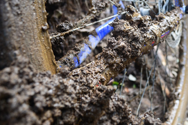 |
| There´s a bike under all that mud |
Section 5: Meadows, Forest, Rivers. About 15 km, 99% rideable, all except some muddy sections near the top. Gradually wind through scenic alpine lakes and meadows before descending in a shady forest to a river. Follow it for several kilometers, crossing it numerous times.
 |
| A Chilean flag at the top of the climb. Part in of this route is technically in Argentina, though all the Chileans we talked to claimed the land belongs to them. No one seems to care enough to dispute it, because no one lives there. |
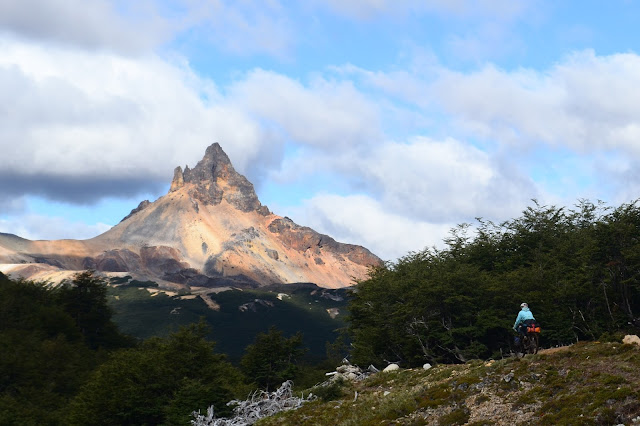 |
| Colorful peak |
 |
| Roughly half of my memory card is just photos of this mountain |
 |
| Grassy tracks and scenery |
 |
| Perfect |
Section 6: Open Country. About 4 km, 99% rideable, all except some steep uphills. Mud becomes sand as the trail climbs from the river over a small hill.
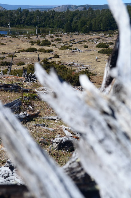 |
| Deadfall litters the suddenly dry landscape |
Section 7: Rio Caceres. About 10 km, 99% rideable, all except the very steep ascent after the river. The river is wide but also very shallow, an easy crossing. Sandy flats bring you to the foot of the last big climb.
 |
| Scenic descent |
 |
| Watch out for traffic |
Section 8: Out of Breath. About 4 km, 80% rideable. After the first sunny push, the trail enters a shady forest. The steep ups require frequent breaks but are definitely rideable.
 |
| Reaching the top, my bike deserves a rest... |
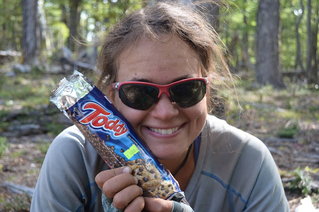 |
| ...and we take a break to inhale some of our favorite cookies! |
Section 9: A Final Adventure. About 11 km, 99% rideable, all except for a few hundred meters of exceptionally steep, rocky descent. Follow the track through forest and pastures to the town of La Tapera, crossing the Rio Cisnes just before reaching the town. The river is wide and shallow, but swift.
 |
| Mountain biking at its best. |
 |
| It´s possible to push the bike until the current begins to drag it away. Then, hold on tight. |
Stats
Distance traveled: 80.95 kilometers (starting a few kilometers from Lago Verde and including a few side tracks we temporarily got lost on)
Moving time: 11 hours, 56 minutes
Ascent: 2,360 meters
Min/Max Altitude: 350/1234 meters
Considerations:
- If coming from Argentina, you´ll have to descend about 200 meters over 4 kilometers to the town of Lago Verde, stamp in at the carabineros (first building on the right), then turn around and head back uphill. The entrance is about 500 meters from the border. It´s also possible to take an old horse track from town and meet up with the road about 6 km later. This track also looked transitable by bicycle, at least where we met up with it. Download the GPS file for Section 22 of the Greater Patagonian Trail for that trail, which mostly shares and sometimes parallels this road.
- We took just over two full days of riding, but plan for more, as the terrain is difficult and help would be very far away. Food is available in Lago Verde and La Tapera.
- Wild camping is available almost anywhere en route.
- Water is found frequently, including during the big climbs. We never carried more than three liters each, and I don´t believe we ever used it all before coming to our next source.
- The mud in sections 2 and 3 was definitely exacerbated by weeks of rain before we arrived, but expect mud always in those areas, even if it would be slightly better at dry times. During winter and spring, this track may even be impassable on foot or bike due to exceedingly wet, muddy conditions and high rivers.
- If you´re going the other way, more of the track would probably be rideable due to longer, more gradual ascents and steep, brake-killing descents.
Route-Finding Details:
GPS track
here.
There are lots of unsigned forks near both ends of the route, so a GPS would be best. If no GPS, here are the turns:
- Immediately after turning south onto this route, take an immediate left through a gate. The newly cleared right track also meets up later, but it was blocked by a fence when we passed.
- About 50 meters later, stay straight.
- A few kilometers later, stay right.
- Pass through some gates, and after a few more kilometers, stay left. This junction is just after a gate and there´s a sign on a tree that says ¨Excursion.¨
- About 15 km later, after descending to and climbing away from a river, stay left.


You guys are providing great incentive to keep going! Keep it up. Bon Courage!
ReplyDeleteThanks, Debbie! Big hugs to you and Lothar.
DeleteWe are really grateful for your blog post. You will find a lot of approaches after visiting your post. I was exactly searching for. Thanks for such post and please keep it up. Great work. get information
ReplyDelete