Uyuni-Ramaditas-San Cristóbal-Rosario-Vilama-Soniquera-Quetena Chico-Uturuncu-Laguna Colorada-Sol de Mañana-Polques-Hito Cajon-San Pedro de Atacama (Chile)
Leaving Uyuni we take the main road almost straight south towards the
great mountain of Uturuncu. There's a bit of traffic, but the wind is in
our favor and blows all the dust the vehicles kick up away from us. For many sections it is almost as if we are riding
on pavement.
November 9th is Danny's birthday. It's hard to do
something special here in the middle of Bolivia but we have a fun
evening playing games in the tent. Plus, it's not every
birthday you get to spend camped in a llama pasture. These are the ones
you never forget.
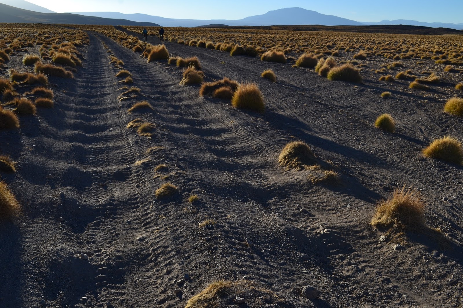
The next day comes our first true experience of the rough Bolivian roads we've heard so much about. The road quality deteriorates, turning eventually into one of the worst we have ever ridden.
 |
| Bump bump bump bump bump bump bump... |
Slowly we chatter our way along sandy washboard, trying to enjoy the expansive landscape, but mostly focused on the ride. When we stop for lunch, a huge sandstorm whips up out of nowhere and fills our mashed potatoes with a bit of extra "seasoning." It's a long day and we're ecstatic to reach the small town of Soniquera where we can refill on water and the small shops sell us cookies. Even better? The people at the local health center are super welcoming and let us camp out back.
 |
| The path of least resistance is not always on the road |
The next morning we wind through a canyon and climb a small pass before, in early afternoon, we reach the entrance to the Eduardo Avaroa Andean Fauna Reserve. Here we pay a fee of 150 bolivianos (US$21.50) each for 4 days in the park, although the ranger explains that cyclists are allowed to stay longer because they realize that we go slowly. I just hope that they use some of our money for road improvement. Maybe then we wouldn't go so slowly.
 |
| The park is full of mineral reserves, like this iron-rich sediment that sticks to the circular magnet on my bag. |
After fighting a raging headwind all afternoon, we reach the town of Quetena Chico. We're a bit dismayed that the town, this tiny collection of adobe huts and overpriced tourist hotels (slightly larger huts), has spent a huge sum of money on a new, bright green, turf soccer field. They must love soccer a whole lot. It's a strange place. Tourism is popular here, the popular jeep tours from Uyuni stopping here for a night on their hectic but beautiful few days around the colorful
lagunas (more on those later). When we go out looking for food, we are told that there are no restaurants and that our jeep driver should be arranging food for us wherever we're staying. We eventually find a friendly lady who makes us a simple meal of rice, eggs, and potatoes for a few bolivianos.
I wake up nervous. Today we are going to attempt to climb the 6,000 meter volcano Uturuncu with our bikes, something I never imagined I'd be doing. As we walk outside in the early morning, the sun is just beginning to light up the sky. The first bit of road is sandy and we bike through a thin crust of ice on a shallow river. At 8:30 in the morning we're feeling pretty good about ourselves; we've completed 15 kilometers, half the distance up the volcano. Unfortunately, we've done almost none of the elevation. It's time to start climbing, and with expectations of steep rock piles as a road, Danny and Hannes both comment on how great the road is. I don't think anyone should call this road "great." Rideable, perhaps, but not "great."
I guess everything is relative.
 |
| "Great" road |
At 5,000 meters we celebrate a new altitude record for the highest we've ever biked, woohoo! Then we keep riding.
 |
| Tam heading up |
Slowly
things get tougher. The road is super steep and filled with large
rocks. Most parts of it would be challenging to ride at low elevation, never
mind up here. The momentum we need to power over the rocks leaves us
exhausted and out of breath. We end up walking large sections.
 |
| Hello, hill. One of the good sections, just steeeeeep |
After walking an especially rough section up to 5,500 meters, Hannes and I decide that there's no point in bringing our
bikes along if we're not riding them. We drop them in the boulders and walk
the remaining three kilometers to the saddle. Danny meets us there, having been pleasantly surprised by the relatively smooth last section to 5,760 meters (about 18,900 feet).
The saddle
between the two peaks of our mountain is steaming with sulfurous
hydrothermal activity. Along the road, small vents covered in brilliant
green and yellow algae send up plumes of vapor. We hope that we don't plunge
through some thin section of crust into some boiling chamber below, but the recent tire tracks indicate that we should be okay.
 |
| Steam vents accompany a sulfurous smell as we approach the saddle |
 |
| A steam vent |
|
|
|
|
|
|
|
|
|
|
Danny drops his bike behind a boulder and we hike to the top on solid scree rock. We are exhausted by this point and walking slowly, but it's not too long
before we reach the summit at 19,711 feet and are rewarded with spectacular views of
the red, windswept landscape. From here we can see Chile and Argentina,
but I'm not sure where Bolivia ends and those countries begin. Far below
are various brilliant lakes of blue, yellow green, and milky white. The
only town we can see is a glimmer of the building of Quetena. I wave to
Julia, the only smart one who decided to take a rest day today.
 |
| Hugs on the summit |
 |
| The remains of some colorful flags |
 |
| An iron-filled mountain nearby |
 |
| We made it! |
The first part of the descent is really tough, steep, rocky and technical. But the more we go down, the more oxygen we have! We bump and crash our way down, racing the sunset, and ride the last bit just as darkness sets in.
 |
| Bumping our way back |
Our hotel is super warm and Julia has prepared food for us, a wonderful surprise after a crazy day.
 |
| Good night, Uturuncu |
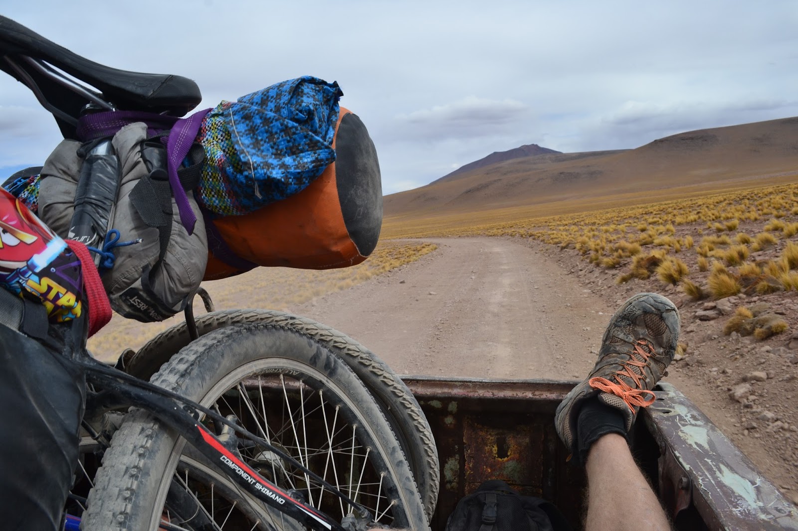
None of us is feeling particularly motivated the next morning, and we don't like Quetena Chico enough to want to stay another day. We head off slowly up the pass out of town, and later, while taking a break in the shelter of some rocks, a rickety truck drives by and we decide to see if we can get a ride! Success! And we didn't miss out on anything; I still felt every bump in the road, just at a faster pace.
 |
| Fast-forward |
|
|
|
 |
| Our first view of Laguna Colorada |
That evening we end up camping in the town of Huaylajara, where all eight buildings are hotels, and are
gifted some potato chips and beer by some friendly jeep tourists. Later we
join them for dinner (our second dinner) and have an amazing evening
with lots of food, drinks, and funny stories.
A huge thank you to Mark, Stefan, and the rest of the crew! We'll see you down the road.
Rather than begin biking up the next pass, we spend all of the next morning hanging out with the flamingos at Laguna Colorada. There must be thousands of them out here. We do our best to analyze the colors of their beaks, butts, and legs to differentiate the three different species that nest here. (We spot all of them!)
 |
| Look at all those flamingos! |
 |
| A graceful James flamingo |
 |
| Delicate-looking birds in harsh conditions |
After saying goodbye to the flamingos, we start up the pass, our highest in Bolivia. It's not a huge climb, as we're already starting pretty high, but the blasting headwind and sandy, washboardy road (it's somehow both at the same time) make going rather slow.
 |
| Evidence of the hordes of jeep tours |
 |
| Julia powering through some sand |
We don't even make it to the top of the pass, ending the day huddled behind the only windbreak we can find in this desolate landscape. One of our most difficult cycling days also ends up as one of the shortest.
A frigid breeze is already blowing when we set out in the morning. Our first stop is the geyser Sol de Manana, a large hydrothermal basin filled with bubbling pools and clouds of sulfurous smoke. The landscape is active and colorful, painted with streaks of red, pink, grey, green, and orange.
 |
| Steaming landscape. Technically fumaroles, not geysers. |
 |
| Bubbling mud |
The fumaroles are pretty neat, but the real treat is coming this afternoon...
A big descent takes us to a brilliant blue lagoon and hot springs! Before soaking in the amazing pools we hang out by the restaurant, and some extremely friendly jeep drivers load us up with delicious lunch leftovers. These guys might be crazy drivers, but they sure are friendly!
 |
| Soaking up the heat |
 |
| Beautiful mermaids |
It's hard to beat an afternoon filled with free food, flamingos, and floating in relaxing hot tubs.
 |
| A vicuna keeps us company |
The next morning sees us through some more spectacular scenery, and although the wind is already blasting by 8 am, the road is much less disastrous than before.
 |
| the Piedras de Dali, "Stones of Dali," reminiscent of Dali's surreal landscapes |
 |
| A colorful mountain |
 |
| Laguna Verde, the "Green Lake", with Licancabur Volcano in the background. The lake's brilliant color is caused by its high levels of arsenic and copper. |
 |
| Tam cycling on the moon |
Too soon we reach the
refugio at Laguna Blanca and have to say our goodbyes to Julia and Hannes. They are catching a ride back up north for some time in the jungle before heading back to Germany. Fortunately, however, the bitterness of goodbye is tempered by a couple of long-lost hellos. We are excited to encounter Aritz and Esti from the Basque region of Spain, whom we had met a few weeks before, and, after riding with them to the border, we find none other than Chris, our British mate whom we coincidentally met in numerous cities in Peru! It is a small world, indeed, and I'm sure our paths will cross in the future with Chris and other friends in unpredictable ways.
 |
| The surprisingly busy Bolivian migration. Chilean immigration is 40 kilometers away in San Pedro de Atacama, so we had to content ourselves with... |
 |
| ...this sign. Chile! Facing the wrong way, but exciting nonetheless |
 |
| Pavement, yea! "There's a truck coming, just take the picture anyway!" That's Aritz on his back, Esti on the right side |
 |
| Chileeeeeeeeeeeeeeeeeeee |
The two of us are excited to reach Chile for reasons in addition to the beautiful, smooth pavement. Within a day of reaching San Pedro de Atacama, we find ourselves on a flight to the U.S, a much-needed break and visit to our families in the works. A thousand thanks to Aritz, Esti, Dan, and Gina for making our quick departure possible, and to Andie and Michel for arranging the whole thing! We're excited to see our families for the first time in a while, and, in addition, to celebrate a holiday centered around food. More adventures in a few weeks!
Route notes:
- The north part of the more famous
laguna route runs slightly west of where we went. See
here also for a solid guide, though the roads are better (just slightly...) than they let on.
- We headed south from Uyuni towards Ramaditas in order to be slightly off the most traveled jeep track and to set ourselves up to climb Uturuncu. Ramaditas (50 km from Uyuni) has water, maybe a shop. San Cristobal has a decent market with real food, pasta and such. About 10 km after San Cristobal we turned left, a shortcut through Rosario (water) and Vilama (water, perhaps a small shop). The last 30 km approaching Soniquera (water, small shops) were awful, lots of sandy and washboardy pushing and bouncing. Don't expect to go very fast...
- Soniquera to Quetena Chico (water, slightly larger shops, restaurants, accommodation) was another relatively rough day, though nowhere near as bad. Though exhausting, climbing Uturuncu was incredible; see
here for all the details.
This site also has an interesting account.
- The road from Quetena Chico to Laguna Colorada was where we got a ride, so I can't give a cycling perspective, but it was pretty rough in the truck.
- Laguna Colorada to Sol de Manana "geyser," about 20 km or so, was really rough and sandy, but the road improves after that and stays good (less bad, really) to the border. No water at Sol de Manana. At the hot springs there is water, leftovers from jeep tourists, and some buildings under construction that made a decent camp spot.
- On the south shore of Laguna Blanca there's an abandoned hostel, a fantastic camping option. Apparently it's prohibited to camp there, so just make sure the awful ranger at the
refugio 1 km away doesn't know you're there. Even if she does know, you probably won't have any problems; she didn't even check around the side of her building to see if we were camping where she said we had to.
- Bolivian immigration didn't charge us the 21 boliviano fee we had heard about to leave the country; maybe the rules had changed. They can also change money there at the border, at a more fair rate than in San Pedro.
- Chilean immigration in San Pedro de Atacama is a fairly straightforward process. Just remember, you can't bring any meat, dairy, or plant/animal products into Chile.
- At 5,000 pesos (US$7) per person per night to camp, Aji Verde hostel in San Pedro seemed to offer the cheapest option for lodging. With a nice kitchen and courtyard as well, and fast wi-fi, it was a decent deal.
If going this route, it's unnecessary to bring all your food from Uyuni like we did. Quetena Chico is expensive but has enough to outfit you for a few days with pasta, mashed potatoes, bread (on certain days), and other simple items.