Kasani-Copacabana-Tiquina-Huarina-Batallas-Pucarani-Laja-Viacha-Coro Coro-Callapa-Cosapa-Wila Kkolki-Sacabaya-Bella Vista-Sabaya
We decided to take a bus from Cusco to the border at Copacabana because our visa for Peru was running out, and we wanted to make sure to ride the salars in Bolivia before the thunderstorms and rain started. Thus, we invested in a luxury bus that had wide, fully-reclining seats and would carry us through the night to Bolivia. It was a good investment, and we slept well on the double decker behemoth of a bus.
October 26th
Our bus drops us off early morning at the side road where we will take a smaller bus to the border crossing. The big buses can't go this way because you need to take a ferry to continue through Bolivia, and the ferries do not accommodate double decker buses. Some of the backpackers on the lower level are quite furious about the change in buses, since at the bus station in Cusco, the ticket we bought is advertised as "Direct to Copacobana." In reality, none of this is true. The bus is neither direct, nor does it go all the way to Copacobana. We are dropped off at the border and told to find another small bus leaving from the other side.
 |
| Entering Bolivia |
 |
| The border office. We appreciate the clear markings, ¨Migracion¨ |
The agent at the border seems to hate us from the moment we say we're from the U.S. No other country's citizens have to pay to enter Bolivia, but US citizens must pay $135 for a visa*. At least, we had heard that it was $135, but we find out on arrival that the price has recently gone up to $160. We had some extra money with us, but not that much! We pool every cent that we have with us on the desk and the border guard carefully examines each bill. One twenty has a tiny rip in it, maybe 2 mm, and he gives it back to us, saying that we still owe twenty. We plead that this is all the money we have, and eventually, reluctantly, he accepts our "ripped" bill.
Other visa requirements include:
1) Color mug shot on durable photo paper. We are prepared with photos, but they aren`t the exact shape, size, and paper that Bolivia needs, so we have to borrow 20 bolivianos from another tourist to pay to get our photos taken. Thanks, Christian!
2) Copy of passport not expiring in the next six months
3) Copy of yellow fever vaccination
4) Proof of purchase for your plane ticket leaving the country
5) Documentation showing where you're staying in the country (your hotel and contact info for your tour agency) and how you are traveling there. Options include plane, train, boat, or car. There is no "other" box.
Clearly we cannot provide some of these, but the guy finally, begrudgingly, prints out visas and pastes them in our passports, saying that he's only letting this slide because he can see our loaded bikes outside. I think he just wants to get rid of us. We`ve been there for over an hour.
*It`s important to note that this fee is a ¨reciprocity fee¨ charged in response to the requirements for Bolivian citizens to acquire a U.S. visa. Although it seemed like a huge bother to us, it`s much more difficult for citizens of other countries, especially developing countries like Bolivia, to visit our country. Someone told us that Bolivians are required to prove that they have $10,000 in the bank as one of the visa requirements. We have it good.
Finally, in Bolivia! Before we can leave the border area we are stopped by a guy who is filming a documentary for the Discovery Channel. He asks us a few questions and films us with his huge, fancy camera. He says that the goal of the documentary is to show how it's possible to travel with little or no money by living simply and working along the way. It's meant to encourage more people to go out there and do it! It's a great idea and we're happy to have met him.
It's almost midday as we set off biking around Lake Titicaca, now sparkling a gorgeous aquamarine in the sun. Brilliant pink flamingos wade in the shallow waters and we're glad we decided to cross the border here rather than Desaguadero.
 |
| Lake Titicaca: laughed at by middle schoolers everywhere, but still the highest navigable lake in the world |
Heading into the town of Copacobana, we see two cyclists on the road! Fin and Ester also started in Alaska but took a plane from Mexico to Cusco because they were more excited about the South American routes. It's great to meet them and we hope to see them down the road!
Once in town, we are able to get money from an ATM and then go in search of some food. We end up at a little pizzeria/bakery run by friendly Americans Debbie and Jeff. They tell us that they originally came to Bolivia for missionary work (but don`t evangelize, they are quick to point out) and have stayed to keep helping with the community projects. There are great photo albums on the table with pictures of kids making books, men building houses, and women making gardens. Debbie explains that they used to raise money by asking wealthy foreigners to donate, but then realized that they were doing exactly what they were encouraging locals not to do. So, they decided they needed to practice what they were preaching and started their own business down here. They try to live the example by doing simple things like always being open on time, giving good customer service, being sober at work, etc. I think that it's a wonderful way to be, and their bakery serves delicious food! After chatting for a while, Debbie even gives us a veggie spring roll for the road.
To support their social development projects, click here.
 |
| The entrance to Pan America, Debbie and Jeff`s cute little place in Copacabana |
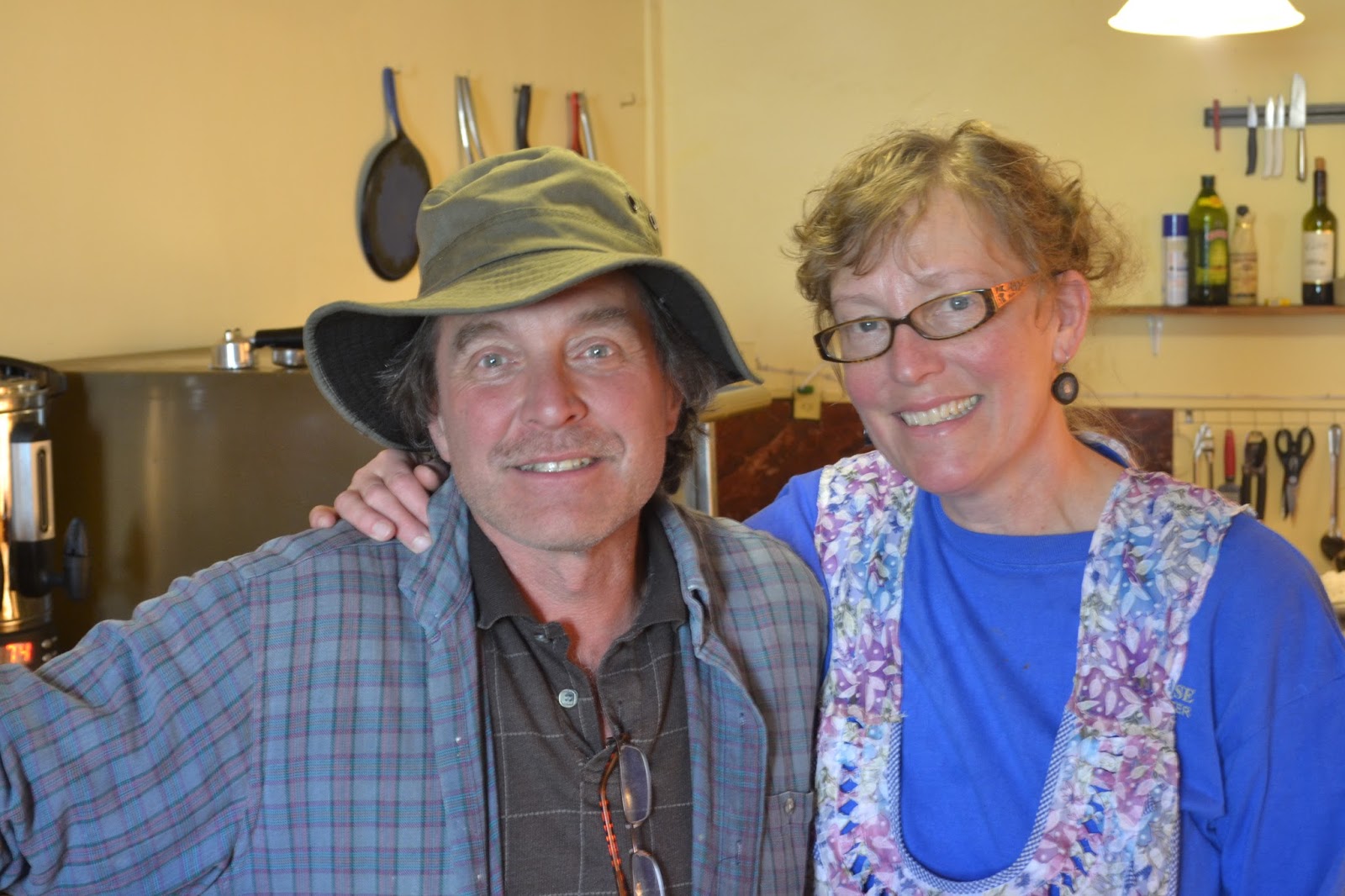 |
| Jeff and Debbie, bakers in Bolivia |
Early afternoon we roll out of town and into remote grasslands. Our road is paved and even has a shoulder, but there is no traffic. Down below us the sparking lake, and off in the distance are huge snowy peaks. What a great place to ride! Our road brings us out onto a peninsula which crosses almost all the way across the lake. We wind from side to side getting great views on both. On one side Titicaca looks like an ocean, on the other side it is filled with various small islands. I'm amazed in every direction I look.
 |
| Near Copacabana: great riding |
 |
| A fearless mountain caracara |
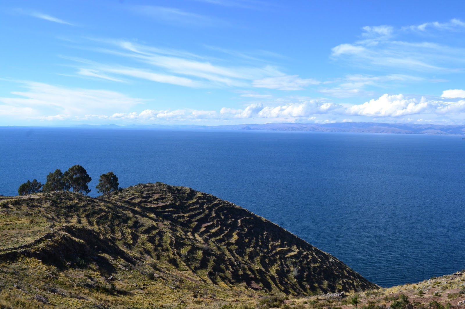 |
| Pre-Inca terracing at Lake Titicaca |
 |
| The Cordillera Real, Bolivia`s Andes |
Late in the day we descend to where we will take a ferry to cross a short section of lake and meet two more cyclists! Freddy and Mauricio from Colombia are overloaded with stuff, but are clearly loving life on a bicycle. Like the documentary makers we met, they are traveling with no money and simply working along the way for food and shelter. What an inspiration! They have been traveling all around Latin America and have many stories to share.
It's getting late when we finally catch a "ferry" across the lake. The ferry is a huge wooden barge with uneven, rotting planks that float low and slow through the water. I imagine our double decker bus embarking on one of these. As the sun begins to set over the snowy mountains, we find a viewpoint under construction and decide to camp. We have great views, but as we set up the tent the wind starts to howl and almost blows out tent away! Luckily, at this moment, we realize that there is a construction guy overseeing the project who sleeps on site. He scolds us for being outside and brings us into his small, unfinished house. Gratefully, we sleep soundly out of the wind and rain.
It's getting late when we finally catch a "ferry" across the lake. The ferry is a huge wooden barge with uneven, rotting planks that float low and slow through the water. I imagine our double decker bus embarking on one of these. As the sun begins to set over the snowy mountains, we find a viewpoint under construction and decide to camp. We have great views, but as we set up the tent the wind starts to howl and almost blows out tent away! Luckily, at this moment, we realize that there is a construction guy overseeing the project who sleeps on site. He scolds us for being outside and brings us into his small, unfinished house. Gratefully, we sleep soundly out of the wind and rain.
 |
| Ferry across the Strait of Tiquian |
 |
| Sunset over the Cordillera Real |
The first bit of our ride continues along the lake, and we pass many houses. Not too many people are out, but the ones who see us greet us and wave. No one yells out "gringo!" We feel quite welcomed by Bolivia.
As we get closer to La Paz, the traffic picks up and we are happy to turn off onto a lesser used dirt road. A sign informs us that we are entering cattle country, and so we are. The wide open grasslands, distant snowy mountains, and abundance of cows remind me a lot of Big Sky, Montana.
 |
| alto (high) + plano (flat) = altiplano. High and flat it certainly was |
Late in the day we reach a small town and ask to camp in the yard behind the health center so that the walls would provide a windbreak. The yard is clearly never used; it is overgrown and filled with junk. However, there is clearly a bureaucracy at work here, and after talking to seven different nurses and waiting over half an hour, someone finally tells us that it's too complicated and we can't stay.
We bike out of town and find an old quarry which provides a nice windbreak and is far simpler.
 |
| Moonlight competing with the distant lights of La Paz |
October 28th
We are woken up at first light by andean flickers, woodpeckers that have made their nests in the quarry walls. We have no option but to get an early start. Lots of trucks are on the road this morning and the road quality deteriorates. It is clear that they have poured water on the road to keep the dust down, and this has resulted in horribly bumpy pockets and ruts. As we slowly near the city of Viacha we see the reason for the mess, a gigantic mine. We're more than happy to finally reach paved city streets late morning. Once in town we're able to do some shopping, and we purchase a gigantic loaf of cheesy cornbread at a bakery. Unfortunately, the power goes out in town, and no one seems to have running water. You would think in a city that you could count on these things, but apparently not here.
Eventually we do find water, and to our delight we discover that the next section of road is totally paved! No traffic and beautiful, mostly flat scenery, make for an excellent ride. At first it's hot under the sun, then rain clouds come up and suddenly it's hailing and pouring rain. We change layers numerous times throughout the day. What a crazy climate!
The storm clouds look gigantic as they form and move across the huge expanse of sky, and it's quite amazing to watch them. Late afternoon we find a good place to camp just before one reaches us.
 |
| A large storm rolling across the altiplano |
 |
| Random water spigot on the side of the road? We`ll take it! |
 |
| The storm that would pour on our tent for hours |
 |
| Lots of lightning |
October 29th (by Danny)
We were a bit worried about what lay in the road ahead, but our morning ride south from the town of Coro Coro proved to be decently rideable. The famous Bolivian sand never materialized; that would come later. Although the spacious landscape felt remote, we passed through numerous small villages. One, Jayuma Llallague (pronounced ha-YU-mah ya-YA-gway... say that three times fast), was mining salt. They had terraced and blocked the river into little pools, which would evaporate, leaving behind the salt. Large white cones lay everywhere.
The environment turned more desert-like as we continued south. Exposed rock and dirt of all colors made up the martian landscape, white salt mixing with the mineral reds and browns of the desert to create an eye-catching mishmash of form and color. Against this background, the church in the town of Callapa stood out. Its railings ran almost the length of the entire town, and the white tower flew brightly in the clear blue sky.
 |
| Callapa`s massive church |
 |
| The desert |
 |
| But even in deserts, there`s water! A whole lot of muddy water |
 |
| Rural Bolivian traffic jam |
We soon met the main road connecting La Paz and the coast of Chile. The pavement made for quick riding, and the trucks and buses, although driving as if in a race, didn`t bother us too much. After a few hours of desert heat, we set up camp under a darkening sky as raindrops began to fall.
October 30th
A huge day of riding! Over 100 km!
Traffic is light in the morning and we make good time through the flat grasslands. Soon we are at the junction to the biggest town we are going to pass. We don't really want to ride into town so we are happy to find some stores and restaurants along our main road. The restaurant has a sign outside advertising 7 different dishes made with llama, but luckily they also make eggs, rice, potatoes, and tomatoes. A great breakfast!
 |
| What`ll it be, llama or llama? |
 |
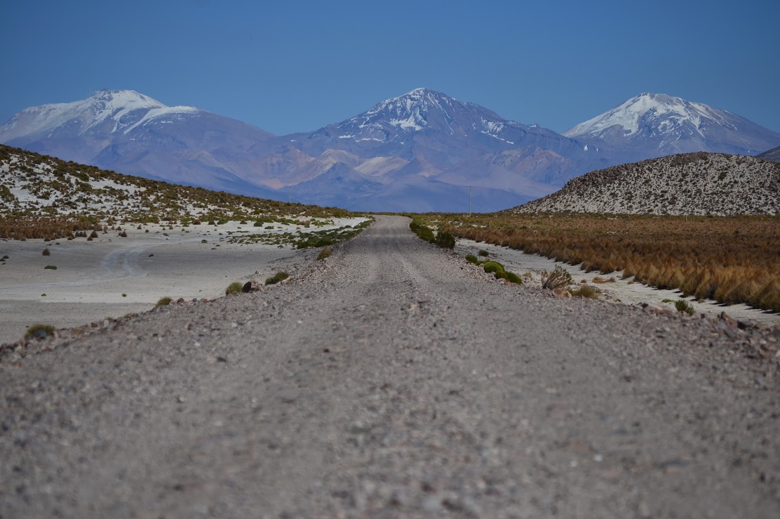
| Volcan Sajama in the distance |
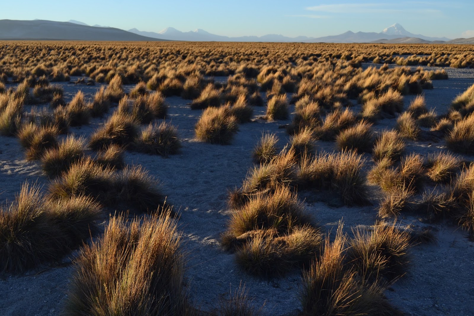
Continuing down the road we enjoy a whole variety of scenery. First we pass through reddish sandstone canyons with craggy rock formations everywhere, many in interesting mushroom shapes. Then we enter a wide valley bordered by tumbling mesas. Llamas and alpacas roam happily along the marshy green ground, munching their full, while bright flamingos stand regally and fluff their feathers. Then we're back on the "flats." At times the altiplano can be deceiving; it looks flat, but it is actually composed of long rolling hills. The riding is enjoyable because of the wonderful views of volcano Sajama and other nearby snowy peaks.
Late afternoon we reach the junction to our gravel road and find another restaurant complete with water tap and delicious snacks imported from Chile. I have a feeling I'm going to like Chile with these kind of snacks around!
Late afternoon we reach the junction to our gravel road and find another restaurant complete with water tap and delicious snacks imported from Chile. I have a feeling I'm going to like Chile with these kind of snacks around!
 |
| Volcan Sajama |
 |
| Straight and flat to Cosapa |
For the rest of the day I learn how my bike handles on sand and how to ride through it. At first I'm nervous but once I get the hang of it, it's kind of fun. When the sand isn't super deep, you feel as if you are gliding along it, kind of like skiing. When the sun begins to set we pull off the road and set up camp. There's nothing out here besides grasslands and llamas.
 |
| Learning the ways of the sand |
 |
| Grasslands and llamas. I`m sure there are some llamas somewhere in this photo |
 |
| Camping in the open |
October 31th
A holiday I love in the U.S. but totally forgot about down here!
Our morning ride is quiet, flat and enjoyable, but when our road turns right we are forced to get off our bikes and push. It seems that our track has been totally swallowed by sand dunes. After 10 minutes or so of pushing we reach a point where our GPS says that the road should turn left. Since neither direction looks particularly promising under the mounds of sand, we forage our own path through the bushes and in a few minutes happily connect to a rideable road.
Suddenly, Danny spots some strange creatures off the side of the road. They look like ostriches, but smaller. What? Didn't expect to see anything like that our here! We learn later that they are rheas, threatened species.
 |
| Rheas on the altiplano |
Before long we come upon a small village that looks surprisingly advanced. A water pump is out front next to a huge cell tower, and several of the houses have small windmills for generating electricity. With the winds out here, I don't know why we don't see more of these. A friendly local guy comes out to greet us, helps us pump water, and asks about our trip.
 |
| Feliciano in front of most of his village, Wila Kkolki. He smiled the whole time we were with him, except for when I took this picture. |
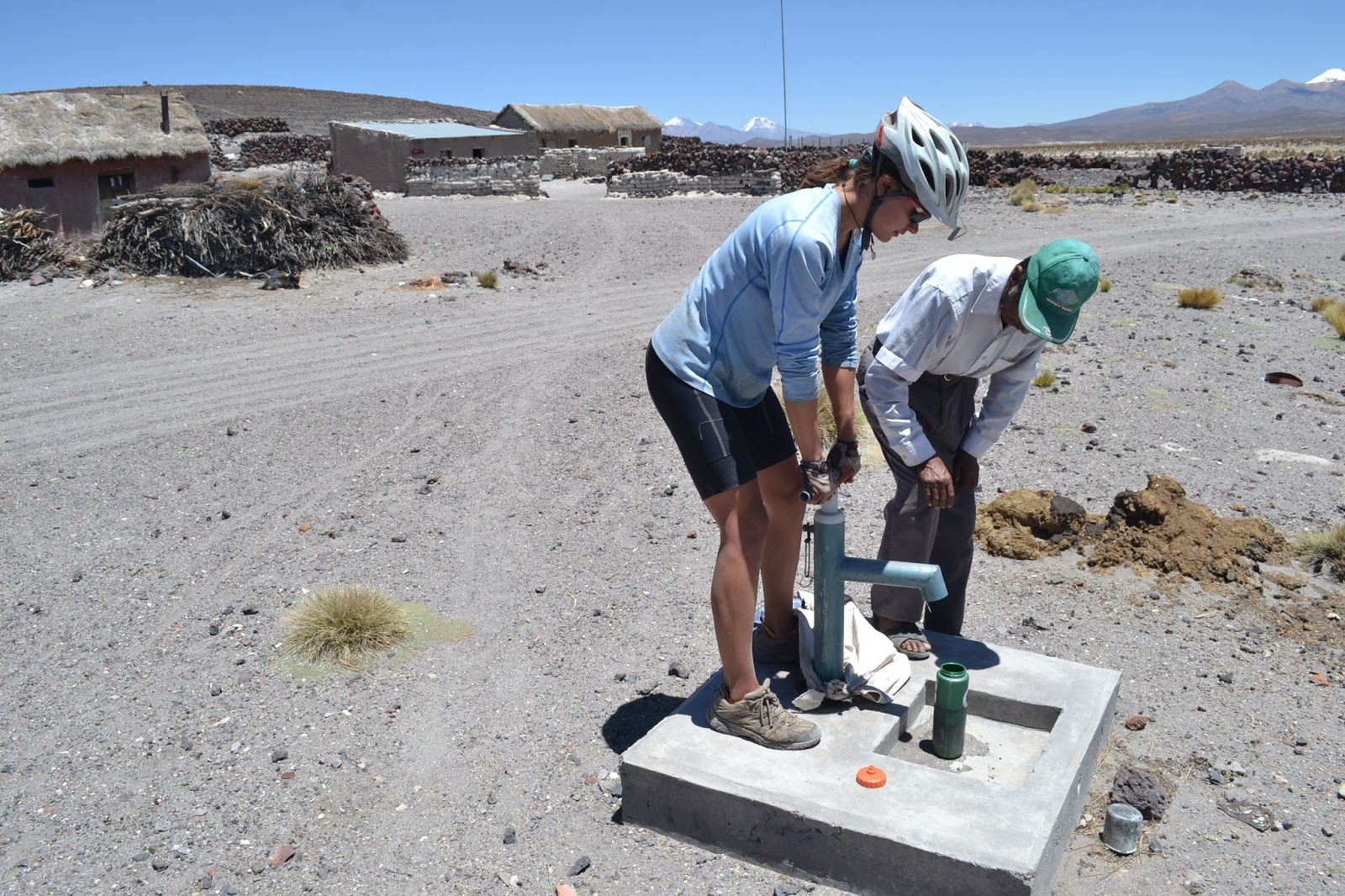 |
| Helping Tam figure out the pump |
Around mid day we reach a large, clear river that we have to cross. The cold water is so refreshing that we decide to do some laundry and go for a swim. As our clothes dry, we eat lunch and enjoy watching the llamas grazing under the enormous snowy volcanos in the distance.
 |
| Crossing the Rio Sajama |
The town of Sacabaya is larger than the other small groups of houses that we have seen, and it seems that more buildings are currently being built. The people couldn't be friendlier. Three guys come out to welcome us, and they are soon joined by three families. They are genuinely curious and happy to talk to us, and they all want to know what we think about their country. We think that it's great! They seem proud of where they live and the llamas they raise, even though they are poor and the landscape is harsh. We buy some snacks and juice at a store and share some cookies with the group of children who are following us. The lady who runs the store is a sweetheart and gives us an apple for the road for free.
In good spirits, we get back on the road, but a terrible wind and rough road surface make for slow going. Finally we find the ruins of an adobe house and, using it as a windbreak, set up camp.
In good spirits, we get back on the road, but a terrible wind and rough road surface make for slow going. Finally we find the ruins of an adobe house and, using it as a windbreak, set up camp.
 |
| A street in Sacabaya, a typical Bolivian altiplano town |
 |
| Riding out into the grasslands again |
 |
| Volcan Sajama still in the distance. We could see it for six days. |
 |
| Camped behind the only windbreak around |
November 1st
We wake up to another cold, bright morning, and it's so easy riding without the wind that we make progress quickly to our first town. Unlike Peru, where the main plazas were almost always bustling with activity, many of these towns seem almost completely deserted. We wander around town for a good half an hour trying to find the correct sandy track out of the village before finally finding a cute old lady who shows us the way.
Not long after leaving town we join up with a larger road and the official Andes by Bike route that we looked at before beginning this section.
 |
| The official route. We`re actually going the other way... |
Turns out we're meeting it near the end, and good thing: the road is super washboardy and not very enjoyable, so I have my head down when we pass our two friends, Hannes and Julia, early afternoon. Luckily Danny, riding behind me, spots their bikes, and we have a happy reunion! After meeting in Loja, Ecuador, and again in Cusco, we're finally going to ride together!
Julia and Hannes have just met some wonderful people who invited them into lunch and offered a place to stay in the town of Sabaya! This wonderful family immediately welcomes us in as well and sends us all off with huge bags of sweetened popped corn for the rest of our ride.
We take the shorter way around the volcano to Sabaya, and although a bit sandy at times, it's quite enjoyable due to a raging tailwind. It's also super fun riding with and chatting with Julia and Hannes. Since they have also come from Alaska, they have an equally crazy story for every one we have. Our shared experiences make for a lot of good laughs.
 |
| Sabaya`s main plaza. Photo courtesy of Hannes |
After showering we make our way to the former home of Freddy's deceased aunt, where we learn all about the local traditions. On All Saints Day for three years after a relative´s death, they are remembered and a memorial is built to help them ascend into the sky. The second year after their death, this memorial is made in their home town. This is why, although Freddy and his family live in the city of Oruro, they have all come out to celebrate in Sabaya.
These "mesas," or table memorials, are elaborate and beautiful constructions with multiple levels. On the first level are food and drink offerings, flowers, candles, and a picture of the deceased. The second level has several intricate bread sculptures: people to accompany the deceased so they won't be lonely, horses to carry goods, and holy crosses. The final level has more bread sculptures of the sun, moon and other objects signifying happiness in the sky. Most bakeries close for the whole week in advance of this holiday to make all these sculptures! This explains why we didn't see bread being sold anywhere.
The memorial displays often have cheesy looking purple, black, and orange Halloween-themed decorations draped around the top, which somehow seems very out of place.
Adults who walk into the room stop to say a prayer in front of the memorial and then are given a shot glass of sweet red wine and a bag of sweet popped corn (same snack we were given earlier) with a few candies and stale bread rolls inside. Before drinking the wine, it is custom to spill some of it on the floor for the deceased, and the same is true for the glasses of beer that follow afterwards. I imagine that the dead are quite happy with all the wine and beer spilled for them.
Gangs of children go from house to house saying prayers in front of the memorials, often including mischievous phrases you don't pick up on because they are talking so fast. It's quite creative. In return they are given lots of puffed corn and some candies. We see some tiny kids with bags literally bigger than they are.
After a while at the house of Freddy's aunt, we move to the house that once belonged to his uncle. Here we find a similar display and a long table where we are served delicious bowls of soup and plates with root vegetables and llama meat. Danny can`t resist trying llama, and I discreetly distribute my meat to Hannes and Julia. We enjoy some conversation with Freddy and his relatives and then head back to the house for some sleep, all of us loaded down with huge bags of puffed corn.
Next: the salars!
Route notes:
Buses from Cuzco to Copacabana run only at night. We sprang for the ´Cama VIP,´ the full reclining chair seats, and they were luxurious! Most companies force you to change buses in Puno, with the original bus going to Desaguadero, but ours changed at the junction with the road to Copacabana. None of the buses actually go to Copacabana; they drop you at the border, from where you must ride the 8 km or take another minibus for Bs 3. The bikes cost 15 soles each, negotiated with the bus driver, not the company.
Our route can be divided into roughly three sections: 1) the main road from the border, 2) avoiding La Paz, and 3) connecting Volcan Sajama to the salars.
1) Copacabana to Batallas: All paved, straightforward following the main road from the border towards La Paz. Copa has ATMs, shops, accommodation. Check out Pan America next to the basilica by the plaza - great food, less expensive than you`d expect a place with a menu in English to be.
Copa to Tiquina is a surprisingly remote 45ish km. A few km after taking the short ferry over the estrecho de Tiquina, there is a mirador that was a nice, albeit windy, camp spot for us. Tiquina to Batallas is another 45ish km, paved, consistently populated with lots of houses and little towns but not much traffic.
2) Batallas to Cosapa: The desvio to Viacha was unpaved and a bit bumpy, especially the last few km into Viacha, which were both bumpy and super industrialized, not a fun stretch. Viacha is a small city with all city-like things, and the two towns on the way, Pucarani and Laja, both have shops but no accommodation. South of Viacha is paved to Coro Coro, a really nice stretch with little traffic, nice scenery, and enough towns so that we never had to carry more than a couple of liters of water. After Coro Coro, we headed out to Callapa on the main road, a remote stretch of generally smooth dirt and eye-catching scenery. It`s also possible to keep heading south on the dirt through Ulloma and meet the main paved road about 40 km south of where we did. Plenty of small towns with little shops and water, not much accommodation, but wild camp anywhere (with a wind break, preferably).
As there are tons of little roads branching off everywhere, I would recommend some kind of GPS to get you through this section.
Once meeting the main road, it`s a straight shot south, about 100 km of pavement, to the junction to Cosapa. There`s a small shoulder and great scenery, and the traffic isn`t unbearable - a vehicle every minute or so, usually a truck or bus. Contrary to what our map says, Curahura is about 4 km off the main road, but there are a few restaurants and small shops at the junction. Roughly 50 km later is the signed turnoff to Cosapa (marked, oddly, as ¨381¨ on OpenCycleMaps), and there are a few restaurants and small shops at that junction as well (didn`t check in the town, but it looks big enough to have a shop).
3) Cosapa to Sabaya: There are a number of ways to connect the main road with Sabaya and the start of the salars. Some cyclists pass into Chile (see velofreedom or machacasonwheels) and roughly follow the border until entering Bolivia again at Pisiga. From what we`ve heard, that sounds like the most interesting way. There`s also an andesbybike route that connects Sabaya with Sajama, a decent route as well, from what we`ve heard. Ours was much less hilly than both of those routes, in fact, it was almost totally flat.
Good gravel from the main road to Cosapa. We hung a right about a km out of town onto a sandy, washboardy track. It was continuously sandy to Sacabaya but all rideable except for two or three sections where we had to push for a few minutes. There is one easy river crossing, knee deep but slow moving and with a smooth bottom. After meeting up with the main road of the andesbybike route near Tunapa, the road gets pretty washboardy, still all rideable, just slower. Take the southern route around the volcano when approaching Sabaya - it`s really nice, only sandy in a few small spots.
No comments:
Post a Comment