Wednesday, July 29, 2015

Mudslides and More, July 25-29

Riobamba-Lagunas de Atillo-Macas-Sucúa-Logroño-San Juan Bosco

From Tam´s journal:

July 25th
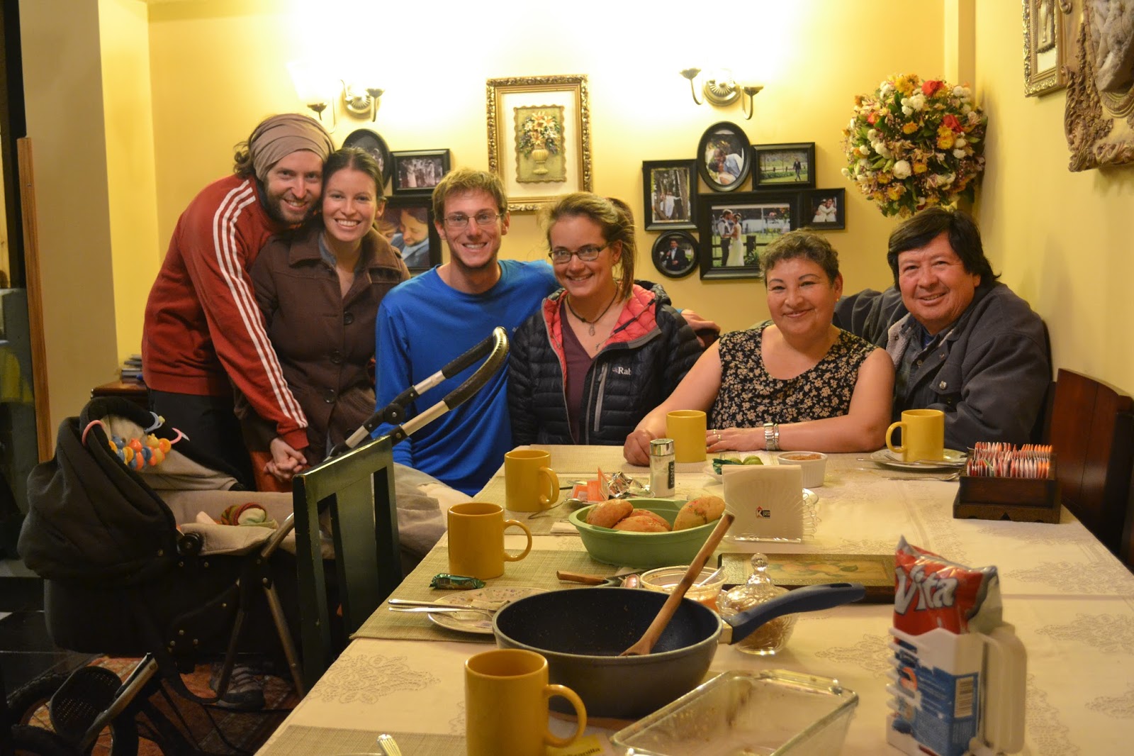
We plan on leaving today, but when we wake up it's already 9 am, and then breakfast goes until 11. We decide that it can't hurt to spend one more day with these wonderful people.  It's a true rest day: we stay in, share photos and stories, and write postcards.  Most importantly we enjoy wonderful meals with our host family!

July 26th
It's a slow morning, with breakfast, goodbyes and photos.  Who wouldn't be reluctant to leave such a homey place? I feel like just in the last two days we've become part of the family. Borja, Nathalie, Luci, and Pubi, we can't thank you enough! And of course saludos to Mati!
Immediately out of town our road has a large shoulder and I barely notice the traffic.  As we climb away from the city the shoulder diminishes in size, but it doesn't matter because the traffic is so minimal. A number of road cyclists pass us on the climb, and we're happy to see others out riding. Riobamba fades away below, and we look back to see it nestled in the valley. Adios!
Our road begins to follow a large gushing river up into the mountains. Unfortunately, instead of gradual river grade, we have a series of steep ups and downs, climbing up to small rural towns, then descending down to the river.  Most people we see are friendly and wave.

The river we followed for a while up out of Riobamba
Along the road are frequent signs explaining why we need to protect the environment, bumps to slow down cars, and crosswalks.  It seems ridiculously overdeveloped considering how few cars there are and the extremely rural population, many of whom probably can't read well and have no problems crossing the road wherever they want.
The weirdest thing we see all day? A giant roast pig hanging outside of a small store. Gross.
It has been a long day of climbing, and we're tired, but we push on, determined to reach Sangay National Park. I'm glad we do.  Just at the park entrance are the famous lagunas that we've been told about.  In the setting sun there's a rainbow, and the mountains around the reflective lake clear a bit to reaveal a dusting of snow on their peaks.  Across from us a huge waterfall thunders into the lake. Everything is spectacularly serene.

Lagunas de Atillo, Sangay National Park


July 27th
It rains all night and continues in the morning, which does nothing to increase our motivation to get going. At 9:30 we finally hit the road--still raining. Some ups and downs bring us past more mountain lakes, but unfortunately we can't see much because of the clouds.  Then we begin to descend in earnest. Almost immediately the vegetation becomes thicker and more lush.  Waterfalls, big and small are everywhere. Some are so huge that they would be the main attraction somewhere else, but here no one cares; they are nothing out of the ordinary. I feel like I'm biking through a flood.  The rain, the waterfalls, the rivers. Water everywhere!
The road is paved the whole way, but we encounter a land or mudslide every few minutes. Some are just rocks in the road, others are huge piles of dirt, trees and rocks, still others are full out rivers flowing across the road.  (Luckily these rivers are never more than a couple inches deep.) In some places I can see why there has been a mudslide, as the bank is already far too steep and muddy.  In other places it looks as if a small river has flooded and washed all the material from its banks out into the road. And in some places gentle banks covered in green vegetation have simply caved in, given way. Why? I think everything is just too wet.

Avoiding a mudslide
We get to watch one mudslide in action. We pass through a pile of thick mud on the road, and then turn back to the sound of the hillside puking. That's what it sounded like. Gurgles and sloshes send down a big mass of brown mud, which proceeds to slowly ooze out into the growing mass on the road.
A few other interesting things we encounter on the way down.
1) An earthworm that we thought was a snake because it was so big! Probably 3 feet in length! (Danny moved him off the road to safety, don't worry.)
It dwarfed my one liter water bottle

2) A tunnel that's almost a kilometer long! Thankfully it is well lit and a nice break from the rain... although it's raining in some places inside the tunnel as well.
3)Lots of birds! We hear them singing everywhere, but as you can imagine, under the conditions it's hard to get a good look at them.

Late afternoon, the rain finally stops and we can take off all our layers. A bit more biking, and we're happy to find ourselves in the large town of Macas.  The firefighters all seem to be in a bad mood but let us camp inside at their station. Awesome! We hang up things to dry and go out to do some shopping. Im feeling excited.  Today was unlike anything we've biked yet on this trip.  We're in the Amazon rainforest!

July 28th
It starts raining overnight and we discover that the roof is leaking right over where we are sleepíng.  Time to relocate! Luckily there is plenty of space in the room we´re camped out in. The upper floor of the fire station has clearly not been well designed. Besides the ceiling leak, there is a fume hood but no stove, toilets and electric hand dryers but no sinks, and a urinal on the wall that isn´t actually hooked up to any pipes.
At 4 am, we hear what sound like gunshots.  Oh wait, it's only the nearby church shooting off fireworks and broadcasting mass. I will never understand the way religion works here. We put in our earplugs.

In the morning we're on our way on a well paved road. At first we are traveling flat to downhill, and just cruising! It has been so long since we've been on a fast road like this!
Slowly, things get more hilly.  Every time we cross a river (frequently), we descend steeply down to it, then climb steeply back up.
We pass a lot of small towns and houses, and I'm surprised by the fact that the majority of houses are really nice. We see smooth walls, colorful paint, multiple floors, covered balconies and huge flower gardens. I imagine that some of this is simply a result of wood being so readily available here. Despite the development, we enjoy quite a lot of jungle as well.  As soon as you look out past the houses, there is layer upon layer of dense forest. Even the farmland is barely recognizable because everything looks overgrown. It must be quite the struggle to try and clear a plot of land here.
In the afternoon, the sun comes out and dries off our stuff a bit. Its heat and warmth are welcomed until we start to sweat. It's humid here!
Our road brings us down to a great confluence of rivers. Below us we can see them mixing, the murky brown of one swirling with the almost black brown of the other.

Chocolate and peanut butter, mmmm
We can see that we've left the drainage of one and are about to climb up into the drainage of the other. After some very steep, slow climbing, we stop at a farm house and ask to camp under a small shed area.  The lady is very friendly and tells us about how they ranch cattle, then leaves us to set up our stuff.  We're really just excited to have a roof to put our tent under, since it seems to rain every night.

As we're eating dinner, something strange happens: we see another cyclist ride by in the other direction. Since we haven't seen another cyclist since northern Colombia, and we're both pretty tired, we simply sit and watch, a bit dumbstruck, as she rides by.  Once she's past and going down the hill, we start kicking ourselves for not running out and saying hi.  I wonder where she was going?

July 29th
We sleep well and head out early in the morning.  A bit of misty rain and clouds is keeping things cool.  Our road is absurdly hilly.  I feel like we're climbing more here in the Amazon than we were in the mountains! Today there are less towns and more dense forest.  We pass more waterfalls, rivers, landslides, and beautiful flowers. Still haven´t identified the new birds we saw... but there´ll definitely be some new ones for our list!
Jungle riding
Fresh bread with creamy avocado and cheese for lunch, then up and over some more mountains and into the town of San Juan Bosco for the night. We're in early, which means we have time for shopping and blog updating!

So, I was expecting to find lots of fresh fruit here in the rainforest, but the little stores we pass only sell candies and bags of chips. Maybe it's not the right season, or maybe this is a symptom of too much globalization. We also listened to Katy Perry blaring from a gas station today.  Where are we again?
The rainforest!


Route Notes:

- Riobamba to Macas: There are a few unpaved options after the main road out of Riobamba, but we stayed with the pavement all the way. Not too much space, but not too much traffic either. It also helped that we left the city on a Sunday. We weren´t sure if the road would be open because of recent landslides and continued rain, but the twitter page of the Ministerio de Transportes y Obras Publicas (MTOP) indicated the road was cleared a day before. It was open, though still full of landslides, and well-paved all the way to Macas.
- Macas to San Juan Bosco: Paved and quiet with plenty of small towns and houses along the way and rivers everywhere for water. Really nice bomberos in Limon Indanza, about halfway between Macas and Gualaquiza -- we didn´t stay there, but one of them saw us eating lunch and offered to let us stay at the station that night -- and police/bomberos in San Juan Bosco.

Friday, July 24, 2015

High Passes and Potatoes, July 20-24

Zumbahua-Angamarca-Cunuyacu-Riobamba

July 20th
We sleep in a bit under warm wool blankets in the church dormitory, so when we finally set forth the sun is shining bright in the sky. We stock up on food provisions and climb out of town on a beautiful paved road. Slowly the valley drops away below us. The many fields look like pieces of a well-loved quilt strewn amount the rocky outcroppings, and lining the road are the highest altitude cacti I have ever seen. Did you know that cacti can grow at 12,500 feet?
Up, up, up, mountains, mountains, mountains 

Near the top of our winding climb we spot signs for the road we will take to Angamarca. Time to let some air out of our tires and get back on the dirt! The road is bumpy in places but generally in awesome condition, and gradually it takes us up higher into the mountains. Up here, the most common farm animal, the cow, has been replaced by herds of llamas and sheep, which are much cuter and fuzzier. The llamas look at us with their huge eyes as we ride past and I get the sense that they are staring into my soul.

Perfect cycling
A mosaic sheep
Out for a walk with the pig
At the top of the pass we reach a new record for highest elevation biked: 13,500 feet! Exciting!
A gradual descent brings us down to a river, then we climb up our second pass of the day. Near the top things get really foggy, and suddenly a rather ephemeral church emerges from the mist. A nice landmark for the top!

The only building for miles
For the beginning of our descent we are cloaked in mist. Everything is completely silent except for the bumping of our bikes. Slowly, farmland begins to emerge again and soon we find ourselves in the quiet town of Angamarca. Not much is happening in town, so we buy some food and then head out. The descent to the river is easy, but when we reach the turn-off for the road that will take us to Simiatug the road begins to climb up steeply. The dirt surface is packed enough that we can ride, but it's so steep that we pause at the top of each rise, gasping for breath.

Dodging a cow on the descent
Angamarca way below
As we're stopped looking for places to camp, I start talking to a local guy, Jose, who says we can camp beside his house. A very friendly guy, he shows us to his place where his family proceeds to observe us with great interest as we set up our tent. We chat with them for a while and then have an early night.

July 21st
We wake up early to the various noises of a farm community. Donkeys braying and whistling, roosters crowing, dogs barking, babies crying, etc. As we're packing up I ask Jose if they have a bathroom I can use. No, he says, they don't have a bathroom. They explain that missionaries who have been living and working in this area helped them build this house, but they haven't started the bathroom projects yet. Inside the house I can see a TV, and I wonder why this had priority over a bathroom.
The start of our climb is steep and tiring but rideable for the first few kilometers. Then, we reach an impasse. Someone has dumped a layer of large loose rocks on the road. We assume this was meant to improve the road surface, because why else would you purposely cover the road with rocks and line the sides carefully with larger boulders? Considering the steep grades, we can't ride on them. The local donkeys and horses that are sharing the road with us don't seem to like them either. They pick their way along small grassy dirt paths by the roadside and we do our best to follow.
Hooves > Wheels

With the challenging conditions, we end up pushing our bikes up a good portion of the road and are ecstatic to finally reach the top. From here the road is more gradual and has a more manageable surface. I can't believe people are still living up here at this altitude. The dwellings we see are mostly short huts with mud brick walls and some sort of straw/hay layered heavily on the roof. I imagine the more the better for insulation.


We stop at a "micro tienda" (tiny store), the only business we see all day, for some snacks. The ladies running the place are very fashionable and very excited to see us. I don't think they get many customers up here.
Shortly after, we stop for lunch at the edge of a huge green valley, as we sit with our backs against a row of pine trees, we watch clouds flow in an out of the valley. I don't know if I have ever seen clouds like this. Thin and wispy, they're blown into beautiful configurations by the wind, twisting in waves and spirals. I could watch them all day!


After lunch we leave the hot sunshine and climb up into the clouds. I can assume that we're surrounded by more farmland, but I can't see anything, just white mist! It is gloriously quiet and peaceful. At some point we reach a top and begin to descend, then we reach the bottom and start going up again. I'm tired from all the climbing, so we stop a bit early to camp outside of a school. As we set up our tent, a group of kids watches us silently, clearly interested in us but too shy to talk. After a long while, Danny finally gets them to engage in a bit of conversation. When we ask what their favorite food is, they all say potatoes. I don't know if they eat anything else here. 

July 22nd
It rains all night, and in the morning, it's still raining. A bunch of small ladies come over to talk to us. Turns out that they work at the preschool we camped behind and are curious about us. They invite us inside for some eggs and hot coffee/panela (sugar) water. While we're waiting for breakfast to be prepared, we help them with a project that they're working on: cutting out small, brightly colored foam hands. They tell us that today the kids are going out for a walk with the hands for some sort of special event. The hands represent that everyone has rights, to combat the internalization of indigenous prejudice. Quite a statement for pre-schoolers! I'm happy to see that these people care about education and opportunity for the little ones in these far-flung communities.
When the ladies set off to collect their students, we leave as well on our bikes. It's muddy and raining but there's a spectacular rainbow emerging from the valley!


"Have a good journey"
We pass by a number of small houses, and at one point Danny, stopped to fix his helmet, is approached by a guy who says, "Go fast." Danny, thinking he's making a joke about how slowly we travel, says no, we travel slowly on bikes. Suddenly the guy reaches out and shoves Danny, and we realize that he is extremely drunk. We start pedaling and get out of there as fast as we can, calling back that we'll be passing through quickly.
Worse, up ahead is a whole group of clearly drunk men. Before Danny can say "buenos dias," one guy says, "Regálame alguito." Give me something. We know we're in for trouble. We try to accelerate through the group, but they are blocking the way. One man kicks my front tire and another grabs my backpack, but they are uncoordinated and we are quickly past. Rather unnerved, we are more than happy to pedal up into the paramo and away from the houses. We don't think those guys were really ill-willed, just incoherent and looking for trouble, typical drunk man behavior.
Soon our difficult morning is forgotten in lieu of more pressing challenges. The wind and rain pick up and envelope us in a freezing high-altitude storm. At times the rain turns to snow. We are reduced to pushing our bikes, heads down against the barrage. It's tough going, but we don't want to go back to the drunken celebrations, and we certainly don't want to stop here. We push on. We don't have any photos from this section; for Danny to take his camera out would have spelled the end for the camera.
Eventually we reach a giant cross marking the top of the pass, barely visible under the awful conditions. We take a couple seconds to celebrate a new altitude record: 13,877 feet! Then we head down. After a bumpy, cobbled descent we reach the "town" of Cunuyacu. Really it's a collection of a few small buildings and some swimming pools. These are what we're excited for: natural hot springs fueled by thermal activity from the local volcano! We find a tiny room at the local hospedaje (really a house with a few small rooms for visitors) and chow down on enormous bowls of steaming eggs and potatoes. Then it's to the hot springs for the rest of the afternoon where we soak gloriously for hours.
At the hot springs we meet a family from a local town who explain to us that every town in the area has a day each year when they celebrate the anniversary of the town, the town "birthday." Their local tradition is to come to the hot springs. We speculate that this explains why all those men were drunk this morning - at 10 am on a Wednesday - and hope to avoid all town holidays in the future.
The plan for dinner? More steaming potatoes and eggs. As we wait for the food to cook, I help the ladies shred pieces of old white shirts to use as gentle sponges for cleaning cars which they sell here at the shop. With a few picks of a dull serrated blade the material comes apart in delicate curlicues in their hands. I whack away until little white pieces shred off. How can destroying a shirt be so difficult?
After more filling food, we're happy to have a warm night inside out of the rain and mud. All of our stuff is soaked. 

July 23rd
In the morning it is still cloudy and raining so we're reluctant to leave, but we want to restock food in the big city of Riobamba so we set off.
Not-so-encouraging morning weather

Miraculously, as we begin to ride, the sun starts to peek out of the clouds and a tailwind picks up. We yell out encouragements to the good weather. "Come on sun, you can do it!" Our paved road makes a gentle ascent up to the turnoff for Chimborazo, the tallest peak in Ecuador. Fun fact: the top of this mountain is actually earth's closest point to the sun due to a topographic bulge at the equator. As we ascend to the volcano, it is still cloudy and rainy at points, but compared to yesterday, it's perfect riding. There are lots of vicuñas, small, llama-like creatures, out and about. Their funny long necks and gorgeous fur billowing in the wind make them fun to watch, and they're easy to see in the barren landscape. Our high-altitude surroundings, in fact, remind me of the desolate Mojave Desert in California. There's nothing there, or here, but it's perfect for these strange creatures.


At the foot of mighty Chimborazo we reach yet anther altitude record: 14,448 feet! We stop at the small visitors center to get out of the wind and enjoy a view of the snowy base of the mountain which has finally emerged from the clouds.
Volcan Chimborazo, 20,564 feet high 
The road to Riobamba is almost completely downhill. It's a beautiful and speedy descent on pavement. Once in town we get some bread for a late lunch and find the place of the warmshowers hosts we contacted. In a short while we are welcomed into an amazing family, Borja, Nathalie, their adorable new baby, and Nathalie's parents Luci and Pubi. They welcome us in with hot showers, a washing machine, and later a delicious meal of traditional Ecuadorian food and chocolate. I think we are the luckiest people in the world.


July 24th
Rest day in Riobamba! Time for shopping, shoe fixing, bike cleaning, blog updating, route planning, and most importantly eating too much ice cream!

Ice cream with Luci


We found a zapatera to fix our worn-out shoes

Sunset over Riobamba
Route Notes:
- Zumbahua to Angamarca: Smooth, paved ascent out of town. Take a left near the top of the climb (it's signed for Angamarca) and find a scenic, well-surfaced dirt road topping out around 13,500 feet. There's a descent into a beautiful valley, another climb, then a bumpy downhill to the town.
- Angamarca to Cunuyacu: We took the squiggly but relatively direct road on Open Maps (MotionX Terrain), descending to the river on the route to El Corazon and hanging a left steeply uphill just before crossing the second bridge. The map indicates that the left next to the bridge links up with the desired road via nothing more than a narrow trail, but numerous people told us this was the way and indeed it was, an easy-to-follow road the whole way. At one point, as you near Simiatug, there's a fork; go left, uphill. At the second fork, really a T-junction at a switchback, take a right to descend to Simiatug or a left for Cunuyacu. The surface was generally good, though some parts had tons of large, loose rocks that made riding downhill a bit sketchy and demanded some pushing on the steep uphills. After the initial ascent out of the river next to Angamarca, the road surface got better. Cobbles on the last part of the descent into Cunuyacu, but it's worth it: hot springs await!
- Cunuyacu to Riobamba: Follow the Antigua Via Flores uphill until it meets up with the Ambato-Guaranda highway. Good shoulder on that road, some traffic but not overwhelming. A left into the park - there's a sign for Riobamba, 51 km - brings you up to a high pass then way down on the other side. All good pavement, the occasional car, and a lot of vicuñas.

Sunday, July 19, 2015

Off the Beaten Track, July 14-19

Quito-Sangolqui-Parque Nacional Cotopaxi-Lasso-Toacazo-Isinlivi-Yanaurcu Grande-Chugchilan-Lake Quilotoa-Zumbahua

Before the actual post, here are a few photos from our time in Mindo.
Rufous-tailed Hummingbird, Mindo

Cloud Forest

July 14th
It´s hard to say goodbye to our wonderful hosts who have provided a second home for us here in Quito, and to all our new friends at Construbicis.  We can´t thank you all enough!! 
For some bike-building photos, see here.

We end up leaving Quito around one in the afternoon after spending an educational morning with Carlos learning about a few important bike maintenance techniques. Despite the large size of Quito, the ride out of the city isn´t too bad.  We take a bike path down to the old town and then a busy road which fortunately has a shoulder for much of the way.  After a big descent on the Pan-Am, we turn off onto the old highway, which takes us through a collection of small towns and has much less traffic. Since it´s already getting late, we decide to stop in the town of Sangolqui, where the friendly firefighters let us stay at their station.  It´s the nicest station I have ever seen, with a huge tower for practicing rescues from high buildings, a volleyball and basketball court, and a massive dorm room that no one is using, except for, now, us.  Best of all?  Bakery and fruit store right across the street.

July 15th
We sleep in a bit, tired from a week of bike building and learning that was more exhausting than we expected. Out of town, our road is paved then turns into smooth cobbles, then into uneven stone cobbles. Slowly we begin to bump our way up into the high mountains. The road is beautiful, bordered by green farmland, river gorges, and the occasional large waterfall. The bumpy ride is improved by our new shocks and wide tires, but it´s still exhausting. Soon, after a quick lunch in a tiny town, we leave the farm land and enter high altitude paramo (grassland). From here the skyline opens up and views are incredible. On the right, a jagged caldera, on the left, a colorful rocky peak poking into the clouds, and in front, the immense, snow-covered volcano, Cotopaxi.


Volcan Sincholahua, en route to Cotopaxi

When we´re tired of climbing on the rough road, we start looking for somewhere to camp.  With a bit of unexpected luck we find the perfect spot.  In a few minutes the tent is set up on soft green grass next to a series of three waterfalls and a pool with a small pebbly beach. We´re bordered by rocky cliffs that block the wind and provide a breathtaking view of Cotopaxi when we climb to the top of them.  What an amazing place we are in.
Cotopaxi was a bit shy. This picture was taken from an altitude of around 12,000 feet, which gives some scale to just how big the volcano is.
July 16th
We wake up to sunshine and clearing clouds after a night of rain. Our campsite is blissfully warm and sunny, but once we´re back up on the road we feel the full force of the chilling wind. Thankfully the climb is gradual, and after a night of rest, I´m better prepared to tackle the sandy road. It´s not long before we reach the park entrance, where two friendly rangers greet us, take down our names and wave us through. We continue into a grassy wasteland strewn with boulders from an eruption long ago.  On closer observation, the area is quite beautiful, bursting with wildflowers.  I spot red paintbrushes, yellow asters, purple-blue lupines, and fragile geraniums. Flying around us are some andean lapwings and carunculated caracaras, both new species for us! Unfortunately, the huge volcano at our side is mostly hidden by clouds; you would hardly know it was there.

The Cotopaxi Plateau. I was riding on a trail next to the road, Tam on the road.

We stop for lunch behind a huge boulder sheltered from the wind and enjoy the landscape for a bit longer before decending out of the park.  The road turns to pavement part way down, which makes for an excellent, smooth ride. Near the bottom of the descent we turn off onto a smaller road that runs parallel to the Pan-Am. Here there is no traffic, and we are shaded by glorious eucalyptus trees on both sides.  After a little while we start passing huge greenhouses that are filled to the brim with long-stemmed roses. Apparently Ecuador is famous for these roses, the majority of which, wierdly, are exported to Russia.
After doing some shopping in Lasso, a town near the Pan-Am, we cross the huge road and start climbing into the mountains on the other side. Up and up we go, until around 11,000 feet I´m tired of climbing and we decide to stop for the night. A friendly guy we talk to gives us permission to camp in the yard of a local recreation center.  It´s a nice place, with a volleyball court, soccer field, and pool! Soft flat grass to camp on tonight.

July 17th
As we´re heading out in the morning, the family who lives on the property as caretakers bring us out a steaming bowl of soup.  We have barely spoken to them, and yet they thought to make us breakfast.  So generous! The soup, at first glance, looks good, filled with onions and potatoes, and it is good, filling our bellies with warmth. Unfortunately, at the bottom we discover huge pieces of chicken.  We determine that they´ve probably given us the choiciest bits because we can´t recognize what any of them are. A liver? A heart? We try to throw a few pieces to the dog when the family isn´t looking, and then give the rest back with the excuse that we´re not used to eating chicken in the morning. The small kids seem happy enough to eat what´s left. What a kind gesture!
Our first bit of riding is a paved climb, but soon we turn off onto a cobbled road for a scenic detour recommended by other cyclists.
Cobbles and Cotopaxi, route from Toacaso to Yanaurcu Grande

The cobbles are awful for riding, but happily, when our road begins to climb in earnest, it becomes paved. So begins an unbelievably spectacular ride, gentle switchbacks with little traffic, and amazing views of Cotopaxi across the valley as it finally starts to emerge from the clouds. 
At the top we find a tiny town where we buy some snacks. We notice that everyone here has toughened, reddened cheeks. I imagine that this is a result of cold wind chill and sunburn, the trials of living at such high elevation. Despite the tough environment, the ladies are incredibly fashionable. High heels are the norm. Pair this essential with tights, a fancy long pleated skirt, sweaters, carefully knitted shawls, and the characteristic felt hat, and you´re ready for life as an Andean lady. I don´t know how they manage to keep warm while looking so nice.
Fields and Cotopaxi
Ascending to 13,000 feet on ¡pavement!
The church in tiny Yanaurcu Grande

Out of town our road turns sandy and rocky, and the wind really picks up.  At one point it literally blows our bikes around. Most of the time I´m focused on the trials of the road, but when I do have occasion to look up, the scenery is fantastic. Surrounding us are green hillsides with long, fluffy white grasses blowing in waves with the wind, and huge jagged boulders.  Volcanic remnants perhaps?
Finally we reach the top of the pass and it is time to head down.  We stop multiple times as Danny helps me improve my mountain biking skills. I can ride all day and night on pavement, but I still need a lot of practice to feel confident on these rocky mountain roads. It´s worth the challenge for the amazing places we get to visit.
Once in the picturesque town of Isinlivi, we decide to splurge and pay to camp at a hostel.  We cook up a delicious dinner and enjoy talking to the lady who runs the place.  She gives us info for a shortcut we can take tomorrow!

More fields
July 18th
After a big oatmeal breakfast, we´re back on the road. Out of town we descend a ways down to a river valley, and then begin to slowly climb back up. We begin following the lady´s vague directions for the shortcut, and at first the road surface is good and climbs gradually up the cliff along the river.  When we reach a junction, we´re not sure where to go, but luckily a truck pulls up (the only car we have seen all day) and the friendly family inside gives us some road beta. We decide to head right and up to the main road.  Not quite as easy as it sounds.  The road turns extremely steep, with loose sections of rocks and sand.  We´re reduced to pushing our bikes in sections. Still, all things considered, when we reach the main road, we agree that the shortcut was faster, more scenic, and a better challenge than taking the main road out to Sigchos.


The back route to Chugchilan
More of the back route

Back on the main highway, we rejoice in easy grades and well packed dirt. Almost as good as pavement! Below are houses perched on cliffs, small green vertical farms, and the cliffs of the impressive river gorge.  I imagine that in the U.S. this would either be a National Park or these houses would be worth billions of dollars.
Hungry, we stop for lunch where some ladies are cooking things on the side of the road. Turns out they have fried potatos, eggs, huge avocados (for 30 cents), and mandarins. Paired with our bread and cheese, we couldn´t ask for a better lunch! 
Shortly after eating we´re back on our bikes and cruising into the town of Chugchilan. Here we discover that the rest of the road to Lake Quilotoa is paved! This will make our afternoon much easier! Even better, there are very few cars on the road, with the exception of a pack of driving school cars, mostly piloted by older men who I assume never had the chance to learn how to drive when they were younger. Many of them honk at us in greeting. Pretty much everyone we pass is friendly and waves in greeting.  At one point we encounter some kids who chase after us, asking us questions and helping us up the hill by pushing our bikes from behind as we ride. Nice to have a boost! Then they start asking us for money. This is a tough situation, and not the first or last time we will be stuck in it. Obviously we have more than these kids, but giving them a dollar isn´t going to fix anything; if anything it will only teach them to beg for money from other light-skinned people, and that certainly isn´t a formula for success in life. We want to help, though, so we give them a few bread rolls that we had in our bags for an afternoon snack. They eagerly snatch them, and we continue pedaling. We decide that from now on we´ll carry some cookies for this sort of situation.

The last part of the climb is the toughest. Workers have avalanche-proofed the hills on either side of the road by covering them with cement, creating a gray tunnel with nothing else to look at but the similarly gray sky above.  The wind starts blowing in our faces, and the air turns frigid. The road is steep and seemingly never-ending.  Around every turn I keep hoping for it to level off, but we keep climbing. Finally, what a joy it is to reach the top and put on our warm layers! From here it is a short descent into a small valley by the lake. Excited to see this world-famous destination, we ride our bikes up to the viewing platform. Spectacular! Such a reward for all our hard work today. A glistening blue-green lake far below, bordered by steep cliffs. There are no roads, just small trails and tiny villages. In every direction stretch more mountains, the sun highlighting some, clouds floating among others. It´s wild.
Lago de Quilotoa
A pensive dog

We ask some American tourists if they would mind taking a picture of us with our bikes.  They seem a bit embarrassed to admit that they came from Quito today via bus.
Back in the town of Quilotoa, a little collection of houses near the rim, we find a place to stay for $10. It´s freezing up here with the wind, so it´s worth it to pay for a bed inside tonight and a hot shower. The family who owns the place lets us use the kitchen to cook dinner, and afterwards the place warms up with a big fire in the wood stove and some flying, passionate, indigenous music.  Danny joins in with his ukulele. The littlest kids of the family stumble around trying to dance and are completely adorable.

July 19th
Jose: an artist, musician, and father in Quilotoa
My sore legs make me reluctant to get going in the morning. We sleep in a bit then have breakfast and spend some time with Jose, the owner of the hostel, helping him learn English.  He says that whenever English-speaking travelers come through he tries to learn a little, and he already has a notebook filled with some common phrases.  We help him with hostel-specific things, like how to say ¨$8 per person,¨ ¨we have rooms with private bathrooms,¨ ¨we have showers with hot water,¨ etc. Jose is also an artist, so we help him with some painting-specific vocabulary and he shows us around his artist workshop, a beautiful place filled with brilliant paintings of the local landscapes and indeigenous people. He tells us that his dream is to be able to exhibit some of his work internationally. I don´t know anything about art exhibitions, but if anyone reading this is interested in exhibiting or selling some spectacular Ecuadorian art abroad, let us know!

Inspired, I head up to the lake to do my own painting, and we do some people-watching.  This place is swarming with tourists taking selfies.
After lunch, we head out.  A short ride brings us to the town of Zumbahua where we find internet and groceries. The wonderful Father at the local church opens up the school dorm next to the church for us to spend the night.  We have bathrooms, beds, and wonderful thick blankets. Such kind people.

From here we´ll be heading south on some more back roads towards the volcano of Chimborazo and then Riobamba.  There is limited internet access in these areas but we´ll do our best to write another update soon.


Route Notes:
- Leaving Quito: We connected to the Pan-Am and turned right onto the old highway after bridge #8 (the bridges are clearly labeled). From here, ask for the old highway, a roughly paved road to Sangolqui. Not sure if this is the best route out of the city, but it wasn´t bad.
- Sangolqui to Cotopaxi National Park: follow the well-signed Calle Juan de Salinas southeast out of the city to a rolling climb on cobbles. After about 15 or 20 km, the road turns to dirt at the paramo.  Windy with loose rocks and sand in places, but always rideable and beautiful.
- Cotopaxi National Park to Lasso: We took the road on the west side of the volcano.  At first it is dirt, then it turns to washboarded gravel.  Partway down, the descent becomes paved.  Near the bottom you will pass a large mine. Take a left on the road here. This is beautiful dirt, running parallel to the Pan-Am for a few kms before turning to pavement and bringing you to a bridge to Lasso.
The other option for Cotopaxi is to do the Vuelta de Cotopaxi mountain bike route around the east side. Other bikepacking blogs have info on that; check theridesouth or whileoutriding. We heard upon arriving that it was a swamp and decided against it.
- Pan-Am to Toacazo: paved ascent, not too much traffic.
- Toacazo to Isinlivi: Look for a blue sign for Insinlivi along the main road.  The road starts as cobbles for a short, mostly flat section, then there is a paved switchbacking climb. After the town of Yanaurcu Grande, the road turns to dirt\gravel\sand. An incredible ride.
- Isinlivi to main road connecting Sigchos and Chugchilan: theridesouth has info on a direct route from Isinlivi to Quilotoa, but with phrases in the narrative like ¨the suffering is not yet over,¨ that route seemed a bit too masochistic for us. We still managed to find a decent shortcut to avoid going around to Sigchos. Follow the main road on a smooth dirt/gravel descent to the big river. About 100m after crossing, take a left. It´s a small road on Open Maps. Look for yellow splotches of paint on the rocks near the junction. There´s a smooth dirt climb up to another junction where there are two options (actually three, but one is a short path to some houses): 1) Staying left/straight, we learned, takes you down a road to the river, and then up a trail to the main road. Apparently you may need to push your bike in sections. Could be fun. Or 2) Veer right. (this is what we did). This is an extremely steep climb up to the main road, with loose sections. We pushed our bikes for parts.
- Main road to Chugchilan: well packed dirt with nice grades and little traffic, excellent riding.
- Chugchilan to Lake Quilotoa and then to Zumbahua: All nicely paved, not much traffic. Steep leading up to the lake. Entrance is $2 per person, and if you want to meet Jose and his family, his place is the handicrafts store on the left just after entering the little town.


Monday, July 13, 2015

How To Turn A Road Bike Into A Mountain Bike, July 7-13

With the highest peaks and passes of the Andes looming ahead, Tam and I have been talking about making our bikes more mountain-friendly. They are road bikes by nature, and though this reality has not dissuaded us from riding remote dirt roads and tracks, it certainly has made it more difficult, tiring, and unsafe, what with our high-pressure tires and impotent road brakes. South of here, we want to be in the mountains far from traffic and, most of the time, pavement. So, with a lot of thought as to what might be our best option, we decided to transfer all of our components over to mountain frames. See the full reasoning and explanation for this at the end of the post.

The day after returning from the Galapagos, we set up our bikes and, instead of riding out of Quito, set out to find a well-stocked bike shop with a good mechanic. In our past experience in Latin America, this hasn't been so simple, but we figured that a good place to start looking would be a place called Construbicis. The owner, Carlos Tacuri, designs his own proprietary brand of frames and also used to run a casa de ciclista, so we knew he would know a lot about bikes as well as the specific needs and parts for touring bicycles, something knowledgeable mechanics often have little experience with. (A casa de ciclista, literally translated as "home of the cyclist," is exactly what it sounds like: a home for cyclists who are on the road. These casas can be found in almost every major city in Latin America.)
A Tacuri frame

It turns out that we headed to exactly the right place. Carlos listened to our thoughts and ideas, contributed some of his own, drew up a price quote, and then offered to let us use his shop and, when needed, his labor, free of charge. We couldn't have asked for a better deal, not to mention an invaluable learning opportunity!

It would take a few days for the necessary bike parts to arrive, so we decided to spend some time in Mindo, a little town just west of Quito that's known for its high density of bird species. Pope Francis happened to be visiting that day, so while hordes of people flocked to the city, we took a bus to the country. We had had our Pope experience the day before when we rode down a closed street and saw a line of people miles long, huddled under hours of driving rain, not even to see the Pope but for the chance to camp overnight close to where he would be speaking the next day. Along the line were countless vendors selling Pope shirts, Pope figurines, Pope flags, and anything else you could possibly want that's Pope-related.
Closed to cars, open to bikes!

Mindo has tons of tourism infrastructure: ziplining, Wi-Fi, tours, signs in English, but when we got there, we dropped our stuff at a hostel and simply went out for a walk. There is a little-trafficked road leading to some waterfalls just southeast of the town, and we spent our afternoon walking along and enjoying the sights, sounds, and smells of the cloud forest. The dense surroundings made birding rather difficult, especially coming from the Galapagos where birds casually walk up to you, but we managed to see seventeen new species! The next morning we took another walk and saw a few more, but the highlight was after, when we visited a "bird garden." We expected tranquility and peace, but this garden was full of activity. Really it was utter madness. Countless hummingbirds were zooming around faster than we could follow, and many more tanagers, bananaquits, and thrushes were feasting on overripe bananas set out on nearby tree limbs. We ended up counting almost fifteen species present, about half of which were new to us, all chirping and flying around in pandemonium.
We don't have any pictures from Mindo, but we do have one of this delicious pizza we made the day after.

Finding ourselves back in Quito, we set out the next morning for the bike shop. Carlos told us to disassemble everything, and we did what we could until he and one of the mechanics, Ivan, showed us things we didn't even know were there, let alone that you could remove! All of that, including cleaning, took about a whole day.
My former bike frame and fork

Putting things together over the next two days was even more fun. Under Carlos' expert tutelage, we assembled our wheels, bottom brackets, headsets, racks, handlebars, and brakes, and hooked everything together until, finally, we had what looked kind of like a bicycle! As of this writing, we still need to fine-tune a few things and fix a few more issues, but it's looking like we'll be riding mountain bikes out of Quito!

Tam's new bike

My new bike

We could not have done this without the team at Construbicis. Carlos is extremely knowledgeable about even the tiniest bike minutiae, and though he is insanely busy (two toddlers tend to have that effect), he will find the time to help you. What's more, he told us that what he's doing for us is not really out of the ordinary. His philosophy is to teach, and this infuses his shop's policy. When customers come to see him for little things like fixing a flat tire, for example, he refuses to allow them to leave the bike and pay a few bucks. Instead, he teaches them how to do it, sometimes for free. We saw this in action when a guy came into the shop asking about brake pads. Instead of doing it himself, something that would have taken just a few minutes, Carlos taught the customer how to change them, charging only $3 for the brake pads and nothing for his twenty minutes of time.
If you can't already tell, Carlos Tacuri is not your ordinary bike mechanic. We have been so fortunate to be able to learn from him, and you can too! His shop is at Mañosca and Dionisio Braes in Quito, about a kilometer west of Parque La Carolina. He's also on facebook.


The bike specifics are technical and not so accessible, so that's why they're down here instead of in the narrative above. Yet I feel they're relevant, especially for those of you who are gasping at how I could give up my top-of-the-line Surly for a cheap aluminum frame (Eagle brand, yeah!).
The two main things we felt we needed on an off-road bike were: 1) disc brakes, for better stopping power and to minimize rim wear in nasty conditions, and 2) wider tires, at least on the front wheel. Ideally we would get fat bikes, but that's not realistic here and now.
So far on our tour, I have been riding a 700c Surly Long Haul Trucker. My brakes have been virtually maintenance-free, and stopping power and rim wear wasn't too big of a deal until we started going off-road. Then, on huge descents and in the rain, the brakes did very little to stop me but a lot to erode my rims.
The fork and chainstays can accommodate a maximum tire width of 45mm (1.7"), not really wide enough for real off-road touring. Surly's 26" Disc Trucker has disc brakes and can accommodate wide tires, but I didn't buy that version; it would have been the wrong choice when anticipating a road tour and wanting to have interchangeable wheel components with Tam's bike. Although Tam's 700c Kona Sutra has disc brake mounts, the frame can only accommodate a tire width of 40mm (1.6"), which is what we have now. 

One solution we considered was to keep the current frame while 1) changing both of our forks to accommodate wider tires, and 2) procuring a disc brake conversion kit for my bike to have disc brakes on the back. This ultimately would have been much more expensive, with imports taxed heavily in Ecuador, and it would have been a terribly imperfect fix with only one disc brake (on my bike) and one wide tire. Additionally, because our forks are really short as mountain forks go (390mm for me, 440mm for Tam), changing them would have really screwed up the frame geometry and riding posture (if our frames could even accommodate a suspension fork; finding a wide, rigid fork would have proved very difficult).

Thus, after spending a lot of time evaluating pros and cons of different options, we decided that the best solution in terms of cost, ease, and effectiveness was to find mountain frames that would accommodate our components. Fortunately we had Carlos to help us out, but we still hit some snags along the way. Many snags, in fact. If you're interested in all the minute details, read on!
1) Disassembly: A lot of parts had rusted on to our old bikes. Tam's bike especially proved very hard to disassemble. There was a lot of WD-40 and banging with mallets involved.
2) Racks: Installing my Blackburn EX-1 rack was a whole tree worth of snags. It was not made for disc brakes, so I carefully bent it in a few places to widen it enough to clear the brakes. There were no long screws with the correct thread size and length for either side of the rack, so I creatively used spacers and cut screws to size. The left rack leg interfered with the quick release, so I ground it down. Finally, the frame didn't come with rack mounts, so we affixed the rack arms to the seat post quick release screw, which was too short with the arms attached, so we found a longer screw and an according nut.
Plenty of spacers

3) Derailers: Our front derailers are bottom-pull, but the frames were designed to accommodate top-pull derailers. We solved this problem by adding a hollow screw under the frame and running housing attached with zip-ties all the way to this screw. There is a small loop of housing protruding under the bottom bracket, but not far enough that there's a good chance of damage from large rocks.

4) Brakes: Our brake levers, with the weird exception of one of Tam's, are short-pull levers, meaning that they don't pull enough cable to operate disc brakes well. It's possible, but not optimal. We weren't able to find the right levers here in Quito, so we'll just make do for now with what we have.
5) Cables: The cables running under the top tube rubbed against Tam's frame bags, so we simply covered the open cables under the top tube with housing on both of our bikes. I was unable to feed the new brake cables through the brake levers, so I took off the levers, fed the cables through, then put the levers back on, replacing the handlebar tape and the housing inside in the process. 
6) Bags: My frame bag, designed specifically for my previous frame, didn't even come close to fitting the new frame. We took it to a sports uniform store, and the owner, a friend of Carlos, worked some magic. Now it fits!

Even with all of these challenges, between all that we have learned and the fact that it will come out costing close to nothing after the sale of our old frames, this switch has been overwhelmingly positive. It's also really nice to be riding bikes that we built, not only because it's handy when things break, but because it's just tremendously satisfying. We're not sure how these bikes are going to hold up, but we're excited to give them a try!