Friday, December 18, 2015

18(.5) Months: The Stats

With just a few short breaks, we´ve now been going for over a year and a half! To sum it up in numbers...
Distance bicycled: 15,108 miles (24,314 kilometers), approximately
Countries visited: 14
Bird species positively identified: 509
4,000-meter (13,100-foot) passes bicycled: 43
Highest altitude bicycled (loaded): 16,325 feet (4,976 meters), Punta Pumacocha, Peru
Highest altitude bicycled (unloaded):  18,900 feet (5,760 meters), Cerro Uturuncu, Bolivia
Highest altitude attained on foot: 20,144 feet (6,140 meters), Volcan Queva, Argentina
Most water carried up a pass: 9 liters (2.25 gallons) each
Most water carried at a time: 12 liters (3 gallons) each

Awkward flamingos at the Bolivia-Chile border with Hannes and Julia, our wonderful friends from Germany

Just for kicks, we tallied up how many cycle tourists of each nationality we have met during our past year in Latin America (Mexico and south). The winners:
France: 10
Germany: 9
Canada: 5
Spain: 5
Our US of A is not too far behind with four, three of whom are from the Bay Area and two of whom are solo females. Rock on, Adriana and Huyen!

Controlling for the populations of these countries can tell us how likely someone from those countries is to go cycle touring in Latin America (and meet us, of course)! Compared to the US, here´s how much more likely we are to meet someone from one of these countries on the road:

Canada: 11.3x
England: 2.5x
France: 12.1x
Germany: 8.9x
Mexico: 1.3x
The Netherlands: 14.2x
Poland: 6.2x
Spain: 8.5x

We included here all countries from which we have met more than one group of cyclists. Is your country not on the list? Get on a bike and start pedaling! And find us, of course, so that we include you!

*This is not a scientific study. For another cyclist to meet us while on the road requires an element of randomness; were we on more traveled routes, surely we would have much more accurate statistics!  But we can at least see that we should be meeting more cyclists from the US based on its population, not to mention its proximity to Latin America. 

Northern Argentina: Where Even the Singletrack is Washboardy, December15-18

Santa Rosa de los Pastos Grandes-Salar del Hombre Muerto-Abra Falda Cienaga-Antofagasta de la Sierra

We leave Santa Rosa in the morning with more water than we have ever carried on our bikes: 12 liters each! For our route south, we have only information the locals have given us (which will join with the andesbybike route in a couple days) and we don't want to take chances with water. Thus, the bikes are feeling a bit heavy, but that can't stop us from enjoying the scenery. We pass lagunas and salars with vibrant flamingos, and some not-so-vibrant flamingos. We wonder, why are two of them entirely brown?

Beautiful birds

We pedal through a canyon with incredible rock formations, huge rounded mounds of stone with odd protrusions.  I name one "the melting dinosaur." And let's not forget the vicuñas. They are everywhere.  Racing across the wide open plains, framed against the perfect blue sky and gentle greenish hills, they look like something straight out of a National Geographic special.

Perfect vicuña habitat

Sometimes you just have to stop and stare

Mining in the salar. Does anyone know what these parallel lines of rock are?

After lunch we stop a a mine close to the road, figuring that it wouldn't hurt to top off on water.  To our surprise, the guys are so friendly, they don't just top off our bottles, they send us off with six liters! Later in the afternoon, a mine vehicle stops and gives us 3 more liters of water! These guys are just too nice. We literally can't figure out what to do with all this water and all the bottles, on our normally lightly loaded bikes.

Drinking like a champ

Is it possible to have too much water? We later found another bottle stashed away in one of our bags.

It's hot and windy in the afternoon and the extra water is appreciated.  We also experience two of what I like to call "cloud moments," those wonderful seconds when a cloud sweeps across the sky and covers the sun, shielding you beneath it. Oh, what a fantastic and fleeting relief.
We are also entertained by a small aplomado falcon who is surprised by us as we go by, but as he attempts to fly off he is blasted back by the wind, bright feathers splayed wide. He ends up flying a bit farther down the road, where the same thing happens as we pass him again.

We camp behind a small abandoned house in a cloud of dusty goat poop. It's far from optimal, but it's the only windbreak out here that we can find and we're too tired to look for anything else.

We spend the next morning being entertained by the vicuñas. Inevitably, as we approach, they spook and run across the road in front of us. The challenge is to predict when they will begin to run, and then to get the camera out in time for the money shot... as you might notice, no pictures made it into this blog. Vicuña action photography is a work in progress.

Wild and remote

More climbing than we expect brings us  to the top of a beautiful pass with vistas of snowy peaks, and then down to the route we have notes on from andesbybike. We spend the rest of the afternoon climbing another pass and fighting with the wind. It is so frustrating to me how picture perfect the scenery appears. What you can't see is the invisible menace! The wind howling and whipping, and occasionally coating our sunscreened bodies in a layer of sand that simply sticks and forms the baselayer for tomorrows sunscreen coat.

We entered a new province today! Hello, Catamarca! For the night we find a windbreak behind an unmanned police checkpoint.

Setting out early we find smooth riding on a salt flat... and realize that we've missed the turn-off for the shortcut we meant to take. Our longer route takes us across the salar, then back around, and up a big hill. Immediately after leaving the salar, the road deteriorates and sets the tone for the rest of the day. Washboard, sand, and wind. My butt is far from happy.

The salar off the road is not quite so smooth, nothing like those Bolivian salars

Typical road surface...fun

 Slowly we climb up a mountain pass, and then undulate across a giant expanse of red rock.  We're tired but press on, because at this point we have limited water and need to make it to the next town early next morning.

Happily, late in the day we find an amazing rock formation which makes for a perfect windbreak, the only one we have found so far in Argentina. The wind is howling, and our tent is actually not moving. After a long day, it's such a relief to have such a great spot to sleep.

Sunset...

...and nightfall


Today we made it into Antofagasta de la Sierra! A big town! aka small collection of adobe houses. However, they do have free internet, shops, and places to stay. Best of all? Rest day tomorrow.

Meet Justin! He's from the UK, and has biked all around the world and back again!

Even the single track is washboardy

hmm, that's interesting

So many options for charging things here

Classic tacky artwork at our little hotel


Route notes:
Many cyclists who do the type of routes we do cycle the western side of this region from Tolar Grande through Antofalla. That route is presumably more difficult, but I´m not sure how, as our route had no water and difficult road conditions the whole way with plenty of ups and downs. Pertinent information can be found here. If doing Paso Socompa from Chile, it may simply be easier to head south from Tolar Grande. We went way east to climb Queva and, rather than backtracking to Pocitos and heading south from there, just headed straight south past a bunch of mines.

The mines route we took travels roughly 120 km before meeting up with the Pikes´ route at km 91 of their notes (we didn`t have an odometer, so all distances are approximate). Other than a few sandy spots we slid through, the biggest challenges, as is typical with the region, were wind and water. It`s possible to fill up your bottles at the mines, but after Mina Maggie, about 60 km from Santa Rosa, there`s nothing except one small house until the detour to the mine on the south side of the Salar del Hombre Muerto.

Even though the wind lessens at night, it`s necessary to find some sort of windbreak. There are some rock sculptures about 40 km in that might make a decent spot, a corral at about km 75, behind which we camped on loads of goat dung, and some stacks of tires at about km 95. The corral, along with a decrepit cemetery, are off to the left of the road after climbing away from the salars. It´s possible to freestyle down to them, dodging spiky plants, or you´ll pass an access road leading to them about 500 meters later. The corral is owned by the goatherd who lives in the nearby house with his dogs, but he told us it was fine to camp there. We thought it was abandoned originally. He may also be able to offer water, but we didn´t need any more so didn´t ask.
We marked a bunch of waypoints on the route, but I can`t figure out how to show them here on this map. Though the GPS track below was traced after the fact, not from an actual recording, it still accurately represents the route, and the waypoints (¨turn L¨, ¨High point¨, etc) may still be encoded in the GPS file. If not, and you would like them, send us an email and we´ll send you a gpx file with the waypoints in it.

We Like Big Mountains and We Cannot Lie, December 11-14

The Quest for Queva....

20 kilometers from our camp spot at the abandoned train station of Laguna Seca, we reach the town of Pocitos. Things at first appear windy and deserted, except for a lady walking by with a young child. She helpfully directs us to the store in town where we find a talkative lady who is extremely excited to have some travelers passing through. Unfortunately she talks super fast and doesn´t enunciate, trait we come to see are quite common among Argentinians in this region. What are you supposed to do when you ask if there’s cheese and you get “cheshkjdshfj dhjshdjh  dshajdhs j”? Personally, I was hoping for “si” or “no.”

In the end, our visit to the town is successful. We get the groceries we need (there was cheese) and enough water to sustain ourselves to the town of Santa Rosa de los Pastos Grandes. We're hoping to arrive later today in preparation for the climb of the mountain Queva! Why, you ask, are we climbing a huge mountain shortly after returning to the bikes and high altitude after a two-week break at sea level? That’s a good question. 

Even we are thinking that it's a bit crazy, but we can't pass up the opportunity. The summit lies at over 20,000 feet, which would break our elevation record and is a notable benchmark. The mountain sits relatively close to our current route and is an "easy" climb, meaning that there's a good water source all the way up to base camp and no technical skills are required at this time of the year. We have to at least give it a shot. 

The ride to Santa Rosa brings us up and over a small mountain pass, but there's a nice stream that we follow for part of the way and plenty of wildlife. We spot green, parrot-like birds -- really, at this elevation? -- vicuñas, and flamingos. But my favorite part of the day is emerging from the dry, white, and windy salt flat and spotting green grass and bushes! The landscape here is colored by many minerals, but none of them beats the vibrant green of healthy grass. Sometimes, riding out here, I just miss water.
Big landscape, small cyclists
Amazing colors


We spend the night in an abandoned building on the outskirts of town, and then head up the mountain early next morning. We can ride 7 kilometers in, and the riding is sandy but beautiful, following the lush stream the whole way. By mid morning we're stashing the bikes behind a boulder and shoving what we'll need for the night and next day´s climb into our small backpacks. Our packs are not made to carry this much stuff and end up just looking comical. 

Danny´s overstuffed pack. The water bag is being used as a sling.
Slowly we begin to climb on foot.  There's no trail, but the route is easy enough to follow. We wind up along the river valley, climbing up beside a waterfall and out into a giant alpine meadow. Along the way we meet wild vicuñas, llamas, and braying donkeys, all out to take advantage of the fertile landscape. 

llamas, llamas everywhere!

Some casualties along the way

Gorgeous meadows, Queva "peaking" out on the left

Mid afternoon we reach the first camping area and spend a while simply watching the viscachas. These are hilarious animals that look like a cross between a squirrel and a rabbit. When we first arrive they bound up and away from us, but then they slowly return, their adorable little faces poking out between the rocks to check us out. 

Hello!

Since we have more daylight, we fill up on water and hike to the slightly higher base camp. There's a windbreak here, but it's not facing the direction the wind is currently blowing, and we are blasted all night.

Sun going down over base camp

We had originally planned on waking up at five to begin to hike. But when the alarm goes off and it's still dark and super windy outside, I (the one usually up first in the morning) refuse to get out of the tent. We end up leaving around six, just as sunlight is beginning to light up the ridgeline. From our campsite the top of the mountain looked close. Not so. From the top of each ridge we climb, there's another ridge. Near the top, things get steep, and every step we take up, we slide down half a step in the scree. The going is extremely slow, but we drink lots of water and persevere. By the time we near the top, the sun is out enough to warm our cold feet and the frigid wind has actually died down a bit. A final traverse, and we've done it, we made it! Neither of us can quite believe it.

One thumb up for each 10,000 feet. 

It's a great big beautiful world out there
We take a bit of rest on the summit and some time to explore.  Back to the north we can see where we rode into Argentina through Paso Sico, and perhaps way in the distance, is that Uturuncu (a big mountain we climbed in Bolivia)? We can't be sure. Just below the summit are some Inca ruins. Apparently a mummy and some artifacts were found up here! I can only imagine that that mummy must have been a very special person to have been buried up so high.

The summit log is on the slightly lower southern summit, but neither of us has the energy or desire to go climb it. Time to head back to the bikes.

Contemplating the way down

Scree skiing!


This springy moss saved our knees
The following morning, neither of us wants to move. We bike back into town around noon and hang out all afternoon with a young local woman named Laura who makes us delicious sandwiches, with lettuce and tomato! She regales us with tales of other explorers who have come to try and climb the mountain, and tells us of her dreams to start a restaurant. If you're ever in Santa Rosa, definitely ask for Laura; she'll fix you up something good to eat, and maybe you'll get to visit her future restaurant!
Also, if you're into llamas, Santa Rosa has a huge, two-day llama festival in March. They're already preparing for it!

The metropolis of Santa Rosa 

Lunch with Laura 


Queva: Info on climbing Queva can be found here. We biked in and hiked to base camp in one day, and summitted and came down the next. A nontechnical (but exhausting) walk.

Over the Andes and Through the Hills to Argentina We Go: Paso Sico,December 5-10

San Pedro de Atacama-Toconao-Socaire-Mina El Laco-Paso Sico

We flew back into Chile rested, somewhat fatter than when we left, and ready to resume our travels where we left off. Back in San Pedro de Atacama, we found our way to Carlos' house to grab our bikes, and, although he wasn't currently hosting cyclists, he graciously invited us in. After not having to pay the expected $160 reciprocity fee upon entry into Chile, and meeting some great people at the airport, Carlos´ invitation was the cherry on top of our two-week vacation from the bikes. Many, many thanks to Andie and Michel for making it possible!

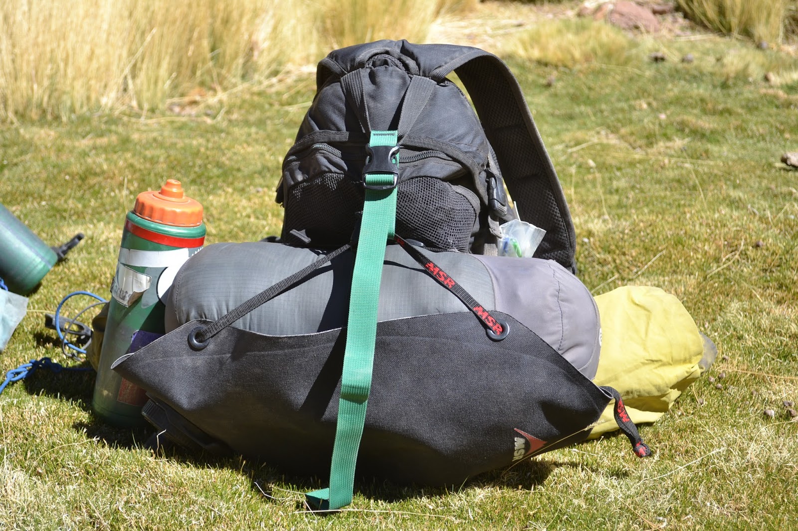
When we arrived in San Pedro from Bolivia a few weeks before, the heat was unbearable. At under 10,000 feet, it was the lowest we had been in months. Now, due to two weeks at sea level, we had to acclimate again, and the heat was still unbearable. We took a day to organize our things and drink all the water in San Pedro, then set off eagerly for the mountains, Carlos energetically waving goodbye.
 

Carlos with one of his many cats

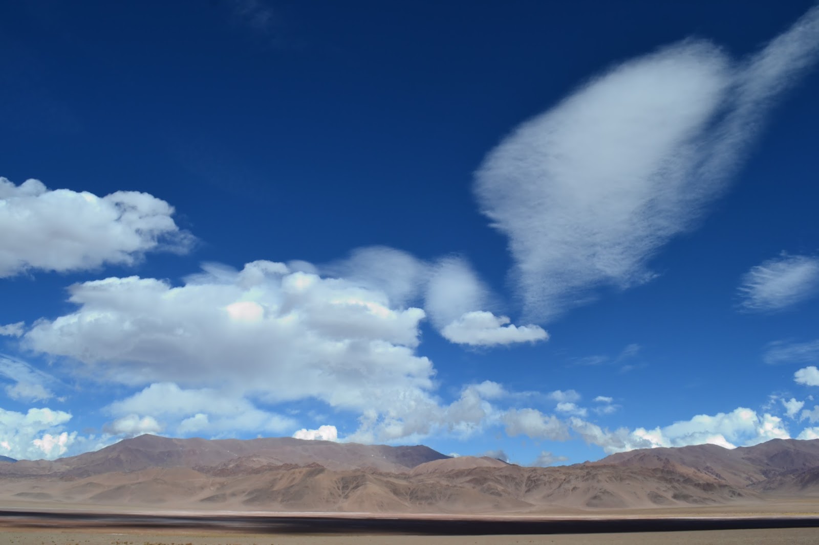
Few cyclists choose to traverse northern Chile. It's hot, dry, and flat, Northern Argentina, unfortunately, isn't much better. Our plan, echoing that of many before us, was to criss-cross the Andes, from Chile to Argentina and back, as many times as possible, starting with Paso Sico. We took it slow at first, easing our feet back onto the pedals and our butts into the well-worn contours of our saddles. The Atacama Desert, one of the driest places on earth, was no place to realize that you weren't quite as physically able as you thought. We sipped water in the shifting parallelograms of road sign shadows, searching for any sort of refuge from the scorching sun. No life was visible in many areas, only a tiny shrub here and there stunted by the wind and lack of water. As the sun slipped below the horizon each evening, we and the earth breathed a collective sigh of relief. Now we rest. To do it all again tomorrow.

Ahhh, sweet relief
Riding south out of San Pedro: hot and flat through the Atacama Desert
Officially out of the tropics, woo hoo!
Even in the desert, life flowers and blooms
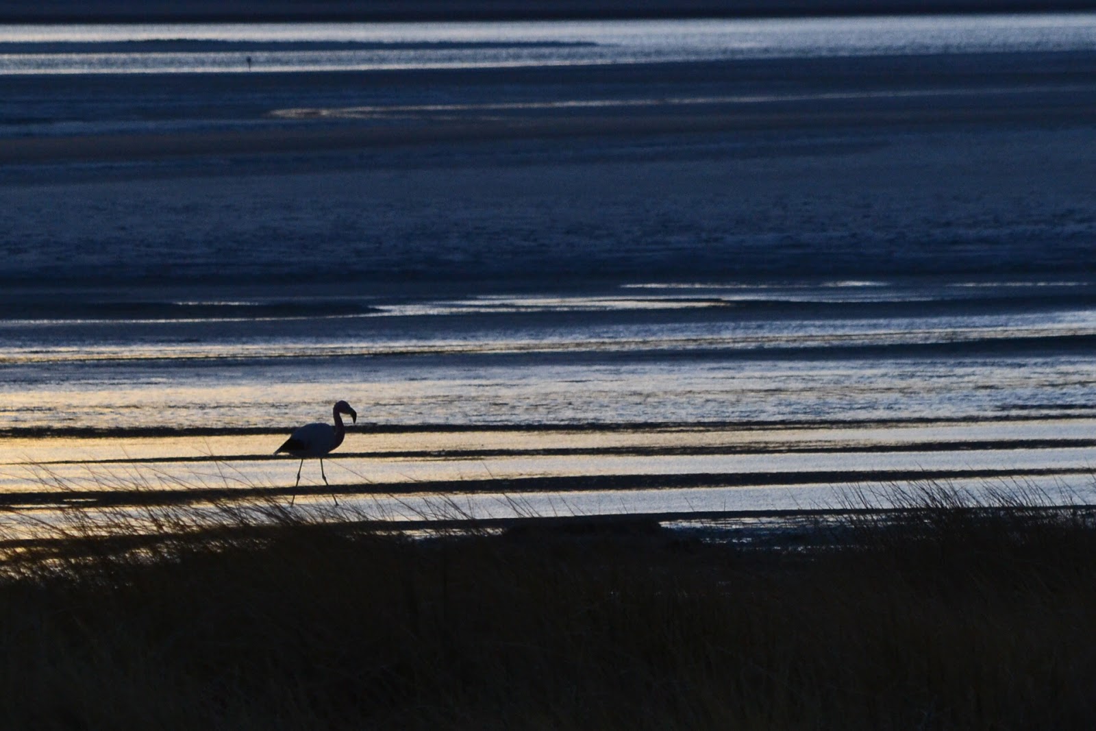
We rode through two sun-drenched pueblos, Toconao and Socaire, before our road turned west and we really started climbing. Before long the faraway peaks seemed close enough to touch, their mineral-rich, multicolored slopes gleaming in the bright sunshine, mines bent on extracting those minerals nearby. We rode by expansive salt flats, by brightly colored lagoons with even brighter flamingos, by foxes, guanacos, and all kinds of birds. The scenery was similar to the popular Lagunas route on Bolivia, only a lot less trafficked and with better road quality. What's not to like?!

Unblemished pavement sped things up for the first bit
Up in elevation we meet our old friends, the lupines
Camping under some lofty peaks near the Salar de Aguas Calientes. Windbreak, check.
Brilliant! Pastel! Emerald! Shimmering! Aaah, too bright!

No sunset would be complete in this area without some flamingos around to keep us company

Ever-changing scenery
Really colorful

At the El Laco Mine. Sometimes the colors get to be too much, and you just have to monochrome it all.

This little guy came out to play while we were hanging out at the mine

Looking back on the litte outpost of El Laco. Paradise, in my eyes. I´m not sure the super-bored caretakers agree.

Superb sunrise scenery

We were lucky enough to share our time on Paso Sico with an amiable Spanish cyclist named Juan. We were able to converse easily in Spanish, but Juan, with dogged determination, decided he was going to use us to practice what English he knew. The years of language lessons never did stick, he said, so he would insert Spanish words left and right without so much as an umm or an er. Spanglish, he said, is what he speaks, and he does it proficiently.

Descending the desolate moonscape on the east side of Abra Sico, we entered into Argentina. Our original goal, to cycle from Alaska to Argentina, was complete! A few oversized road signs marked the border, their welcoming phrases morphed into nonsensical segments by the strong wind, like "Bien os a Chi ". Other than the signs, the barren plateau of dwarfed plants and sand was rather uninspiring, and we proceeded to the joint immigration building 12 kilometers into Argentina. As usual with border bureaucracies, we didn't have the paperwork we should have been given when we entered but were through without too much issue.


Looking out on Paso Sico. On the other side, Argentina!

Woohoo, Argentina! Undoubtedly the most desolate border we have ever crossed

Route notes:
Passes to Argentina: There are four options: Jama, Sico, Socompa, and Huaytiquina (in order of remoteness). Jama is the main thoroughfare, Sico is traveled but probably more often by bicycles than cars, Socompa is super remote, and Huaytiquina, just north of Sico, has only been cycled once that I know of, probably due to the presence of land mines. Deciding between Sico and Socompa, we heard that Sico would be more interesting and found that it would also put us in position to climb Queva (see the next blog post). We don't regret the decision, as it was sufficiently remote and very beautiful. Info on Jama, Sico, and Socompa can be found here. If you're interested in riding Huaytiquina, talk to Guilherme at BBikes in San Pedro; I believe he has done it. There are immigration offices for both countries at Jama and Sico; for the other two, check with immigration officials before setting off.