Friday, March 11, 2016

21 Months: Facts and Figures

From Alaska to Patagonia, the numbers keep growing as the journey continues.

Distance bicycled: 17,085 miles (27,497 kilometers), approximately
National Parks visited: 28, plus countless other types of reserves
Bird species positively identified: 535
Stamps from Argentina and Chile in our passports: 37
Showers in the past month: 4 each, not to mention plenty of brief dips in frigid rivers
Excitement level for the rest of Patagonia: 100%

Tam at Cerro Castillo

Danny enjoying Patagonia´s countless snowy peaks and turquoise rivers

Tuesday, March 1, 2016

Where No Bike Has Gone Before: A New Path Through Patagonia, February27th-29th

Lago Verde-La Tapera

Used only by a handful of cattle ranchers, the track connecting the northern Patagonian hamlets of Lago Verde and La Tapera remained for centuries no more than a difficult horse track. In 2009 it was cleared and revitalized in efforts to create the country-traversing Sendero de Chile, and then in 2016 was given another facelift, connecting these two villages with a road for the first time. We were fortunate to be some of the first to traverse this new track, undoubtedly the first on bicycle; the 80 kilometers took us two days. Though rarely smooth and never easy, the rewards were ample: solitude, fantastic technical riding, and a challenge unlike anything else in the area.

We´ve divided the ride into nine sections, each distinct from the last in its own way. Distances are approximate, and rideable estimates are based on us: fit riders on light bikes, but not particularly strong technical riders.

Section 1: Pastures and Forest. About 18 km, 100% rideable, smooth dirt surfaces.

Smooth two-track

Go ahead! 

The cows are coming! We obliged and quickly got off the road

Crunchy leaf litter

Doesn´t get much better than this

Just in case you´re not sure what you´re doing

Section 2: Big Climb. About 4 km, 20% rideable. The surface is decent, but the sustained steep grades had us pushing for a while. Very muddy near the top.

Slippy, slidy pushing

This little guy, a chucao tapaculo, was very curious about these strange visitors to its forest

A fact of life when cycling: flat tires. We got 15 patches out of this tube before the valve broke.


Section 3: Descent. About 6 km, 95% rideable. Undulate in more mud before descending steeply to follow a clear, bubbling river through serene old-growth forest.

Steeeeeep

Section 4: Ascent. About 5 km, 5% rideable. Climb away from the river. Very steep and muddy.

The top? Please...

There´s a bike under all that mud

Section 5: Meadows, Forest, Rivers. About 15 km, 99% rideable, all except some muddy sections near the top. Gradually wind through scenic alpine lakes and meadows before descending in a shady forest to a river. Follow it for several kilometers, crossing it numerous times.

A Chilean flag at the top of the climb. Part in of this route is technically in Argentina, though all the Chileans we talked to claimed the land belongs to them. No one seems to care enough to dispute it, because no one lives there.

Colorful peak

Roughly half of my memory card is just photos of this mountain

Grassy tracks and scenery

Perfect


Section 6: Open Country. About 4 km, 99% rideable, all except some steep uphills. Mud becomes sand as the trail climbs from the river over a small hill. 

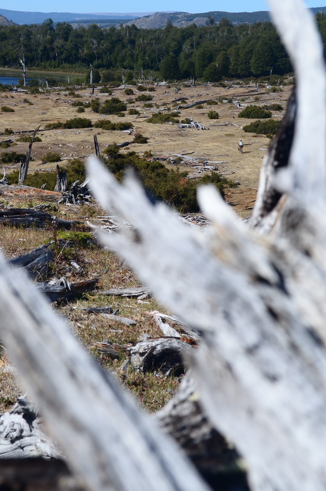
Deadfall litters the suddenly dry landscape


Section 7: Rio Caceres. About 10 km, 99% rideable, all except the very steep ascent after the river. The river is wide but also very shallow, an easy crossing. Sandy flats bring you to the foot of the last big climb.

Scenic descent

Watch out for traffic


Section 8: Out of Breath. About 4 km, 80% rideable. After the first sunny push, the trail enters a shady forest. The steep ups require frequent breaks but are definitely rideable.

Reaching the top, my bike deserves a rest...

...and we take a break to inhale some of our favorite cookies!


Section 9: A Final Adventure. About 11 km, 99% rideable, all except for a few hundred meters of exceptionally steep, rocky descent. Follow the track through forest and pastures to the town of La Tapera, crossing the Rio Cisnes just before reaching the town. The river is wide and shallow, but swift.

Mountain biking at its best.

It´s possible to push the bike until the current begins to drag it away. Then, hold on tight.

Stats
Distance traveled: 80.95 kilometers (starting a few kilometers from Lago Verde and including a few side tracks we temporarily got lost on)
Moving time: 11 hours, 56 minutes
Ascent: 2,360 meters
Min/Max Altitude: 350/1234 meters

Considerations:
- If coming from Argentina, you´ll have to descend about 200 meters over 4 kilometers to the town of Lago Verde, stamp in at the carabineros (first building on the right), then turn around and head back uphill. The entrance is about 500 meters from the border. It´s also possible to take an old horse track from town and meet up with the road about 6 km later. This track also looked transitable by bicycle, at least where we met up with it. Download the GPS file for Section 22 of the Greater Patagonian Trail for that trail, which mostly shares and sometimes parallels this road.
- We took just over two full days of riding, but plan for more, as the terrain is difficult and help would be very far away. Food is available in Lago Verde and La Tapera.
- Wild camping is available almost anywhere en route.
- Water is found frequently, including during the big climbs. We never carried more than three liters each, and I don´t believe we ever used it all before coming to our next source.
- The mud in sections 2 and 3 was definitely exacerbated by weeks of rain before we arrived, but expect mud always in those areas, even if it would be slightly better at dry times. During winter and spring, this track may even be impassable on foot or bike due to exceedingly wet, muddy conditions and high rivers.
- If you´re going the other way, more of the track would probably be rideable due to longer, more gradual ascents and steep, brake-killing descents.

Route-Finding Details:
GPS track here.
There are lots of unsigned forks near both ends of the route, so a GPS would be best. If no GPS, here are the turns:
- Immediately after turning south onto this route, take an immediate left through a gate. The newly cleared right track also meets up later, but it was blocked by a fence when we passed.
- About 50 meters later, stay straight.
- A few kilometers later, stay right.
- Pass through some gates, and after a few more kilometers, stay left. This junction is just after a gate and there´s a sign on a tree that says ¨Excursion.¨
- About 15 km later, after descending to and climbing away from a river, stay left. 


Biking to the Pot of Gold: A Detour to Argentina. February 22nd-26th

Villa Santa Lucia-Palena-Corcovado (Argentina)-Atilio Viglione-Lago Verde (Chile)

We have several cycling blogs that we follow to get ideas for interesting routes, and one of our favorites (velofreedom) gave us the idea to take a horseshoe-shaped detour out to Argentina before meeting up with the Carretera Austral farther south. Our thought was that this would bring us to less traveled, sunnier roads (in much drier Argentina), and would give us a chance to scout out some interesting trails. Here's what happened...

From rainforest and dreary skies in Chile...

...to open pastures and sunny skies in Argentina.

Our detour starts with a nasty, washboardy gravel road. Happily, there's some nice scenery to distract from the pain in my butt. Sunshine, glacial lakes, waterfalls, and the great Futaleufu River. It kills me to pass this internationally famous whitewater destination, but going kayaking or rafting out here is way over our budget for the moment.

The first trail we are considering taking leaves from the town of Palena and leads to the town of Lago Verde. We know that, years ago, this track was frequently used to herd cattle between the two places, but now who knows what state it´s in. Our quest for current information begins by asking a guy who we pass on horseback; perhaps he has ridden some of the trails in the area? He tells us to stop a green truck that will apparently be passing us in 5 minutes or so, and ask them. We do that, and though the people in the truck quite possibly think we're crazy, they direct us to the yellow house on the end of town where we get some good info. Unfortunately, things do not look promising. With the construction on good highways, cattle are now moved between places via truck, and the trail is overgrown, steep, rocky, and tough to follow. When the lady at tourist info in Palena confirms this info the following day, we decide not to do it. On foot it would be a great adventure; with bikes, it sounds like it would be a sufferfest. Second best option: we're going to Argentina!

The Chilean landscape overtaking this small house near Palena

Some friendly border officials and sunshine welcome us back to one of our favorite countries. As we stop to admire a river flowing through a big gorge, several young, local guys approach us. One is wearing a wetsuit and a GoPro. He's gonna jump from the bridge! Before the jump, he and his friends pass around a drink. In the US, this situation might call for a beer or a Red Bull. In Argentina? A cup of mate. 

And... he jumps!

The road continues to be in awful condition, but at least there is very little traffic, and we have nice scenery to distract us. Red-streaked mountains, sandy soil and windy remoteness all remind me of the northern expanse of this country, but trees, shade, and frequent water sources are a welcome difference. Late in the day we come upon an enormous, wild lake. On the side opposite from us, jagged peaks cradle glaciers that waterfall into the deep blue depths. Wind whips the too-blue water into frothy whitecaps and sweeps it up onto the sandy shore that our tires are grinding across. Fighting to ride through the gale, I feel like the water wants to rise up and swallow me. Hello, Patagonia!

Beautiful blues

The next morning dawns with considerably less wind and a gorgeous rainbow. The colorful ribbon seems to end just ahead of us along our road. Let's bike to the pot of gold!
Unfortunately our rainbow fades, and as we turn east back towards Chile a frigid headwind picks up, spitting rain into our faces. We put our heads down and ride to stay warm.

Things are considerably improved by the town of Dr. Atilio Viglione. Not expecting to find anything here, we are pleasantly surprised to meet a wonderful old lady with a well-stocked shop that happens to have our favorite brand of Argentinian cookies. Score!

Some riding on quiet forested roads brings us to the Gendarmeria where we're happy to go inside to have our passports stamped and to get out of the rain. Turns out that the officials at this immigration complex are super nice and want to do everything they can to help us out. Soon we are camped in a covered area shielded from the wind and enjoying a hot dinner made with water brought out to us in a thermos. What a wonderful end to a tough day.

The picturesque gendarmeria building

Camped in the woodshed

Helping the day end even better! Our copy of this book has been through almost as much as Mark Watney.

The next morning dawns with another rainbow. We set off, warm and dry and in high spirits, because this isn't any normal border crossing: it's a 4x4 track with several challenging river crossings.

Riding some riverbed gravel

Tam using her improvised carry method to cross the Rio Pico

I wish all international borders were like this one!

When we arrive in Lago Verde we are stamped in by the carabineros of Chile and start asking around for information on the next section of trail we are hoping to explore. This track runs from Lago Verde to La Tapera and would cut out a significant amount of distance for us. Turns out that we're in luck! The next blog post has all the details.

Route Notes:
The Argentine ripio is generally in relatively poor condition with lots of washboardy gravel. No water from Lago Palena almost all the way to Atilio Viglione except for one little irrigation ditch that may dry up at times. Also be aware of the river crossings that may become more challenging in wetter seasons. For more info on this route, see here.
We were unable to follow Nathan´s route notes (on the link above) from Atilio Viglione to the gendarmeria. Ask locals for the current location of the bridge, and then stay on the ¨main¨ road - there´s a lot of fun two-track around there, but we got a bit lost trying to figure out where it all went.

It´s Raining Cyclists: The Northern Carretera Austral. February 17th-21st

Puerto Montt-Hornopiren-Caleta Gonzalo-Chaitén-Puerto Cárdenas-Villa Santa Lucia

We first heard about the Carretera Austral in Canada, when someone told us that it was like the Icefields Parkway through Jasper and Banff, except far longer. It's been in our minds since then, and it's hard to believe that now we are actually here. The road was built under Pinochet in the 1970s in an effort to connect the isolated small towns of southern Chile, and it now has become known to backpackers, cyclists, and other travelers as one of the most scenic routes in the world. Below is the story of our ride through the northern section.

The northern Carretera Austral, surrounded by greenery

There are plenty of small towns along the route but we know that the Puerto Varas - Puerto Montt area would be our last chance for a while to tune up bikes, do some shopping, and cook up some healthful delicious food. None of this would have been possible without our warmshowers hosts Lucas, Paloma, and Gabriela. So many thanks to you all!

Finally, from the streets of Puerto Varas, we see Volcan Osorno! We were up there...

Some hilarious graffiti around the city

Our gear getting some waterproofing. Here we´re painting Chris´s gloves with a mix of silicone and turpentine...

...and later we apply a similar mixture to the seams of our tent. Fortunately it later rains, offering a chance to test out our DIY handiwork.

Some colorful landscaping in Puerto Varas

Our travel guide describes Puerto Montt as a city with many exit points, whether it be by bus, bike, or boat. Our big exit will be along the Carretera Austral, which officially starts here.
Unfortunately, the only way to get there is to take the main highway south from Puerto Varas. Yes, there's another road but apparently that road has even more traffic (because there's no toll) and no shoulder. So, the day begins with us racing alongside great tractor trailers and other speeding traffic as we all rush to reach Puerto Montt as quickly as possible.

Puerto Montt: our first time cycling at sea level since Cartagena, Colombia, near the northern tip of South America.

The weather rages on outside as climate-controlled life continues in swanky department stores

Relieved to finally be outside of the madness of the big city of Puerto Montt, we leave the traffic of the main carretera and take a smaller road along the coast. Out here it's quiet and the mist makes everything a bit mysterious. We ride along coastal mud flats, passing by fisherman´s shacks and wooden rowboats. It feels good to be in a place where locals are living and working, and out of cottage country. Plus, there happen to be lots of ripe blackberries along the road, and that means snack time...


Outside of the city, it´s not long before we start seeing wildlife: here, a black-necked swan...

...and here, a snail taking the fastest ride of its life on Danny´s helmet.

Back on the main road, we make good progress to La Arena where the pavement ends and we need to catch a short ferry. Just our luck, a ferry is in the process of loading as we arrive, and we cruise right onboard! The second we're on, the ramp lifts and we're motoring away. That's our James Bond moment for the day.

As we stand on deck admiring the rugged green hills and pouring waterfalls, something in the water catches our attention. Penguins! Our first of hopefully many sightings.

A ferry similar to ours


Our bikes on board

It seems that the sky here is determined to be grey and rainy. Luckily, when you're cycling, every day has sunny surprises, regardless of the weather. These are my top three for Day 2 on the Austral.

1) We stop to talk to a loaded-down cyclist making his way in the opposite direction. Alex, from France, started in Ushuia and is hoping to reach Alaska! How amazing to talk to someone at the beginning of their journey as we are nearing the end of ours. I am so excited for him.

2) When we reach the town of Hornopiren we stop at a small local, log-cabin style restaurant to get out of the cold rain. We're planning on just getting hot drinks, but soon the lure of hot food wins us over and we're chowing down on fresh fries, eggs, and spicy merken (pronounced mare-KEN).
For those of you unfamiliar with merken, it's a local specialty of southern Chile, a delicious spice made from smoked peppers.

3) Around 5 pm, the drunken men outside the supermarket are replaced with cute old ladies selling cakes and pies. Looks like dessert is going to be before dinner tonight.

We're up early the following morning to catch a ferry. There's no road through this section, so a long ferry is the only option. It's a big, industrial boat loaded full with cars and people. When we arrive at the loading dock, a guy asks us for our tickets. As Hannah fishes through her jacket to find them in an inner pocket, he asks again and again, "los boletos, los boletos!" As soon as the tickets are out, he tells us to head on board. "Adelante! Adelante! Adelante!" This guy, who is in such a ridiculous hurry to load the ferry even when there's still half an hour before we leave, makes us laugh.  Remember all the other over-anxious men who have loaded our bikes onto various forms of public transit in Central and South America? Chile is still part of Latin America, no matter how hard they try to pretend otherwise. 

Morning dew in Hornopiren

Steaming south

There are 5 other cyclists on our ferry, and we've seen others on the road. It is unbelievable how many cyclists are out here! Part of me is really happy to see so many people out here using bikes to explore and travel, and another part of me is sad to see the cycling culture change. For every other section of our trip, every time we saw another cyclist, we would stop to exchange stories and info. Here, with so many people on the road, that's simply impractical if you don't want to spend all day chatting. So now we just ride by and wave. It's different.

When our ferry arrives we have a 10 kilometer section of road to bike to the loading ramp of the next ferry. When I ask a ferry attendant how much time we will have before the next ferry leaves, he tells me 40 minutes. Not sure if we can make 10 kilometers in that time, I inquire, "what happens if we don't make it?" In response he shrugs. "Make a fire?"
Not reassured by this, we bike as quickly as possible, and as we arrive, the next ferry is just pulling away. Noooo!

There it goes. So close!

Luckily, things are not as bad as they seem. Another ferry is coming in half an hour or so (why couldn't the first guy have told me that?) and since not a single cyclist of the nine made the first ferry, we all sit around and share snacks before boarding the last boat.

Finally done with ferry rides, we arrive in Parque Pumalin. In an effort to conserve some of the last temperate rainforest in the region, American businessman Doug Tompkins simply bought a whole bunch of land and made it into a park. Chile, apparently, was originally very suspicious of his motives, and the whole thing was rather controversial. Regardless, now it is open to public visitation, and we are excited to explore it!

We ride a bit and then stop to walk the Sendero de Los Alerces. The path takes us through a stand of old-growth forest, the kind of forest where it's easy to believe in magic. The Alerce trees are thousands of years old, rare, huge, and majestic. Ferns and mosses grow from every surface, and strange insects dance around us. We see a neon orange bumblebee and an iridescent beetle that looks like it just emerged from Pan's Labyrinth. We're all happy we took a bit of time to wander out here; sometimes even biking is too fast.

Don´t get caught in those pincers

Textured, cedar-like bark of the alerce

Everything growing seems to be growing from everything else. Even the dead trunks have multiple trees growing out of them, not to mention the countless ferns, lichens, mosses, and fungi.

And we get to be a part of it! Here´s the four of us coming together to form an alerce tree.

In the park it's required to stay in campgrounds. It would be almost impossible to wild camp anyway: the vegetation is simply too dense! When we arrive at the campground we want to stay at, it's completely full. Luckily, one of the parked RVs does not have a tent in its tent site, and the two friendly Swiss inside the RV say we can camp there, for free! Even better, we have a private, covered picnic area that is a fantastic refuge from the relentless rain. It´s all very North American in style.

Volcan Chaiten, the nearby volcano, had some nasty eruptions from 2008-2011, and we can still see the destruction it wreaked on the park. As we ride we pass huge rivers strewn with dead trees, and hillsides of blackened vegetation. It's a stark reminder of the power stored within the earth.

Regrowing forest

It takes rain - a lot of rain - to make a rainforest.

We do one more hike before leaving Pumalin. My favorite part? The chucao tapaculos. These birds are small, but quite loud and extremely curious. When we stop and wait quietly, they approach, getting within inches of our feet! I feel lucky to be able to share a small moment with these delicate creatures.

A curious chucao tapaculo. This photo was actually taken far south of Parque Pumalin; the forest in Pumalin is simply too dense to let enough light through to allow a quality photo of these energetic little birds.

Leaving the park, we arrive in the strange town of Chaiten. The whole place is rather run down and feels almost deserted, except for the hordes of backpackers and cyclists. The place was hit hard by the volcanic eruption, and it seems clear that it has only survived due to its location on the Carretera Austral.

Continuing south, the sky begins to clear a bit and our road winds through a crazy mix of jungle and glaciers that make up the unique scenery.

And lakes. Don´t forget lakes. There are tons of them dotting the landscape along the Austral

Descending to Villa Santa Lucia

No one can deny that the Austral is beautiful, but Danny and I haven't been enjoying it as much as we would have at the beginning of our trip. We've learned and changed a lot throughout the last 20 months, and right now the Austral isn't the challenge we're looking for. Annoyed with tourist traffic, we want to find our own road less traveled. Hannah and Chris aren't in the same headspace. They are enjoying the Austral and excited to make some progress south. We talk about it and decide that it would be best to split ways for a bit. We'll miss our wonderful friends, but we'll catch them down the road.

Don´t drive too fast, folks.

Hannah and Chris: a portrait.

Route Notes:
Puerto Montt-Villa Sta Lucia (Carretera Austral): Make sure you buy your ticket ahead of time for the Hornopiren-Caleta Gonzalo ferry! There are shops in Hornopiren, Chaiten, and Villa Sta Lucia. Free wi-fi in the plazas of Hornopiren and Chaiten. About half of this stretch is currently paved, and they're hard at work on the ripio around Lago Yelcho. No fee for Parque Pumalin trails, but camping in the park sites is 2500 pesos p/p or 7500 for a "modulo," your own covered picnic area. Camping outside of the campgrounds would be difficult, as the forest is continuous and dense. It's also prohibited. There's an info center in Caleta Gonzalo.