Sunday, June 14, 2015

Answers to the Annual Blog Update Quiz

Below is the annual blog update quiz! In case you forgot the questions:

Which is greater:
1) Miles travelled by bus or miles travelled over water? 
2) Number of flat tires or days of rest? 
3) New bird species seen in North America or Central and South America? 
4) Number of crocodiles seen or bears seen?

There's also a bonus question: what is the average age of touring cyclists we have met?

At long last, the wait for the answers is over! Here they are with explanations of how we arrived at these conclusions. 

Question 1) Which is greater: miles traveled by bus or miles traveled over water? 
The sailboat on which we spent a week crossing from Panama to Colombia

Though it's tough to accurately measure distances over water (tougher than plugging it into Google Maps, anyway), we approximated that, on our big boat trips crossing the Sea of Cortez in Mexico (260 miles), the Gulf of Fonseca from El Salvador to Nicaragua (45 miles), and from Panama to Colombia (350 miles), we traveled approximately 664 miles. That also includes 3 miles from Monterrico to La Avellana, Guatemala, and 6 miles of Colombian riverboats, in case you're wondering. 
By bus, our major trips were in and out of Mexico City, through Panama, and into Bogota, which add up to 981 miles. This number doesn't include the side trip we took by bus to Palenque, Mexico.
The winner: Bus, 981 to 664 miles

Question 2) Which is greater: number of flat tires or days of rest? 
Tam's split rim, Baja Mexico

Flat tires is not a category we continued to count after five months, at which point we were at 11. Extrapolating the same rate to a year is, I believe, pretty accurate, plus perhaps five from Tam's tire continually causing flats in the Baja. Thus 31 is my guess, but who really knows?
Contrary to intuition, bad roads don't contribute that much to flats; more likely indicators are the amount of trucks on the roads (the metal in their deteriorating tires causes the majority of flats), and the quality of the bike tires and how worn they are. Memorable llantas ponchadas include my running over a large nail and Tam's tire getting friendly with a razor blade, both of which deflated their victims in about three seconds. 
Not counting the month we were in southern California, the two weeks working in/near La Paz, Mexico, and about a week of very active "rest days" (if not more), assuming one rest day every five days gives us 63 days of rest.
The winner: Days of rest, 63 to 31

Question 3) Which is greater: new bird species seen in North America or Central and South America? 
American Kestrel, Desierto de Tatacoa, Colombia

We've probably seen more species here in Central and South America, but having little prior knowledge of tropical birds and no field guide (the guide to Colombia is three inches thick and costs $75), we are unable to identify anything.
The winner: North America, 233 to 143

Question 4) Which is greater, the number of crocodiles seen or bears seen?
We saw bears almost every day along the Cassiar Highway in Canada, but while we saw crocodiles only a few separate times, two places together, a hatchery in Mexico and the Rio Tarcoles in Costa Rica, added up to a lot.
The winner: Crocodiles, 45 to 25

And one peacock in Colombia:

Bonus question: What is the average age of touring cyclists met?

Tam and I spent a few minutes one night trying to recollect every touring cyclist we had met on our journey. We remembered 68, estimated all of their ages, and plugged the numbers into a histogram generator.


The majority of cyclists fall into the age range of 22-31, but we met people as young as 2 (an infant being pulled in a trailer), and as old as maybe 65 or 70 (it's difficult to estimate the age of someone much older than you that you met six months ago).

Mean age: 32
Median age: 28
Mode: 23 (because of a group of five that we estimated all to be 23)

In the Baja, Mexico, with Phillip and Nici, two Austrian cyclists somewhere around the median age of touring cyclists we've met.

That's all for now; check back in about 358 days for next year's annual quiz!


Flats and Fake Deserts, June 11th-13th

Girardot-Espinal-Guamo-Natagaima-Aipe-Villavieja-Neiva

June 11th
The morning dawns rainy and grey 
We smile and hope it stays that way 
The cloud cover limits the heat 
That we are desperately trying to beat
Our road is flat and the shoulder wide 
Making for a smooth and easy ride
A few pedals and we start to fly
Suddenly the kms are passing by
We glide past farms and cows
Colombians have planted as much as the soil allows
The valley bordered by mountains tall and green
I'm sure they're further than they seem 
Occasionally we pass some chickens and turkeys 
Or cross a river that is brown and murky 
Eventually the clouds clear and the sky turns blue
We put on more sunscreen and pedal through. 

Our road

The afternoon continues much the same as the morning. We pass multiple stands selling hand-woven sombrero type hats, clay pots, piggybanks, and wind chimes. For whatever reason these items seem to be the local specialties. Never in Colombia will you see just one stand selling something. There will always be at least five (more often more) selling the exact same thing, for the same price. It is still a mystery to us how they make any money. Maybe they don't. 
The "towns" we pass are just tiny groups of houses. We stop to camp in a dry field. The family who owns it is very friendly and tells us that if we need anything, just ask. 

June 12th
In the morning we try to get an early start to beat the heat, but today there are no clouds, thus the sun is already burning bright at 6 am. Our plan for today is to get to the desert of Tatacoa, a unique geological formation that several people have recommended to us. To get there we need to cross to the other side of the River Magdalena, and after talking to a few people along the road, we decide that the best option is going to be to take a boat from Aipe. 
Aipe is a cute town with good grocery stores and fruterias. We stock up on yummy food for the next day or so. Finding the boat to take us across the river is a bit of an adventure. Here's how it goes. 
1. Ask nice lady at grocery store how to get to the desert.
2. Follow her directions, then ask random guy on the street if we're going the right way.
3. Descend down steep hill to a branch of the river.
4. Take bridge across it.
5. Ride dirt trail through some fields and arrive at second, smaller bridge. 
6. Choose between two small dirt trails that both lead away into pastureland.

Two roads diverged in a yellow wood...

7. Choose left trail because it looks more traveled.
8. Follow trail until it ends at a flooded field.
9. Return to first bridge and ask the different random guys we meet there how to get to the desert.
10. Go back down dirt trail, cross second bridge, and take right hand fork. (Turns out we should have followed the example of Robert Frost)
11. Ride tiny dirt trail past a bunch of cows.
12. Reach a red gate, open it, and go through it.
13. Ride on another tiny trail by the river.
14. Reach a rocky bank along a big river.
15. Wait for motorized canoe that is coming our way! 


Our boatman

The boat ride itself was only 5 minutes or so, and thus we made it across the mighty river Magdalena! We crossed the same river weeks ago to reach Mompox; it is big here, but nothing compared to its size in the north.
On the other side we order some fresh fruit juices at a restaurant and spend a little while avoiding the mid day heat. Then we ride out of town and off towards the desert. This road has been newly paved and it great for riding! We're immediately struck by how green it is, and that somehow, there are still cows out here. 

Our winding desert road

Once in the desert we meet some wonderful people from Medellin who have come out here for the weekend with an astronomy club. Apparently the desert is one of the best places in Colombia to see stars. They kindly invite us to join their astronomy party in the evening.
Side note: they also explain that the Desert of Tatacoa isn't really a desert, it's just a really, really dry forest. That explains all the greenery. 
For the rest of the afternoon we hike around a bit through the crazy formations, and then pay $2 each for the use of a cold swimming pool at one of the little hostels. It's amazing! 


Cool formations! The soil is extremely dry, flakey, and fragile.

A cute kestrel on a giant cactus

Impressive shadows

Exploring 

Hello cactus

All of the soil used to be as high as this tower, but slowly it was worn down by erosion and now we have these crazy formations. 


Once the sun goes down we spend hours enjoying the constellations, and have the opportunity to see Jupiter, Venus, Saturn, and various globular clusters through a telescope. The night sky is spectacular. 
So many thanks to our new friends from Medellin for an incredible evening! 

June 13th
One of my closest friends from high school today is getting married today! I wish I could be there with her to celebrate. Congratulations and best wishes to Emily Hisey and Zack Palchak. :-)
We'v decided that the desert of Tatacoa is Colombia's version of BLM land in the States. You can come here and do whatever you want. Throughout the night we listened to motorbikes zooming by on the road, a car going by and honking its horn loudly every 2 seconds, other people camping and counting loudly and repeatedly from one to ten, donkeys braying, dogs barking, roosters crowing, etc. Since sound carries well across wide open spaces, we had quite the symphony. 
We still manage to wake up pretty early in the morning, determined to make it to Neiva. After a short bike out of the desert, we turn left onto a road that we will take into the city. The road, much to our surprise is paved! There is next to no traffic and the sky is completely cloudy, even a bit rainy at times. This makes for excellent riding! When we reach the outskirts of the city, the road expands and it's not too difficult to navigate the traffic. We've made excellent time. By 12:00 we've already done our shopping and figured out where to meet our warmshowers host. 
This begins a lovely afternoon. We meet Erika at her place of work, a small business that is working to promote peace and social development in Colombia. Erika is a wonderful person. She's is open, welcoming, happy, and so excited to have cyclists staying at her and her boyfriend's place because they just signed up on warmshowers. Immediately I feel like we are best friends.
She takes us out to lunch with one of her coworkers, Cesar, and we enjoy a typical Colombian meal with soup, rice, eggs, french fries, and even a bit of salad! 
In the afternoon I do some cooking and Danny goes on a bus adventure to find a part of our tent that we accidentally left behind camping in a field a couple days ago. Luckily the bus travel isn't complicated and Danny is able to find the part! 
We spend a fantastic evening talking to Erika and Carlos, our amazing hosts, and Boris and Charlotte, two French cyclists who are also staying here. They have just biked up from Argentina and have tons of stories and information to share with us!

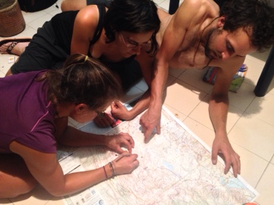
One of our favorite pastimes, looking at maps! 
 
Check out this midnight snack! 

So many thanks to everyone for delicious food and interesting stories and advice. 

Route and Area Notes
- Girardot to Neiva: paved, big shoulder the whole way. Not too much traffic but increasing near cities.
- Desierto de Tatacoa: accessed from Villavieja, 4 ways to enter. 1) paved overland route from Neiva, 2) rough (but, people told us, not too rough, whatever that means - we didn't take it) overland route from Pueblo Nuevo, ~30km north of Aipe, 3) by ferry from Pata, about 20km north of Aipe, 4) ferry from Aipe. See Tam's detailed notes above for directions to the river from Aipe. The motocanoa was COP$3000 per person, and I think it's just one guy going back and forth, so ask around to see if he's shuttling people. If not, Pata may be a better option. The road to/from Neiva is a great ride, no traffic (except right next to the city) and good road condition. No shade, either, so go early. 
- The observatory in the desert is about 6km east of Villavieja. The pavement ends there. The observatory is closed on the weekends, apparently. Just after are a number of posaderas and restaurants, and about 7km past those is another natural attraction, Los Hoyos, which is apparently some natural pools. Saturno, one of the first few little places on the left after the observatory, rents its pool for COP$4000 per person for the day. It and all the other places have zonas de camping, but we just wild camped. 

Wednesday, June 10, 2015

To Bogota... and Beyond! June 3-10

Villa de Leyva-Ráquira-Guachetá-Lenguezaque-Ubate-Bogotá-Mosquera-La Mesa-Girardot

Our night in Villa de Leyva was vastly bettered by local empanadas and garlic-olive bread, and by meeting two brothers: German, an architect designing a hospital here, and Angelo, a classical guitarist.  I can't say I've ever had a better time making pasta, with a feast for the ears emanating from Angelo's deft fingers.  
He strummed and plucked a long mix of classic rock- Kansas, Led Zeppelin, Simon & Garfunkel- the melodies and the chords at the same time, then launched into a series of technical and romantic songs.  The pasta tasted terrific, and we enjoyed chatting with the two of them for a bit as well.

The next morning, we headed south on some well-surfaced roads, taking advantage of an arepa-specializing restaurant in Tinjaca and enjoying the colorful handicrafts of Raquira.  
Cheese arepas, Colombia's version of the quesadilla/pupusa/grilled cheese

The whole area appeared to have been influenced in a positive way by the colonial draw of Villa de Leyva.  After Raquira, the road turned pretty bad, and we began to climb.  

We had hoped to make it to Ubate but were so slowed down by the rough road and giant hill that we only reached Guacheta and decided to stay.  The owner of the hotel we decided to stay in, Gabriel, was really accommodating, even letting us use the kitchen of the restaurant.  In talking with him, he told us that Colombian currency didn't have enough value for him to save up enough to travel.  It's hard to know what to say in this situation, other than acknowledging our good fortune to be from a more developed country, but what I really wanted to point out was that he owns a hotel and was wearing an expensive Lacoste shirt.  Even with the exchange rate in Colombia, his hotel is undoubtedly worth a lot more money than we have spent on this ridiculously long trip, and it's possible to spend much less than we did.  We hear excuses from our American friends, too, all kinds of reasons they can't travel.  Really, all but the very poor have the means to get out there and go, but most put other things first (a career, a family, cable TV, beer, eating at restaurants, heating, basically anything that costs money).  And that's fine -- people can live their lives however they want -- but I wish people would acknowledge their actual priorities rather than simply saying "I can't."

My priority for a few minutes was to find a stegosaurus crossing the road (this is an ad for the "dinosaur park" near Villa de Leyva). This is a stegosaurus, right? It's been a while since I last used my old dinosaur placemat.

While leaving, we gave Gabriel our contact information in the hopes that he would come visit us someday, wherever we end up. Then we biked to Ubate, following relatively smooth and flat dirt roads for the first time in awhile.  Instead of trying to brave the traffic into Bogota, we hopped on a bus in Ubate and found ourselves a short while later in the big city!  Even though we had a map showing some of the many bike lanes in the city (see below for the map), getting around was still a challenge, and we arrived at our friends' place around 5.  Meet Levi and Erin:

They have been teaching in Bogota for the last few months and just accepted a job at High Trails, our former place of work!  A mutual friend put us in touch, and the two of them were kind enough to have us at their place for a few days.  Actually it felt more like our place, because they were out adventuring over the long weekend and left the apartment to us!  We made tons of delicious food, visited almost every bike shop in the city, did a lot of work on the "Where" page of our blog, sightsaw, and did a lot of other random stuff.  Most importantly, we rested our legs for the first time in a while.  Many thanks, Levi and Erin!  See you down the road!

Homemade pizza with salsa for cheesy crust dipping

At the ciclopaseo on Calle 116. Every Sunday, this and some other roads in the city are closed to cars so that people can get outside on bikes, skateboards, or roller blades without worrying about being hit by a bus.

The big old church at the Plaza de Simon Bolivar. Most fun on our trip to the touristy area of La Candelaria was witnessing guinea pig gambling: place your money on the pail that the guinea pig enters, and win big!

We also made a lot of bread. One of Tam's neat loaves:

And one of mine:
I dubbed it "the brain bread."

The best chocolate croissants ever.

After what seemed like just hours after arriving, we hopped back on the bikes and headed out of the city.  We had a fantastic route planned with bike paths all the way, but that plan ended quickly when our riverside trail met an eight lane highway with high medians.  Who designed this bike path?  We found a different way and made it out without ever feeling too overwhelmed.  Even so, it wasn't a fun ride.  The traffic died down a few miles outside the city, but around 4, heavy fog set in, reducing visibility to a few feet.  
With a long descent to hot climates just ahead, we were happy to set up camp in the brisk temperatures of 9,000 feet in a quiet field behind a gas station.

The next morning, we began said descent. Stopping at a restaurant in Anapoima, a ritzy area with country homes for Bogota's elite, we ordered our staple meal, rice and eggs, and the guy offered fruit salad as well.  We hesitantly said yes, hoping to receive a bowl with fruit in it. Instead, we got this:

Fruit salad, Colombian style. Ice cream, yogurt, cheese, mysterious flavored sauces, maraschino cherries, a cookie stick, and some fruit underneath.
From now on, we're sticking to rice and eggs!  Nothing else!

We ended up in Girardot, where we ate some more arepas and I shaved off my beard.
Before:
After:

Route and Bogota Notes:
- Raquira to Guacheta was pretty rough. Rideable, and not so bad as the area around Gambita (see our previous post), but not easy going.  Fortunately the rough part is limited pretty much to the ascent, and the road into Guacheta are better, some parts paved.
- The 45A from Ubate, as seen from the bus, looked awful for cycling. From Zipaquira to Bogota, there was a bike lane every time I looked up from my book. I don't know about the whole way, but definitely at least in parts.
- Getting around Bogota is simple in theory but not in actuality. Calles run east-west, their numbers increasing as you go north. Carreras run north-south, their numbers increasing as you move west.  Bike paths are abundant but sometimes deposit you into a freeway.  My recommendation for getting around: stick to the biggest roads possible that have bike lanes. And use this map.
Email me for a high quality version. This is much better than the Open Cycle Map for Bogota.
- The majority of bike shops in the city are on Calle 68 from Carreras 24-30. There are others on Calle 127 near Carrera 55.  The service we received at most of these shops was awful; probably better to do everything yourself.  We are not bike mechanics, but after realizing that the bike mechanics at the shops aren't either, we watched YouTube videos of the repairs we needed to do, then just asked to borrow the tools.
- Leaving the city through Calle 80 wasn't horrible, but Highway 21 was almost until the intersection with 21 to Soacha. There was room in the bumpy drainage gutter to get off the road if necessary. Traffic for us was exacerbated by construction. If I were to do it again, I would take back roads -- or a bus. The descent to Girardot had trucks here and there but nothing too bad.


Sunday, June 7, 2015

A Year of Biking and Backpacking: Stats, Superlatives, a Quiz, andThoughts


Colombia

Alaska to...


Stats
- Miles biked: 10,865 (roughly... our odometers broke/died)
- Countries biked in: 9
- Bird species seen: 376
On a  ferry from Monterrica to La Avellana,
Guatemala
- National Parks experienced: 19
- Time zones traversed: 5
- Boat rides taken, including dinghys to and from larger boats: 18
- Trucks ridden in (with or without bikes): 10 
- Highest elevation achieved on foot: 15,800 feet, El Pulpito, El Cocuy National Park, Colombia
- Highest elevation biked: 13,100 feet, El Cocuy, Colombia
- Highest elevation camped at: 14,970 feet, El Cocuy, Colombia
- Longest time spent in one place: 4 weeks, High Trails, California
- Number of bike shops visited: 57

Superlatives
- Biggest unexpected bike problem: The steel eyelet that my (Tam's) rack was attached to broke off in California. Didn't think that my steel frame would break. 
- Weirdest food eaten: roadkill moose, Fairbanks, AK
- Favorite food eaten (in terms of quality and quantity): pupusas, El Salvador or fish tacos, Baja California
- Strangest plant observed: boojum trees, Baja California
- Favorite/most helpful bike shop: C.O.B., Smithers, British Columbia, Canada
- Worst big city for biking: Panama City, Panama (although, they are developing a nice path along the coast) 
- Biggest cultural difference everywhere: being vegetarian 
- Favorite national park (although it's hard to pick): Denali, Alaska

A grizzly fishing in southern Alaska
Annual Blog Update Quiz, courtesy of Tam's dad, Michel:
Which is greater:
1) Miles travelled by bus or miles travelled over water? 
2) Number of flat tires or days of rest? 
3) New bird species seen in North America or Central and South America? 
4) Number of crocodiles seen or bears seen?
Check back in about a week for the answers!

Thoughts by Danny
This past year, Tam and I have done some things.  We have swum in glacial Arctic rivers, explored submerged shipwrecks in the languid Caribbean, and surfed the barrels of the El Salvador coast (attempted to, anyway).  We have been caving in California, packrafting in Alaska, and birdwatching in Costa Rica.  We have eaten salmon fresh from the Yukon and drunk tequila in the town of Tequila.  This past year of travel, so unlike anything we have done before, has been a whirlwind of color, music, culture, activity, people, and experience, almost all of it entirely novel and utterly, ineffably incredible.  The people especially, from day one in Alaska and every single day since, have surprised, inspired, and educated us more than I could have imagined, and receiving such kindness has filled our own growing hearts with the hope of passing it on. 
With many new friends in Chiapas, Mexico, on Tam's birthday

Accompanying such positivity has been a conspicuous absence of negativity.  Although someone in every country we've been to has told us horrible things about the next, so far we've had no security issues at all.  Some rumors are based in truth, but the vast majority of what we have heard has been little more than schoolyard whisperings, their augmentation and distortion stemming from ignorance and fear of the unknown.  We all have dreams, we all need a human connection, and we are all more similar than we know.  Were someone to rob us tomorrow, one thing they wouldn't be able to take is my firm belief in the good of humanity.  One negative experience, or even multiple, could never overshadow all the laughter we've shared.

With all that we've done, there is also plenty that we have missed out on.  A prestigious job, processed foods, TV, a fancy car... living outside a culture that pushes us inexorably towards these things has been self-affirming and liberating.  And while I plan to further my education and accomplish something, someday, in the working world, right now I have a whole lot to be thankful for.  An abundance of food and health, a loving partner and family, and the fortune and clarity to follow the road we choose are a pretty good place to start, not to mention my trusty bicycle and a pair of well-made shorts.  

A large portion of this next year will be more of the same, if you can consider experiencing new places and meeting new people every day "more of the same."  We've just discovered the Andes, and, though we still plan to reach Patagonia, we've resolved to slow down and take more back roads, enjoying and learning as much as we can.  

A huge thanks is due to our parents, grandparents, and everyone who has supported and encouraged us along the way!  We wouldn't be able to do this without you. 
Yosemite Valley.  Goodnight for now...

Tuesday, June 2, 2015

Susacon to Villa de Leyva, or Life At 4 mph, May 30 - June 2

Susacón-Belén-Duitama-Paipa-Gambita-Arcabuco-Villa de Leyva

After our wonderful, restful night, we enjoyed a tranquil morning with pancakes and indie music.  With our own cabin, it had felt like we switched lives with someone else!  Our stay at La Violeta in Susacon was absolutely luxurious; thanks, Constancia!  Back on the bikes, we woke up our legs and headed towards Duitama.  The road was quiet and smooth with high ridges all around, checkered fields and pastures reaching up into the clouds.


We climbed and climbed, the road finally leveling off and following a meandering stream gradually uphill through a narrow canyon.  The clear water, the steep-walled canyon, the cool breeze... I couldn't help but smile, and also couldn't place why I was so randomly happy until we came upon a pasture and some cows: here at the top of this pass was the first place in a long time where our road was not surrounded by houses and fields!  There were no dogs chasing us, no people staring, no music blaring.  It was just us and the wind up at 11,000 feet.  We stopped and celebrated the present the best way one can: with Oreos, leftover pasta, peanuts, and tart mandarins (not all together).

After our snack, we rode some more until reaching a tiny village and stopping for lunch at a restaurant.  To explain what vegetarianism is and list all the foods we eat is a bit tedious (because, believe it or not, most people think we eat exclusively vegetables), so usually we just ask at restaurants for large plates of rice and eggs, two things that are unlikely, by themselves, to come with meat in them.  Simple and filling, we spice up the meal with our own veggies and seasoning.  At this restaurant, the lady asked if we wanted salad with our meal; of course!  It seemed unthinkable that a vegetable salad could be unhealthful, but unfortunately, this salad was covered in mayonnaise and canned ham.  Sigh.

We soon dropped into a wide valley, descending steep switchbacks so quickly that we passed a few cars and trucks.  The town of Belen appeared, and, though we only spent a few minutes there, the numerous cheese shops meant that this town would always have a favorable spot in my memory.  

A few hours later, after powering up another pass and descending numerous thousands of feet on the other side, we ended up in Duitama at the house of Reynaldo, the brother of a Warmshowers host.  
Reynaldo on the right with his amigo, Hugo

He and his wife Maria were very friendly, though they, like everybody else, were unsure of how to relate to us after we tactfully informed them that we prefer not to eat dead animals.  ("So, do you eat beans?"  "Yes, we like to eat beans."  "How about juice?  Do you drink juice?"). Reynaldo eats pretty much just meat all the time, so to say that there was much misunderstanding between us would be an understatement.

The next morning we enjoyed a wonderful breakfast of huevos pericos, (scrambled eggs with onion and tomato), grilled cheese, and guava juice with Reynaldo, Mario, their son (or nephew? Not sure), and a friend, Hugo.  Reynaldo and Hugo subsequently rode out with us on some back roads to Paipa, where they opened our eyes to delicious almojábanas and pandeyuca, local pastries made from yucca root.  We also picked up some queso paipa, the only local aged cheese you can get in Colombia.  Then we began to climb.  Reynaldo had recommended to us a route that follows good, untrafficked roads, so we followed him and Hugo up into the hills.  Many thanks to Reynaldo and Hugo for showing us where to go and sharing a pleasant morning with us.


After a good workout, we said our goodbyes and thanks, and while they turned around and headed back, we continued, watching the town shrink behind us and finally disappear as a new valley came into view.
 

In high spirits with an outstanding vista, guacamole in our stomachs, and a solid dirt road beneath our wheels, we started the descent, but just a few minutes in, the road turned horrible.  


Bone jarring, hand numbing, bike killing horrible.  We had no idea why Reynaldo had recommended this way, but we surmised that he had never actually been here on a bike.  The scenery was beautiful, as always, and because it took us longer to descend than it had to ascend, we had plenty of time to take it in.  


After reaching the bottom of the valley and passing through the town of Palermo, we set up camp in a field next to a river, ate a quick dinner, and soon fell asleep.

The road the next day was marginally better in parts.  We made it to Gambita, where we found a guy willing to let us use his computer for awhile to plan and send some emails.  After, as Tam went into a store, a group of schoolchildren approached me, wondering about our bikes and whatnot. I told them I was from the United States, and they all said in unison, "los Estados Unidos?!"  It was really cute.  I don't think it's so novel, to be from the U.S, but they did and spent the next few minutes asking me (and Tam when she came out) to translate words and phrases into English.  Finally we said goodbye, and, piecing together some of what Tam and I had translated, the kids said, "Bye bye, people foreigners!"  Ah, well, a good attempt at least, one I'll take any day over "adios, gringo!"

Hitting the road again after some yummy rice and eggs with breaded yucca-and-cheese sticks, we tackled some steep hills, bouncing around the whole way, and made it almost to the town of La Palma before deciding we had had enough and setting up camp among some chickens and cows in a field.

A waterfall next to the road

Typical Colombian greenery

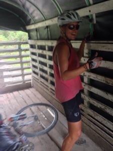
The next morning, the road flattened out a bit and we cruised to La Palma.  In town, we started talking with a guy who was about to drive his truck to the next town, and he agreed to take us along.  Happy to be done with riding on this awful road, we stood in the truck bed, our bikes on the floor, and enjoyed the scenery going by.  Even though Arcabuco was only 20 km away, the truck took hours to get there.  On arrival, the driver refused payment, nice guy that he was, and we rested after our super tough morning with a delicious lunch (more rice and eggs with veggies and, this time, some cheese almojabanas).

A long flat section near La Palma. The speck on the road in the distance is Tam.

Bouncing around in the back of the truck

The ascent to Arcabuco, as seen from the truck

From Arcabuco, we were excited to ride on some better roads to Villa de Leyva, and we choose the slightly longer, well-surfaced version, stopping at a nice waterfall in the middle and reaching Villa de Leyva around 4.  We found a steal on a hospedaje, which, ironically, is called Sueños de Daniel (Daniel's Dreams), and set about exploring and enjoying this beautiful colonial town.  

Cascada La Periquera

Villa de Leyva's picturesque main square

Route notes for other cyclists:
- Highway 55 between Soata and Duitama is about 99% paved with beautiful scenery and little traffic.  The traffic picks up a little bit more after Belen, but it's still very manageable.
- The road west from Paipa is paved until almost the top of the pass, where it becomes smooth dirt for maybe 2 km then really rough all the way to Gambita, with the exception of a few short, paved parts.  More of the same rough road from Gambita to Arcabuco, with short, steep hills just south of Gambita and some flats for awhile around La Palma, then a big climb up to Arcabuco.
- About 10 km after Palermo, just before the road starts to switchback up towards Gambita, there is a nice campsite right by a stream.  There's also a beautiful waterfall maybe 100 meters up the road from there.
- Arcabuco to Villa de Leyva: Two options, paved (mostly) or dirt (mostly).  We chose paved, and the surface was really good for awhile.  Somehow, according to Google Maps, we took a turn somewhere and ended up on the dirt one, which was decent as well.  Because, at the intersection of the two, all we saw where GMaps shows the paved road was a rough dirt road, I think their designation of paved/unpaved is wrong in this instance.  When in doubt, follow the better road, not the map.