Showing posts with label susacon. Show all posts

Tuesday, June 2, 2015

Susacon to Villa de Leyva, or Life At 4 mph, May 30 - June 2

Susacón-Belén-Duitama-Paipa-Gambita-Arcabuco-Villa de Leyva

After our wonderful, restful night, we enjoyed a tranquil morning with pancakes and indie music.  With our own cabin, it had felt like we switched lives with someone else!  Our stay at La Violeta in Susacon was absolutely luxurious; thanks, Constancia!  Back on the bikes, we woke up our legs and headed towards Duitama.  The road was quiet and smooth with high ridges all around, checkered fields and pastures reaching up into the clouds.


We climbed and climbed, the road finally leveling off and following a meandering stream gradually uphill through a narrow canyon.  The clear water, the steep-walled canyon, the cool breeze... I couldn't help but smile, and also couldn't place why I was so randomly happy until we came upon a pasture and some cows: here at the top of this pass was the first place in a long time where our road was not surrounded by houses and fields!  There were no dogs chasing us, no people staring, no music blaring.  It was just us and the wind up at 11,000 feet.  We stopped and celebrated the present the best way one can: with Oreos, leftover pasta, peanuts, and tart mandarins (not all together).

After our snack, we rode some more until reaching a tiny village and stopping for lunch at a restaurant.  To explain what vegetarianism is and list all the foods we eat is a bit tedious (because, believe it or not, most people think we eat exclusively vegetables), so usually we just ask at restaurants for large plates of rice and eggs, two things that are unlikely, by themselves, to come with meat in them.  Simple and filling, we spice up the meal with our own veggies and seasoning.  At this restaurant, the lady asked if we wanted salad with our meal; of course!  It seemed unthinkable that a vegetable salad could be unhealthful, but unfortunately, this salad was covered in mayonnaise and canned ham.  Sigh.

We soon dropped into a wide valley, descending steep switchbacks so quickly that we passed a few cars and trucks.  The town of Belen appeared, and, though we only spent a few minutes there, the numerous cheese shops meant that this town would always have a favorable spot in my memory.  

A few hours later, after powering up another pass and descending numerous thousands of feet on the other side, we ended up in Duitama at the house of Reynaldo, the brother of a Warmshowers host.  
Reynaldo on the right with his amigo, Hugo

He and his wife Maria were very friendly, though they, like everybody else, were unsure of how to relate to us after we tactfully informed them that we prefer not to eat dead animals.  ("So, do you eat beans?"  "Yes, we like to eat beans."  "How about juice?  Do you drink juice?"). Reynaldo eats pretty much just meat all the time, so to say that there was much misunderstanding between us would be an understatement.

The next morning we enjoyed a wonderful breakfast of huevos pericos, (scrambled eggs with onion and tomato), grilled cheese, and guava juice with Reynaldo, Mario, their son (or nephew? Not sure), and a friend, Hugo.  Reynaldo and Hugo subsequently rode out with us on some back roads to Paipa, where they opened our eyes to delicious almojábanas and pandeyuca, local pastries made from yucca root.  We also picked up some queso paipa, the only local aged cheese you can get in Colombia.  Then we began to climb.  Reynaldo had recommended to us a route that follows good, untrafficked roads, so we followed him and Hugo up into the hills.  Many thanks to Reynaldo and Hugo for showing us where to go and sharing a pleasant morning with us.


After a good workout, we said our goodbyes and thanks, and while they turned around and headed back, we continued, watching the town shrink behind us and finally disappear as a new valley came into view.
 

In high spirits with an outstanding vista, guacamole in our stomachs, and a solid dirt road beneath our wheels, we started the descent, but just a few minutes in, the road turned horrible.  


Bone jarring, hand numbing, bike killing horrible.  We had no idea why Reynaldo had recommended this way, but we surmised that he had never actually been here on a bike.  The scenery was beautiful, as always, and because it took us longer to descend than it had to ascend, we had plenty of time to take it in.  


After reaching the bottom of the valley and passing through the town of Palermo, we set up camp in a field next to a river, ate a quick dinner, and soon fell asleep.

The road the next day was marginally better in parts.  We made it to Gambita, where we found a guy willing to let us use his computer for awhile to plan and send some emails.  After, as Tam went into a store, a group of schoolchildren approached me, wondering about our bikes and whatnot. I told them I was from the United States, and they all said in unison, "los Estados Unidos?!"  It was really cute.  I don't think it's so novel, to be from the U.S, but they did and spent the next few minutes asking me (and Tam when she came out) to translate words and phrases into English.  Finally we said goodbye, and, piecing together some of what Tam and I had translated, the kids said, "Bye bye, people foreigners!"  Ah, well, a good attempt at least, one I'll take any day over "adios, gringo!"

Hitting the road again after some yummy rice and eggs with breaded yucca-and-cheese sticks, we tackled some steep hills, bouncing around the whole way, and made it almost to the town of La Palma before deciding we had had enough and setting up camp among some chickens and cows in a field.

A waterfall next to the road

Typical Colombian greenery

The next morning, the road flattened out a bit and we cruised to La Palma.  In town, we started talking with a guy who was about to drive his truck to the next town, and he agreed to take us along.  Happy to be done with riding on this awful road, we stood in the truck bed, our bikes on the floor, and enjoyed the scenery going by.  Even though Arcabuco was only 20 km away, the truck took hours to get there.  On arrival, the driver refused payment, nice guy that he was, and we rested after our super tough morning with a delicious lunch (more rice and eggs with veggies and, this time, some cheese almojabanas).

A long flat section near La Palma. The speck on the road in the distance is Tam.
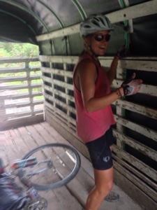
Bouncing around in the back of the truck

The ascent to Arcabuco, as seen from the truck

From Arcabuco, we were excited to ride on some better roads to Villa de Leyva, and we choose the slightly longer, well-surfaced version, stopping at a nice waterfall in the middle and reaching Villa de Leyva around 4.  We found a steal on a hospedaje, which, ironically, is called Sueños de Daniel (Daniel's Dreams), and set about exploring and enjoying this beautiful colonial town.  

Cascada La Periquera

Villa de Leyva's picturesque main square

Route notes for other cyclists:
- Highway 55 between Soata and Duitama is about 99% paved with beautiful scenery and little traffic.  The traffic picks up a little bit more after Belen, but it's still very manageable.
- The road west from Paipa is paved until almost the top of the pass, where it becomes smooth dirt for maybe 2 km then really rough all the way to Gambita, with the exception of a few short, paved parts.  More of the same rough road from Gambita to Arcabuco, with short, steep hills just south of Gambita and some flats for awhile around La Palma, then a big climb up to Arcabuco.
- About 10 km after Palermo, just before the road starts to switchback up towards Gambita, there is a nice campsite right by a stream.  There's also a beautiful waterfall maybe 100 meters up the road from there.
- Arcabuco to Villa de Leyva: Two options, paved (mostly) or dirt (mostly).  We chose paved, and the surface was really good for awhile.  Somehow, according to Google Maps, we took a turn somewhere and ended up on the dirt one, which was decent as well.  Because, at the intersection of the two, all we saw where GMaps shows the paved road was a rough dirt road, I think their designation of paved/unpaved is wrong in this instance.  When in doubt, follow the better road, not the map.

Friday, May 29, 2015

Snowy Peaks, May 24th-29th

El Cocuy-Guican-Guacamayas-San Mateo-La Uvita-Boavita-Soatá-Susacón

May 24th
We´re both feeling a bit under the weather today, partially because we couldn´t sleep last night due to a giant party underneath our window.  Colombians love their loud music. Thus, we decide to stay one more day in El Cocuy before heading up to higher altitudes. Rest day!
At night we have a typical Colombian dinner at our hospedaje. Here´s the menu:
Soup with made with oatmeal, scallions, potatos, big beans, and bits of beef that I avoid and try not to think about.
Main plate with lentils, boiled plantains, a boiled potato with a tiny bit of tomato sauce on top, rice, and an egg for us instead of sardines.
We´ve found Colombian food to be pretty basic and tasteless, but filling.

May 25th
We sleep well and wake up early to begin our climb! Out of town we start to go up immediately.  Luckily the road surface is far better than we expected. Muddy, with rivulets and bumpy rocks in places, it still presents challenges, but mostly it is composed of smooth, gray sand.
El Cocuy below

Our country road

We climb and climb. Amazingly, at 12,000 feet we are still surrounded by farmland, and there is more above us! The treeline here is much higher than anywhere we´ve been in the US. I try to imagine a cow grazing on top of our favorite Southern California mountain, San Gorgonio, at 11,500 feet. All morning it has been cloudy, and slowly it begins to rain.  At this elevation, it´s actually cold! Instead of being uncomfortable, we rejoice in feeling cold for the first time in ages!
Sometime around 11 am we reach our turnoff from the main road, and stop to ask if we can leave our bikes at some of the cabins there.  Unfortunately. no one is around, so we decide to bike up the side road and see what we find. Luckily, the surface on this road is relatively smooth, and in no time at all we reach the Puesto de Control. This is theoretically where they would check that we have paid our park entry fees, etc. but no one is around and the door is locked. We ride past. It´s also worth noting that we reach a new record for elevation biked: 13,100 feet!
It´s not far to the first little hospedaje where we meet Luis and his dog, Hable Do. Only a few words into our conversation, he rushes inside to prepare hot chocolate for us. As the rain clouds begin to clear, we enjoy a lovely lunch of avocado cheese sandwiches, and of course, lots of hot cocoa. Luis shows us his maps, tells us about himself, and agrees to keep an eye on our bikes while we are gone hiking.  We feel good about leaving them here.
Excited for the mountains, we pack what we need in our backpacks and set off. 

At first we hike along the road, then the road ends and we start to follow a trail. It's mostly flat, so we can talk and enjoy the view.  After a little while we turn left, and begin to hike up into another river valley. This valley has steep sections with pounding waterfalls alternating with flat, marshy sections filled with frailejones.  You might be wondering, what are frailejones (fry-lay-HONE-ace)? They look very similar to yucca plants; imagine a Joshua Tree with one stalk, extremely fuzzy leaves, and bright round yellow flowers.  Possibly the best part of this area? The water in the streams comes straight from the glaciers and it´s good to drink without purification.  We drink lots to stay hydrated at this altitude.

Big clear lakes
Frailejones!

Finally we reach a point where the valley begins to close off, and we are surrounded by mounds of rocks.  Here our trail turns and really begins to climb. Since it's the end of a long day, and the air gets thinner with every step, the going is very slow.  I rest every few minutes. Finally we reach the top and see a sign for our camping area. And wait, what´s that? El Pulpito del Diablo and the famous Pan de Azucar are right there! We can't be more than a 30 minute walk away from the snow! I didn't realize how far we had come up.
Our first glimpse of El Pulpito and Pan de Azucar
The cozy tent

So completes a rather epic day, with biking, hiking, and a total ascent of around 6,000 feet.  We´re camping at 14,700 feet tonight!

May 26th
The morning dawns chilly and cloudy.  We wander around a bit and discover that it´s clear enough to see the lakes in the next valley, obvious remnants of the glacier that still lingers on a far peak. Around us, the landscape is barren and windswept, strewn with boulders, and dotted with frialejones. We haven´t seen anyone since we left Luis's place yesterday.
Not every day that you wake up with a view like this

You have to love the high altitude plants 

After breakfast cozy in the tent, we decide to make our way up towards El Pulpito del Diablo. There are still some clouds floating around, but the sun is out, and it looks like they´re blowing through. It´s slow hiking with the thin air and freezing wind. 
The windswept approach 

Eventually, we reach the snow line at around 15,800 feet, the highest elevation either of us has ever been! The massive, reddish black, streaked and striped wall that is the Pulpito stands stark against the misty clouds. Pan de Azucar is just to its right, a gentle, friendly looking peak draped with a snowy glacier.  
At the base of Pan de Azucar 
Wow

On our way back, we see some other people hiking up.  In fact, there are lots of people! We learn that this is a popular trip for people to make from Bogota.  It´s the closest place to go if you want to see snow! Most people appear to be ridiculously unprepared for the mountains, wearing jeans and carrying shopping bags.  When you live in a city, it must be hard to know what to expect up here. At least Colombians are out and enjoying their country´s natural places.

After lunch we have some time to relax, read, and paint before we begin our trek down. Luckily, the climb down is easier and faster than the way up.  
Some beautiful flowers

Just before we reach Luis´ place, we are rewarded with a spectacular sunset that lights the valley on fire. Dinner is peaceful and yummy with more hot cocoa.  As we get ready for bed, the stars start to come out, and the Milky Way blazes across the sky.

May 27th
We wake up early with the rooster and the dog but end up leaving late.  We have to repack all our stuff and do some bike maintenance.  Our bikes did not enjoy all the wet mud they went through on the way up here.
Bye Luis!

The plan for today is to bike the horseshoe shaped road that connects the two mountain towns, El Cocuy and Guican. Since we´ve already been to El Cocuy, we figure we might as well go see Guican.  Plus, the road winds along at 11,000-12,000 feet right at the base of the park and its huge snow covered peaks.  How could it not be beautiful? Well, it doesn´t turn out quite as we expect. Even though the morning is clear and we have a great view of three of the snowy peaks, clouds move in, and gradually we lose sight of the tall mountains.  Instead, our road travels through high elevation farmland, past rushing streams and small houses with dogs that run out to chase us.  

A cool bridge 

High elevation farmland

The most accurate depiction of the mountains that we found

The road condition deteriorates until we are riding over large, loose rocks on a track that barely resembles a road.  It´s past lunchtime when we arrive, exhausted, in Guican.
Why would you ever paint a church like this? 

In the afternoon we bike a short distance to the next town down the valley and then take a long break to enjoy some food. After our break, neither of us feels like biking much more, so we ask at a few farm houses to see if we can camp in a field. At the third place they say yes. It's clear that we have found a good spot.  We have a wonderful view of the valley, the two dogs are small and don´t bark, and the household is run by two friendly ladies who invite us to have breakfast with them the next morning.

May 28th
We wake up and realize that we are covered in ants. AKK! How did they get into our tent? Closer examination reveals that they have eaten their way through the tent floor, creating about 100 tiny holes in the process.  It appears that they were trying to get at some of the bread we had with us; the small loaves are literally swarming with the little black creatures. At least they didn´t bite us.
We do our best to get rid of them, and get our stuff together.  Then it´s time to enjoy a breakfast of corn potato soup and arepas, thick fried flour tortillas.  The ladies who live here, Orelia and Ladis,  spend their time making beautiful baskets out of the grasses in the area and then selling them in town. We are both amazed by their talent. Before leaving we also spend a bit of time with Fabian, Ladis´ son.  He´s learning English in school, so we do what we can to help.
Thank you again to Orelia, Ladis, and Fabian for welcoming us into your home!
Orelia, Ladis, and a half completed bowl

Back on our bikes, we begin an extremely mountainous day.  We spend all morning climbing up about 3,000 feet, then we descend into a river valley and spend all afternoon climbing up another 2,000 feet. Along the way we pass through various cute little towns with ornate churches and central squares, and eat a lot of fresh baked bread from the local panadarias. Our road is paved in parts, unpaved in others. Neither of us can understand why you would only pave parts of a road. If you´re going to all the trouble of bringing the paving equipment up into the mountains, doesn´t it make sense to just pave the whole thing?
Our day ends with an enormous descent. The road is so steep, and the next valley so wide, it looks like we are about to drop off the edge of the world.  We see other cyclists out on the same road; looks like this hill is a popular local cycling challenge!
When we reach the bottom, it´s already getting late, so we decide to ask to camp at a small restaurant. The people say it´s fine for us to stay, so we find a nice spot where all noise is drowned out by the large river. Dinner is couscous with a ton of fresh veggies that I purchased for less than $1 today!

May 29th
When we wake up, large black vultures are everywhere.  It seems that they like to hang out here by the river. One of them attempts to steal Danny´s bowl. We pack up and head out quickly.
Immediately we begin to climb, and climb, and climb. We continue to go up until it´s 12:30 and we decide that it´s time for lunch.  After eating, we´re both tired and feeling a bit under the weather again.  Biking in these mountains is spectacular, but not easy! We decide to look for somewhere to stay in the next town.
Unfortunately, the next town only has a small hospedaje that is way above our budget.  We´re about to leave when the friendly owner shows up.  When she sees that we are young people on bikes, she lowers the price of the room to $22 a night. So, here we are now in our own cabin, complete with private bathroom, wrap-around porch, kitchen, and fridge.  

What a beautiful cabin!

The lovely lady who owns this place also lets us use the washing machine to clean our clothes, has loaned us her computer to type up our blog, and brought us water, fresh fruit juice and beers. What a wonderful afternoon it has been.
If you´re ever in Susacon, Colombia, we definitely recommend staying at La Violeta.


El Cocuy: Getting There and Park Info (by Danny)

1) Trails and Park Info
The park entrance fee for foreigners is COP$52,000 as of May 2015, and you also must buy rescue insurance at COP$7,000 for each day that you will be in the park.  The park office will give you a useless paper map with a ridiculously large contour interval (good thing you have rescue insurance!); see below for some other map options.  
About the trail to El Pulpito:
- Luis at Hermanos Herrera is really nice and apparently charges much less to camp than at the end of the road at Sisuma.  
- There is one wild camping option on the trail at El Alto del Conejo, which is just below the snow line. There are no bathroom facilities there.  Water can be found in many clear pools and streams coming off the glacier.

2) Towns and Roads Around the Park
The trailheads are accessed from the 43 km destapada (unpaved) road connecting the towns of El Cocuy and Guican.  We biked from El Cocuy, elevation 8,900 feet, up to the turnoff towards El Pulpito del Diablo, the highest point in the road at 12,600 feet.  The climb was steady and gradual, the surface easily rideable even in the rain.  The side road to El Pulpito is also rideable, though we walked some steep sections when our wet rim brakes didn't feel like doing their job.  After Hermanos Herrera, the side road gets rockier towards Sisuma.
After hiking, we biked to Guican.  This section of road was noticeably rougher than the other side and included many steep ups and downs, in contrast to the steady grade from El Cocuy.  It took us all morning to reach Guican.  Although many people told us that the road is now paved from Panqueba to both Guican and El Cocuy, the Guican side had much rougher pavement and many dirt/rock sections.  The road to El Cocuy, al contrario, is smoooooth.

3) Roads to Panqueba
There are two options to get from highway 55 to Panqueba, 2 km after which the road forks to El Cocuy or Guican.  
Option 1: Capitanejo to El Espino.  This road has some tough sections near the bottom, but after entering the canyon and turning upriver, the surface improves and takes you gradually up to El Espino, right before which the road becomes paved and stays that way for almost the whole way to Panqueba.  Beautiful scenery and no traffic.  There's one tiny town between Capitanejo and El Espino.  This road isn't followable in Google Maps, but it's in Open Street Maps and is pretty self-explanatory once you're on it.  In Capitanejo, ask anyone for directions to Cocuy or "el nevado." 
Option 2: Soata to Boavita to Guacamayas. Much better surfaces, lots of small towns, and a whole lot more elevation in the form of two big passes.  This route is mostly paved with few rough sections (locals may proudly tell you it's all paved; don't listen to them) and has moderate grades with slightly more traffic than the route from Capitanejo, though still very little.

Maps:
A picture of the map in the El Cocuy park office

The road is the gray line on the left.

These are hardly good enough quality to navigate from; feel free to contact me if you would like the full-size files.