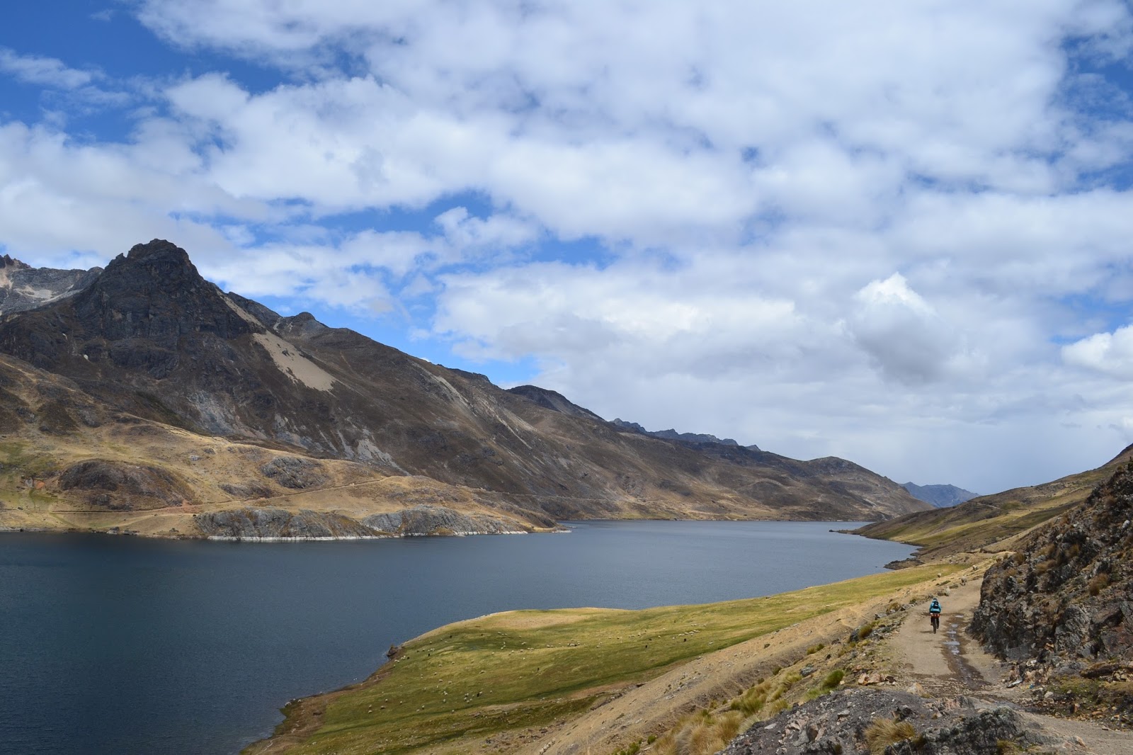
Huaraz-Pastoruri-Huallanca-Huayhuash-Oyon
 |
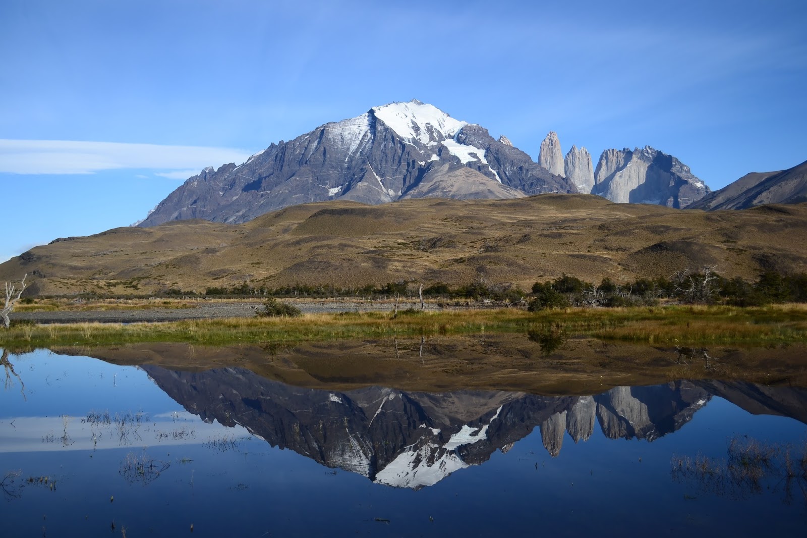
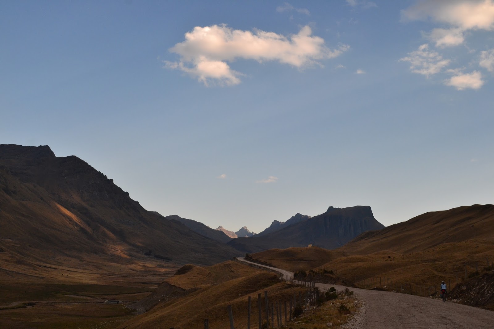
| One of many spectacular vistas from the road to Pastoruri |
From Tam´s journal:
We spend much longer in Huaraz than planned. In light of the challenging mountain passes ahead, we decide to cut down even more on our stuff and go rackless! Getting rid of our racks has several pros:
1) It forces us to get rid of unnecessary things that we don't use often, such as a bird field guide from Ecuador, the ukuleles, sadly, and extra t-shirts and bike parts, to name a few.
2) It allows us to run a wider back tire. Since our racks were already stretched to accommodate disc brakes, there wasn't much space back there for a bigger tire. We probably could have bent the racks more to fit, but lacking the proper tools, it was much easier to just remove them.
3) Progress! We've been consistantly trying to improve and lighten our loads as we've traveled south, and this is just the next step.
Of course, it comes with some challenges as well. We spend a good portion of two days shopping around at hardware stores and creating holders to support two dry bags on the front fork, not to mention finding good quality dry bags to hold our stuff in the new set-up... but that's another story. When we're finally ready to leave on the morning of the 13th, as we're riding out of town Danny realizes that his front derailleur is hitting his new, wider back tire. He actually changed his bottom bracket a few days before so this wouldn´t happen, but with his inset chainrings and the new tire, it´s still happening. We attempt some roadside maintenance and only succeed in intentionally breaking the part of the derailleur closest to the wheel. It´s better than it was, but it´s not enough. We need a bike shop. It's Sunday, so of course no shops are open. Looks like we're staying another day.
 |
| Tools available for derailer adjustment: Leatherman multitool, rock, and broken bits of brick |
The time passes faster than we expect. An unexpected run-in with our new friend and fellow touring cyclist, Chris, results in a six hour stay at a local coffee shop, eating, drinking, sharing stories, and of course laughing a lot.
Chris, originally from England, has bicycled all over the world and is an amazing guy. Check out his blog
here.
 |
| Chris´s mug in an upside down mug |
Morning of the 14th we're able to put a spacer on Danny's bottom bracket and finally roll out. It's a bit bittersweet leaving town. I feel like we've achieved so much in our short stay here. We've climbed an 18,000+ foot mountain, changed up our setup, and given our style a bit of a make-over. What I mean by this last comment is that a nice lady at the market replaced the broken zipper on my fleece with a bright pink one, and we've both aquired a ¨
buff,¨ that lightweight circle of fabric that can serve as a hat, scarf, or numerous other things. I used to think that these were useless pieces of fabric, more useful for fashion than anything else, but now I see how practical they can be.
At the same time, we're both psyched to be leaving the noisy city where marching bands roam the streets and fireworks explode at all hours of the day and night. It's time to get back to the mountains. Slowly, our legs remember how to bike and we speed down a paved road until the turn-off to the National Park and Pastoruri, where we are able to find a place to wild camp for the night,
Sept. 15th
In the morning a dirt road takes us to the Huascaran National Park entrance. The guards here are a bit strange. One talks at us constantly and is clearly disappointed when he sees that we have already paid our entrance fee. The second one asks how long we have spent in Peru, and when I tell him that we'll be here a couple of months, he glares at me and says, "you must be rich." It's not a very kind welcome to the park.
Of course, I understand that having had the opportunity to work in the U.S. has set us up with more money than the typical Peruvian makes, and obviously everyone´s situation is different. But the biggest difference I see is that we have chosen to use our money to travel, whereas the vast majority of people use their money to raise a family. Our priorities are simply different. Bike travel can be extremely economical, and I really believe that most Peruvians with a decent job, such as a park ranger, could save up and travel around their country for a few months if they so chose.
And then there are many Peruvians who really don't make any money, those who are rural subsistence farmers. I can´t ignore that we have so much more than they do, but I still wish that they could see us for more than our money. Why is the first question so often "how much did your bike cost?" and not, "where are you from?" or "what's your name?" I guess that's capitalism for you.
The entrance to the park is improved by an interpretive center which discusses the affects of climate change on the local communities and the mountain ecosystems. It's extremely well done and reminiscent of something that you would find in a North American National Park, except the electricity doesn't work so it's very dark.
Along the park road there are various displays showcasing local natural wonders, and we have a great time exploring and enjoying the views of the surrounding snowy peaks. We go over a pass and set a new altitude record for the bikes, 15,700 feet or so! Beautiful wild camping tonight.
 |
| A bubbling pool. Geothermal? |
 |
| Tam with a big Puya plant |
 |
| Glacial turquoise mixing with mineral red |
 |
| Interesting mountains |
Sept. 16th
The road quality is incredible and we spend all morning enjoying the scenery, since we don't have to steer around rocks and potholes. Some ups and downs bring us to an enormous, circular, sweeping vista. The valley floor looks like a water color palete, watery blues, greens and reds swirled together artfully and then left to dry. In some areas the green forms mossy clumps, in others it represents short grasses. I'm not sure whether the grasses are naturally short or have been mowed that way by the ubiquitous livestock this park protects. From the undulating valley floor rise hills and ridges. The layers of rock put their geological history on full display. In my mind the many ridgelines take on forms and personalities, as amorphous cloud shapes sometimes do in the sky. I see a great caterpillar with a twisted face, a gigantic fish, and a series of enormous mushrooms emerging from the earth. Above all of this -- snowy peaks. Standing in one place and turning my head as far as it can go I can see majesty in every direction.
The top of our pass is a new altitude record, just under 16,000 feet! Then a paved descent to the town of Huallanca where we stock up on food for the next few days.
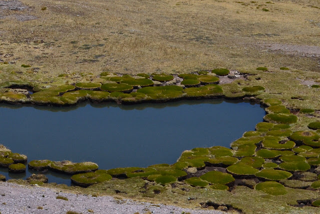 |
| Mossy clumps |
 |
| Mountains everywhere! |
 |
| Quite scenic! Tiny Tam riding on the left |
 |
| Picture-perfect riding |
 |
| The bullring in Huallanca, ¨Ranching and bullfighting capital of Ancash¨ |
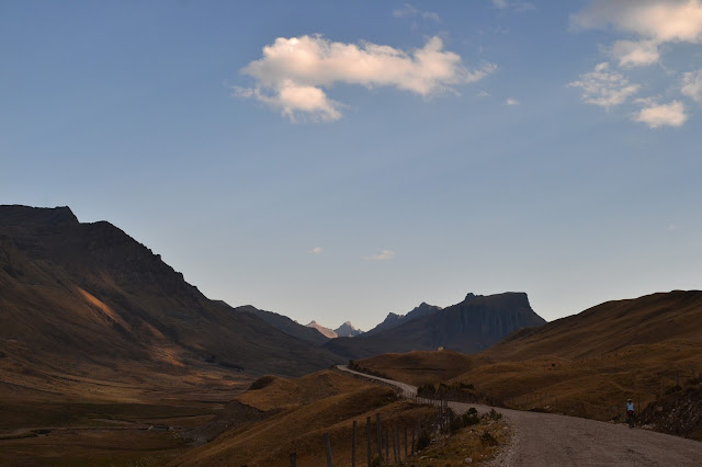 |
| South of Huallanca. Time to find a campsite |
Sept. 17th
We start off riding on the main dirt road and, after breakfast, turn off onto a small donkey track that will take us to the Huayhuash (pronounced WHY-wash) trek. Within moments, the trail goes from ridable, to mud, to rock-garden. As we edge our way along the narrow trail and lift our bikes over boulders, I feel like I'm rock climbing with my bike. When our trail finally reaches a new valley we descend off the trail to the soft green below with the hope that no trail will be better than a rocky one. The valley floor turns out to be covered in a very interesting green plant. Star shaped, small and tough, it forms a carpet, and when you tap on it, it sounds almost hollow beneath. As we half ride, half walk, I feel like I'm traveling over a green glacier. In places, holes like
moulins open up exposing watery, marshy depths. In other places there are vegetation crevasses to traverse, rivers flowing below the carpet.
 |
| A rare rideable section, no trail for the rocks to accumulate on |
 |
| An extra arm workout |
Early afternoon we spot a gleam of hope in the distance: a road! The rocky road feels magical after our marshy morning hike-a-bike, and reaching the top of the pass, the views are spectacular! Tremendous snowy peaks tower in the distance, and a lake below reflects them in perfect detail. Marveling at the reflections in the lake we realize that they are caused by oily mining residue. The whole valley is smeared in a nasty reddish orange. Gross. Mining has really destroyed the landscape in so many of these remote mountains. But... if there weren't mines there wouldn´t be roads for us to ride, and we'd still be on that donkey trail....
 |
| Crazy reflections |
 |
| ¨We care for the ozone layer.¨ That´s nice. |
 |
| Big boulder, bitty bike |
Our camping spot is epic. Outside the tent door is a wide waterfall overflowing with sparking sheets of water, and just beyond, perfectly pointed peaks painted in purples and pinks by a mix of clouds and setting sun.
 |
| Pretty nice camping spot |
 |
| Painted sky |
Sept 18th
We begin our day on the Huayhuash trail. For those of you unfamiliar with Peru, this trail is a popular trekking circuit that passes an insane number of huge snowy peaks, including the second-highest in Peru, and beautiful mountain lakes. Most of the circuit is at very high altitude, so it's a good acclimatization hike for those hoping to climb one of the bigger mountains. The trail is made for hiking, but we're hoping to bike as much of it as we can.
Only a little ways into our ride we are stopped by a lady who steps in front of us and hits a booklet of tickets with her hand. She stands there and looks at the ground for about a minute. We look at each other and back to her a number of times. Finally Danny asks her, "Is there something you'd like to say to us?" Through her mumbled words we make out that we are supposed to pay S40 (roughly US13) each to pass through their community (a collection of about four huts). When I ask the lady what the money is used for, she mumbles something else indistinct into her scarf. The tickets that we have purchased say that they are for conservation, although the picture of the cow on the front makes it clear that their definition is different from ours, that the focus is on conserving the local communities and not natural places -- we are surrounded by ranchland. Rather confused, and feeling a little bit like we were just robbed, we continue on.
We learn later that this is a common practice along the trail. At each camping area a local community charges a fee for passing through. These communities aren't actually near the trail -- they are in nearby valleys -- and we heard different explanations for what the money is used for. The second guy who charged us said it was to go towards improving a local school. The third guy who charged us said it was going to improving a campsite which we didn´t use, and a friendly backpacker explained to us that there used to be lots of robberies along this route, but after the
cuota (fee)
system was imposed, there haven't been any, possibly because the people charging us now pay the people who were doing the robbing before. Well, at least now it's organized, right?
The whole thing makes us frustrated. It would be easy for the locals to set up small businesses here providing a small
hospedaje, cold showers, local fish, or snacks. People would be happy to pay for and support these things. It´s not the fault of the locals; they don't know any better. They ask for money to support a vague notion of ¨conservation¨ or ¨protection¨ and the backpackers pay. It's the system at fault. Education is needed.
Apparently hiking the whole loop costs around S180 (roughly US60) per person. We got away with paying just S85 (roughly US28) each on the section we did.
As this is a hiking trail, we meet several friendly backpackers along the way. They're going about the same speed we are on one of the more gradual ascents, and we enjoy a chat. Hope you folks had a great trip!
After a great descent where we're actually able to ride on some beautiful singletrack (this is my first time ever riding singletrack -- got to start somewhere right?), we have lunch on the edge of a giant turquoise lake bordered by glaciated mountains. A local guide is setting up camp behind us for his clients who are trailing behind. He and his crew of three donkeys have hauled up three tents, big backpacks, food, woolen blankets, a giant propane tank, and more that we can't see. It all looks very luxurious. I think that this is the Peruvian version of RV camping.
 |
| Bike meets mountains at Laguna Carhuacocha. |
 |
| Local improvements: solar panel on thatched roof of adobe hut |
In the afternoon we head up a second pass. The ascent proves to be one of the most difficult things I have ever done. The trail is steep, narrow and rocky. My arm muscles, long out of use, are burning, and my bike moves ahead in shaking increments. The feeling of exhausted joy we experience hours later when the trail flattens out is hard to explain. We set up camp as it starts to rain.
 |
| This was one of the less-steep sections where I could balance my bike and my camera |
Sept. 19th
In the morning we struggle through the rest of the climb over the pass, feeling the burn from yesterday. A descent brings us to the Huayhuash campsite for lunch, where the friendly local guide we met yesterday (with the donkey RV system) shares some bread with us. We have enough food, but we're running a bit low on certain items because all the hiking/biking is taking longer than we expected. The fresh bread is greatly appreciated. I can't help thinking that perhaps all the bread we have given out to locals asking for money has finally come back around to us.
The next pass turns out to be pleasingly gradual and we're able to ride sections of it. I'm able to look past my physical discomfort to enjoy a large peak covered in a glistening glacier that seems to be larger every time I look at it. Across the valley from this glittering monster is an extremely tall waterfall that sends a gentle veil of water showering to the valley floor. A few false summits, and finally we're at the top. New mountains on the horizon look as if they've been garnished with whipped cream. As the sunset starts to light up the sky and we set up camp, we're in tired awe of the landscape around us.
 |
| Rideable trail! |
 |
| Another amazing camp spot |
 |
| I never tire of watching sunsets |
Sept. 20th
It appears that the deep blue lake below us was once a quarry. The sides up to a certain point are white and rocky, stripped of vegetation, and a jagged island in the middle has a road scraped across it. Our trail traverses along the lake edge and then down to where the electricity is made. I can't help thinking that the trail would have less ups and downs if we didn't have to go around the dam area. (no pun intended.)
From here we begin the slow ascent up our last pass of the journey. As we climb it begins to rain, then hail, then snow. This is a new experience: pushing our bikes on a narrow trail through a snowstorm. Luckily visibility stays clear enough and as we reach the top of the pass the sun begins to shine. At the top we look down and see a good quality road! Hooray! Smooth riding again! A long descent takes us into the town of Oyon where we happily find a small
hospedaje to rest and recover.
 |
| Smooth riding |
 |
| Beautiful descent |
 |
| Mountains and bikes, two of our favorite things (if you couldn´t already tell) |
 |
| Laguna Surasaca |
Sept. 21st
 |
| A young child swaddled on the back of the cleaning lady at our hospedaje |
A much deserved rest day! A visit to the market this morning left us well provisioned with delicious fruits, veggies and fresh bread. Time to charge the phone, enjoy some podcasts, and eat plenty of
cachangas (Peru´s version of fried dough)!
If you're wondering about our new set-up and how it´s working... we're still re-arranging bags and figuring out how to make them work best. We´ll put up a link to the gear page when we've settled on something we like.
Route Notes:
Huaraz to Huallanca: South on the main paved road out of Huaraz, we took the signed left after about 40km onto the dirt road to Pastoruri. Well surfaced and water is plentiful. After the turnoff to the glacier and the first pass soon after, the scenery gets better and the road smoother. Really good cycling.
A descent brought us to the main paved road and a left to Huallanca, where there are stores and accommodation and even, if I remember correctly, a bank.
Huallanca to Oyon: There are no connecting roads through the Huayhuash mountains, so the route we took linked up with the eastern side of the popular Huayhuash trekking circuit, in total probably about a third of the trek. Dan from
fatcycling was kind enough to send us his GPX files, so we were able to follow the next part with ease.
We headed south out of Huallanca asking for Huayhuash. The road is well surfaced dirt following a wide valley. At kilometer marker 23 we took the rocky trail on the left. The trail takes you around to and along the right side of a different wide valley, lots of pushing involved, a few hours at least due to rocks. After getting fed up with pushing and carrying, we tried simply freestyling by the river but that wasn´t much faster. We followed the valley until picking up a rocky road near the top of the pass that took us over the top and down the other side.
The next valley is where we picked up the Huayhuash circuit near Laguna Mitucocha. You´ll see the trail across the river on the right near the bottom of the descent. The trail is world-class in parts and always scenic, but mostly the surface is very rocky and unrideable. Tons of pushing and carrying. We followed the sendero for two days and 34 km to the dam at Laguna Viconga, where, instead of heading west along the circuit and dropping into the next valley, we took a different, smaller trail up to Abra Portachuelo and down to Laguna Surasaca. The road after that last pass was absolutely fantastic, scenic and smooth, and then it´s a few km of straightforward riding, mostly downhill, to Oyon. Shops, restaurants, internet cafes, accommodation, and a bank with an ATM.
The consistently unrideable surface, thousands of cows, and non-negotiable fees meant that bikepacking the Huayhuash circuit was not the remote singletrack experience we had hoped for. The trek itself is beautiful and worth doing, but I would advise against bringing the bike unless you have ample off-road skills and are okay with pushing and carrying, sometimes for long stretches. If you would prefer to stick to roads, I would highly recommend the road up to Pastoruri and then heading west to Conococha, where you can meet up with
Peru´s Great Divide. Or, from Huallanca, head south and continue following the road to Chiquian, where the official Huayhuash trek begins, and then to Conococha. Both of those routes take you way out of the way, but hey, bike touring isn´t about getting anywhere fast.