Showing posts with label Alaska. Show all posts

Tuesday, August 12, 2014

An Amazing Ride to Stewart

We convinced Pam and Monica, the two cyclists we met at the campground last night, to ride the side trip to Stewart, BC and Hyder, AK, with us.  It's 80 miles round trip, and at the end of the road is a famous bear feeding and salmon spawning area.  We set off together in the morning and rode the most beautiful road down to the coast.  Snowy mountains with glaciers atop, waterfalls cascading down, lined the road.
Rivers, bears, a clear sky... what a great ride!  At one point we passed through a narrow canyon, the walls shutting out the sunlight, and rode next to a muddy, raging river.  Then back into the big mountains and sunlight.  
Tonight we are going to try and see some bears feeding, then tomorrow we'll head back up the scenic road to Meziadin Junction.

Monday, July 28, 2014

Tam's Journal, July 24-27

July 24: In the morning, we wake up in the bus, eat more than our fill of chocolate chip pancakes, do laundry, and clean up as best as we can.  Afterwards we both spend time talking to Jay and his wife, Debbie, along with their friend Bob, who lives down the road.
They're a wonderful resource of entertaining stories and advice.  It's 3:15 when we finally set off.  We wind up and down over gradual hills with lakes, clear streams, and rounded green mountains that break up the spruce-birch forest.  Around Tok the road flattens out, and it's like a runway. The good road, an amazing tailwind, and pancake fuel make the ride go by quickly.  When we arrive in Tok, I can't believe we've gone 60 miles.

July 25: We wake up and bike 1.8 miles back the way we came, to Sourdough Campground.  We can't pass up all-you-can-eat pancakes for $10!  Together we consume a total of 45 good ol' sourdough pancakes.  The lady working there also makes us veggie sausage and hot chocolate.  While we're eating, we meet three guys from New Zealand: Sam, Sam, and Cam.  They've been driving around having adventures in an old green van with a lego man as mascot on the front.
We share stories over breakfast and talk a bit of politics with the pancake chef.  All of this amounts to a true, sourdough, Alaskan roadhouse breakfast, the perfect way to say goodbye to this fascinating state.  Afterwards we go food shopping and fly out of town propelled by yet another tailwind.  About 57 miles up the road, we stop at a free campground in the Tetlin National Wildlife Refuge.  The campsite is beautiful, and just when we thought our night couldn't get any better, we have the pleasure to meet some other travelers down by the lake.  Two are cyclists on a round-the-world trip, and two are from Switzerland exploring Canada and Alaska in a van.  As we talk, we are entertained by a mother duck and her twenty adorable ducklings out on the lake.

July 26: At 8:40 or so, we meet our new biking friends Billy and Nolwenn for breakfast by the lake.  We share with them the last of our pancakes, and they share Japanese Green Tea and oatmeal with fresh raspberries.  It's a delicious way to start the day.  It's already 10:30 or so when we begin to ride.  Our road takes us through more spruce forest and lots of hills.  The clouds are hanging low, so there's not much to see besides the occasional lake.  Our first bit of civilization is the Tetlin NWR Visitor Center.  We find it thoughtfully designed, just like the campsites and displays also associated with the park.  We fill up water and eat lunch. Just seven miles up the road, we reach the Alaska-Canada border.  Only U.S. Customs is here.  They have a huge building with a yard for the dogs, and the road passing through is watched by large, gray cameras from every angle.  There's no Canadian Customs here.  It's 20 miles down the road, just outside the town of Beaver Creek.  Those 20 miles are on bumpy chipseal, but the road flattens out quite a bit, and the sun finally comes out through the clouds.  On the way, we see multiple cool birds and meet two cyclists on a tandem bike.  They have plans to travel up to Deadhorse, where we started.
At the Canadian border crossing is a large, red maple leaf and a small, brown building.  I'm sure there are cameras, but they aren't large enough for me to notice them.  A nice guy checks out our passports and asks a few questions.  In a couple minutes, we're through.
Once in Beaver Creek, we make a couple of stops.  #1 to purchase and eat an amazing peanut butter cookie, #2 to purchase a grapefruit, and #3 to get a map and information on the road from the visitor's center. We decide to head to the first campground, 10 miles out of town.  At this point, we've been warned multiple times about the construction on this road, and we're not sure to expect.  What we find is a combination of gravel, mud, and rocks, but for the most part it's not too bad, and we make fairly good time.  At the end of the day, we're both happy to find a cute campsite with a big picnic table and a view of the lake.

July 27: When we emerge from our tent, the sky is cloudy but there's no rain. Yay!  We ride for a bit on bumpy gravel then get to a section where we must ride in a pilot car for 3 km or so.  After this, there's only a bit more gravel, then we hit chipseal.  Never have I been so happy to ride on chipseal.  We ride through more forests and lakes.  In one of these lakes, we see two regal trumpeter swans and three of their gray, fuzzy cygnets.  It's a treat to see them so close.  Cruising along, we notice two cyclists coming up behind us.  It's Chris and Berel, both studying medicine in Germany and biking around Alaska and Canada on their holiday.  They're friendly guys, and talking with them makes the miles fly by.  When they stop at an RV campground to get coffee, we keep riding.  For lunch, we stop at a "rest area," really a pullout with a bathroom and a small deck over a lake with some info boards on it.  The boards explain how this valley is, and has been for years, an important migration corridor for birds and other wildlife.  Even ancient tribes in the region used this corridor between the mountains to travel.  Now we are too!  After lunch, we start talking to a young couple from France who have been driving around Alaska.  They share water and cookies with us!  Back on the road, their red van passes us and stops.  We think they might be waiting to say something to us, but then we realize that there's a mama black bear and her two adorable cubs on the other side of the road.  I'm apprehensive about being so close, but the mama bear ignores us as we bike slowly past.  On a road with very little traffic, suddenly there are several cars and multiple RVs all stopped to take pictures.  Down the road, the construction we thought was over, isn't.  I'm convinced we are riding Canada's version of the Dalton Highway.  Even though the road isn't great, we make good time due to a generous tailwind (we've been so lucky with these recently!) When it gets late, we set up camp in an open yard next to a ramshackle auto shop.  Its owner looks like he's lived here for 50 years and hasn't showered once, but says that it's fine for us to stay here for the night.

Thursday, July 24, 2014

The Magic Bus

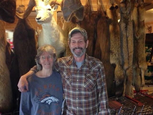
We found our own magic bus.  After 60 or so uneventful miles, we wound up in Slana, a mile or so in on the Nabesna Road, one of two roads that leads into Wrangell-St. Elias (the McCarthy Road is the other).  There wasn't much there, and on our way back out to the main road, a man in an approaching car waved for us to stop.  "Y'all have somewhere to stay tonight?"  Hesitating, as this is not a question we hear every day, we responded that no, we didn't really know, but right now we were headed to the market just up the road.  "I own that place," he said, "and we have a little place for cyclists to stay.  Come on over; I'll be back in a minute."  He drove off.  As I mentioned yesterday, we must be the luckiest people in the world.  Right before he drove up, I had been kicking myself for not looking up on the interwebs where the store was in Slana; maybe we could have saved ourselves a couple of miles.  Of course, then we wouldn't have met Jay.  Those extra few miles are always worth it.
Jay Capps is a true Alaskan.  He hunts, smokes, fishes, does everything himself, and has a nice streak a mile long.  We haven't met his wife Debbie yet, but he says she's even meaner than he is.  After we walked in, Jay showed us to the bus.
I was expecting a leaky contraption with a rough floor, but this was no ordinary bus.  Four beds, a microwave, a toaster, a coffeemaker, pots and pans, a propane stove, a wood stove with hatchet and maul, a table with a booth, and various food items and whatnot that past residents have left.  Jay has even covered the sides with thick metal and replaced the door with a bearproof one.  "Do these work?" I asked Jay, pointing to the lights.  He looked insulted.  "This is Midway [the name of the store]," he said proudly.  "Everything works."  And indeed it does.  
Residents of the bus are encouraged to write something.  The numerous notes and drawings on the walls and ceiling add an incredible amount of character and warmth to what might otherwise just be a bus.  Many of the notes are from cyclists who were/are in the midst of their own Alaska-Argentina trip.  Tam added some artwork to the wall above the "kitchen" table:

Check out these pages from other cyclists who have stayed here:

http://worldonabike.com/1000-americans/1000-americans-jay-and-debbie-midway-services/

http://worldonabike.com/trip-reports/north-america/alaska/day-32-34-august-12-14-2008-tok-cutoff-to-tok-about-sun-mountains-lost-pants-life-in-a-bus/

http://downtheroad.org/Alaska-Canada-USA/pictures/1Alaska_Yukon_Canada/3Glennallen_Alaska_Beaver_Creek_Canada.htm

http://coleccionandoatardeceres.blogspot.com/2013_06_01_archive.html?m=0

(the last one's in Spanish but has some pics of the bus)

Jay also gave us free reign of the inside bathroom, shower, and expansive store, "Just write down what items you take, and we'll figure out money tomorrow."  He also pointed out that, because he was leaving the back door open for us, we could rob him blind, but that doesn't seem to bother him.  "We go off the honor system," he says.  
Tam and I took showers then cooked up a delicious amalgamation of pasta, garlic, and the remaining veggies we had from Kennecott.  Mmm!  Then we made some chocolate chip pancakes.  Having a kitchen is great!

Wednesday, July 23, 2014

Back on the Bikes

We are so lucky.  A few hours after beginning our efforts to hitchhike out of McCarthy and Wrangell-St. Elias, we were picked up by some really nice folks, Janet and Jim.  They and their friends Dan and Nanette, who were following in a car behind J&J's RV, had stayed almost two weeks in Kennecott at a friend's cabin.  We very much enjoyed discussing Alaska, wildlife, and all kinds of other things with them, and had they only dropped us off in Chitina, at the end of the McCarthy road, it would have been enough.  But they agreed to take us all the way to Glennallen!  We wouldn't have to backtrack at all!  This was especially exciting because the Edgerton Highway from Chitina back to the main highway, the Richardson, is pretty much all uphill.  We couldn't believe our good fortune, that these generous folks were willing to take us, and that our bikes could just fit into the RV with all the wheels removed.  Somehow it gets better.  We all stopped for lunch at Liberty Falls, a roaring slide surrounded by a cool spray and clear turquoise pools.
It turns out that Nanette and Dan are from Decatur and Roswell, right near where I grew up in Sandy Springs!  Nanette also taught at a summer camp that I attended when I was very young; I don't remember much, unfortunately, but it sure is a small world.  She's also a bird bander, something I dabbled in briefly, and makes incredible jewelry from repurposed bike parts.  Did I mention Dan and Nanette are both cyclists, too?  I had bought some chainlink earrings a little while ago for Tam, but she had tragically lost one of them to the black hole under the passenger seat in her car.  When I mentioned this to Nanette, as well as my intention to get Tam new ones at some point, she brought out her stash and gave Tam a beautiful necklace!
Chain links surrounding French gemstones below, quartz necklace from Wiseman above

Very cool people indeed.  Friendly, generous, kind... the world would be better off with more like these four (including Nanette, even though she's taking the picture).

After transitioning our gear back to our bikes and putting the bikes back together, we had some awesome Thai food from a little place that was recommended to us by Spencer, the guy we went packrafting with.  The restaurant was in a bus.  In the past few days, we have ordered pizza, fries, and now Thai food from vehicles, and all of it was extraordinarily scrumptious.  We rode about 15 miles out of town, passing our first sign for Canada (213 miles!) and me getting the first flat of the trip from a staple-like piece of metal in my tire.  We're camped right now at a scenic overlook above the Copper River with Mts. Sanford and Blackburn, both over 16,000 feet, dominating the horizon.  Life is good.

Tuesday, July 22, 2014

Adventures in Wrangell-St. Elias, July 17-21

July 17: It's a gorgeous, sunny day. Something we never take for granted around here. The first part of our hike follows the trail that runs along the ridge by the glacier.  The woods are bursting with colorful wildflowers, and around us all sorts of birds are chipping and singing.  To get down to the glacier, we follow a steep scree slope and then hike along the lateral moraine.  A little ways down the glacier, we find Erie Lake, now drained and full of icebergs.  Glacial lakes such as this one are formed when the ice blocks the flow of water from streams.  When the ice blockage is breached at some point during the summer, the lake drains in an exciting event called the glacial lake outburst flood, or Jokulhlaup (pronounced YOKE-awl-aup).  We make camp above the lake with a gorgeous view of the Stairway Icefall, 7,000 feet of towering ice.

July 18: For the first time all trip, we leave our tent set up and head out wih day packs.  We spend a wonderful morning exploring the icebergs below us.  They are reminiscent of the jumbled boulders in Joshua Tree, but made entirely of ice.
In the afternoon, we hike up towards the icefall and find many spectacular glacier treasures: a huge blue pool probably hundreds of feet deep bordered by sheer cliffs we don't dare get too close to; smaller blue pools, also super deep, that we can get close to and gaze into, wondering how deep they go; many rivers gushing through the ice; and waterfalls that thunder down into the deep unknown. 
Fun fact: the glacial ice near the icefall is 2,000 feet deep in places! 
Our favorite discovery is a perfectly clear blue lake only a few feet deep that we can walk down to. Across from us is an ice cliff from which two small waterfalls pour down into the lake. The scene looks absolutely tropical, except it's all made of ice.
After an incredible day of exploration we retreat to our tent on the grassy knoll and simply enjoy the view. 

July 19: We hike out from our lake on a scree trail that we discovered as we watched another group hike easily along it. Then we head back out across the moraine. Behind us is the roar of two rivers cascading out of the mountains. All around us are the more subtle sounds of the ice dripping and stretching, like ice cubes as you pop them from the tray. Occasionally rocks tumble down from their perches on the icy slopes, and every once in a while there is a great thumping from an unseen basement: rocks tumbling and churning far below. 
Out on the white ice of the glacier it's quieter. The loudest sounds are our crampons scraping and puncturing the ice below our feet. Always there is the rush of water; sometimes a small stream, other times the louder rush of a waterfall tumbling into the deep blue depths. Around us rise the mountains, silent, stark and jagged, but clad in the softest coat of velvet green brush. Behind us now is the icefall, cold crystal in the sun. The peaks around it are coated with fluffy snow reminiscent of icing on a cake. Simply spectacular.
In the afternoon, we hike along the medial moraine. There's good traction here provided by the rocks frozen into the ice. We navigate many crevasses, streams, and a moulin before heading back across the white ice and finding a campsite in Donoho basin. Donoho is a mountain peak that separates the main flow of the Kennecott and Root glaciers (we've been hiking on the Root). It looks rather like an alligator- the two peaks as the alligator eyes and the long snout forming the basin between the glaciers where we are camped. 

July 20: It's 12:30 before we motivate ourselves to get going because it's raining again. Miraculously, the moment we emerge from the tent the rain stops and it's beautiful for the rest of the day. Thank you weather! It's easy to get down to the glacier, and from there we start crunching our way through the ice towards Kennecott. This part of the glacier has few big crevasses but it is quite hilly. We walk up a ridge of ice only to see another large sunken bowl as if the glacier was a poorly baked cake that caved in. It's not long before we can see a waterfall pouring down from the cliff we just hiked down. It's a three tiered affair, a thunderous white veil tumbling through the grey rock. What an incredible place we are in. 
It doesn't take long to finish our walk across the glacier then back along the trail into Kennecott. Once in town we treat ourselves to a giant M&M cookie from the lodge and an incredibly delicious pizza from Tailor Made Pizza. Pizza from a bus never tasted so good. Afterwards, Betsy from Kennicott Wilderness Guides lets us set up camp behind their guide shack- a perfect little tent spot that can only be reached through a "magical porthole," a small tunnel of rusted metal left from the mining days. 


In its day, Kennecott was a bustling mining town that successfully mined huge quantities of copper. Now many of the buildings are being rebuilt and preserved for their historic value. Outside the town, high up in the mountains are the remnants of the old mining buildings, now falling into disrepair but still quite impressive for their machinery and locations.  Miners back then, in the early 1900s, received two days off a year: July 4 and Christmas Day.
July 21: An amazing day of packrafting! First, let me introduce Spencer, packrafting expert from Kennicott Wilderness Guides who happens to be good buddies with two of our good friends from High Trails, Austin and Jay! He's a fun and friendly guy whose enthusiasm immediately got us psyched for paddling and exploring the area. Our day started with a small tour of McCarthy and some amazing cheesy fries from another restaurant in a bus: The Potato. Then we suited up in our dry suits, blew up our pack rafts with inflator bags and headed out onto a lake at the bottom of the glacier. Having never used a packraft or worn a full dry suit, all the gear is novel and exciting. 
Our first few hours of packrafting are on the lake, getting used to the boats and checking out the melting ice and mesmerizing rock fall. Spencer says that watching the glacier is his version of TV out here. We approve. The next couple of hours are spent on the "training grounds," a series of small rapids, each of which drains into slow moving flat water. It's a perfect place to practice whitewater skills such as ferrying, peeling out, and catching eddies in our new blow-up boats. Here we are also joined by Candace, a wonderful lady paddler who offers helpful advice and encouragement. I particularly enjoy their acronym for getting out of eddies: SALI: speed, angle, lean, icebergs. It's the same sort of thing I learned in Maine- but here we are literally paddling through small floating ice bergs. It's crazy! Thank goodness for the dry suits and warm sunny weather. 
After a lot of practice, and a bit of river scouting, Spencer determines that we can run a section of the Kennicott (the silty river flowing from the Kennicott glacier) with a class III rapid. We are pumped! It's an amazing paddle with super fun wave trains, and neither of us goes for a swim. 
This wonderful day ends with us cooking dinner and watching whitewater videos at the little house Spencer shares with several of the other guides. They have piles upon piles of fresh veggies from an organic farm in Fairbanks- dropped off by the family of one of the guides. We are instructed to eat as many as possible. What a treat! 
Thanks to everyone at Kennicott Wilderness Guides for your kindness, generosity, and for all the fun! 

Thursday, July 17, 2014

Wrangell St-Elias, Getting Started

I had thought we were going to enter the park yesterday, near Glennallen, but we ended up coming to McCarthy, some 120 miles out of the way, because it's the best place to get into the wilderness.  For all the hassle, it's already been worth it.  We met some friendly, welcoming people yesterday: Danny, Robin, Glenn, Tom, and Ted, who are spending their free time in Chitina, right outside the park, to help Tom build a cabin there.  Cribbage, Oreos, showers, and the softest, most comfortable lawn we have ever slept on.  Fantastic!
We had decided the night before to hitchhike the McCarthy Road, one of the two roads in this 13-million acre wilderness, rather than take the full day to ride it, but the meager flow of traffic made it tough.
 After about three hours and maybe six cars having passed, a nice couple picked us up and brought us along to the road's end at the tiny village of McCarthy (pop. 40 or so).  There is a lot of copper mining history around McCarthy and Kennecott, the only other town in the region, but as I'm typing on a phone, I won't delve into that.  Google it.  It's interesting.
With the help of Kennicott Wilderness Guides, we planned a five-day stay in the park.  The next four days will be for glacier and mountain exploration (we rented crampons), and on Monday we will be going packrafting!  It will be very different from our previous two trips in Alaska, and to say we are excited is an understatement.
The view from our front door!  Glaciers, mountains, and a clear sky with a setting sun.  Life is good.  And somehow there's superb cell service too.

Monday, July 14, 2014

Back to the Mountains, July 13-14, 2014

July 13
It rains all night and we sleep with the fly off under the pavilion.  What a luxury!  Unfortunately, it's still raining in the morning when we set off.  Our ride takes us up and down steep hills and through lush forest.  In the pouring rain we make slow progress.  After almost four hours and only twenty miles, the weather gradually begins to improve.  We have a long, beautiful descent into the Matanuska river valley, and a shoulder reappears on the road.  Hooray!  We stop at an overlook and eat lunch at a wonderful picnic table with a spectacular view of the Matanuska glacier.  The glacier looks rather out of place glowing in the sunshine in the middle of a lush, green valley.  After lunch, the afternoon gets better and better.  We have sunny weather, no bugs, and a tailwind that gets stronger as the day goes on and literally pushes us up the hills.  
Mid-afternoon we stop at the Grand View Lodge to share an amazing veggie burger and blueberry pie with vanilla ice cream.  Here we meet a motorcyclist who is very impressed with our journey and tells us, "I love adventure, the more the better. Five minutes on the edge is better than a lifetime of boredom."  Just down the road, we summit Eureka Pass, the highest point on the highway, and are rewarded with a spectacular view of the Wrangell Mountains, enormous and snowy.  We camp in a large gravel area filled with trails and firepits that appears to be a playpark for ATVs.  Our grassy spot is perfect.

July 14
We start our day with a wonderful downhill.  The morning air is a bit chilly, but not uncomfortably so because the sun is out!  In the perfect weather, we bike through a gentle valley with rolling hills of spruce forest.  The trees on either side are occasionally broken up by a small, murky pond or blue lake.  It's perfect habitat for moose and mosquitoes.  Unfortunately, only the mosquitoes come to greet us.  The few lodges or houses along the road are either for sale or look abandoned.  We eat lunch on a dirt hill on a side of the road, 30 miles in.  Nothing special.  What's nice is that after lunch, the ride is mostly downhill, a runway straight to the enormous mountains in front of us.  In Glennallen, a small town right outside Wrangell-St. Elias National Park, we stop at the IGA to buy some extra provisions.  Eating an enormous bag of tortilla chips with salsa outside, we meet Toby and Ann, two touring cyclists from Switzerland.  They are traveling from Anchorage to Skagway over the span of about four weeks.  We share stories and end up camping with them in a small park just out of town.
   Our new friends: Toby and Ann

Fun fact: Wrangell Mountain, which we're right next to, is the largest active volcano in Alaska at over 14,000 feet!  It can be seen smoking on clear days.

Saturday, July 12, 2014

Adios, Anchorage. July 8-12, 2014

Anchorage was great, but we were itching to get on the road again. Here are some highlights, good and bad, from our time there:

- We stayed with some wonderful people: our new friends Jeff and Sarah, who generously shared their lives with us, and Tam's friend from college, also named Sarah.  Sarah and her roommates were incredibly accommodating, and we can't thank them enough for opening their doors to us.

- Tam got sick.  She had some kind of bug or was maybe just really exhausted.  Whatever it was, we stayed an extra day for her to recuperate.

- We made pancakes.  Twice.  There's not really much more to this, but they were soooo good!  Having access to a kitchen was a rare treat.
    Blueberry and chocolate chip awesome-ness, almost ready to be flipped

- Adventures!  We explored the Chugach Mountains on a two hour run with Sarah and her friend Julie, who are both training for a 50-mile race.  Our early morning run took us through a spectacular valley bordered by snow-dappled peaks, and gave us beautiful views of downtown Anchorage on the edge of a misty ocean.  The joy and beauty of the run was long outlasted by the full body soreness endured afterwards. Running and biking do not use the same muscles.  
We also went canoeing with Sarah and her friend Diana on the glacial-fed Eagle River.  Fortunately we capsized before the Class III section and swam safely to shore, then we hiked back to the road, leaving the canoe to rescue the next day.  Exciting!
With a useless, tiny boat we had, before we all piled into the canoe

- We were able to finish a bunch of errands and projects, including things like my buying new rain pants (my old ones grew legs and walked away when we were in Fairbanks) and Tam sewing a new zipper onto one of her bags.
    Tam's handiwork


The road out of Anchorage was more pleasant than we had anticipated, for the city is rife with bike paths.  We made it to Eagle River yesterday, incidentally to the campground where we would have taken our canoes out had we made it there.  On the way to the campground, we saw Manu and Katrien, the couple from Belgium who had helped Tam fix her bike weeks ago!  They were coming into the city after spending a bunch of time in Fairbanks and Denali, and it was great to see them and hear about their adventures.

Today, we headed north on the Glenn Highway then branched east to Palmer.  The shoulder's a bit thin at times, which makes for some sketchy riding, but overall it's not too bad.
    Tam at a pullout on the Glenn Highway

The area we're in now, the Matanuska Valley, is known for its moderate weather and fertile soil.  We couldn't have asked for better weather today: mid 70s, partly cloudy... it's hard to believe we're still in Alaska!  Tonight we're camped at a campground right next to the large, silty Matanuska River.  We scored a covered pavilion all to ourselves.  I hope it rains while we're here, just so we can sit at the picnic table, dry and warm, and listen to it patter on the plexiglass roof.

Tuesday, July 8, 2014

Anchorage! July 7, 2014

Made it to Anchorage!  Many, many thanks to Jeff and Sarah for welcoming us into their home last night.  We caught up on some errands today and met up with Tam's friend Sarah (different Sarah) from college.  We will spend the next few days fixing bikes and clothes, running more errands, eating tons of wonderful food, exploring the Anchorage area, and planning our route from here. 

Many thanks also to our parents and Leslie for sending us letters and packages!

My fancy new saddle


Saturday, July 5, 2014

More Pancakes! July 5, 2014

After we wake up, we bike into town with John and Maureen to have pancakes at the well-known Roadhouse restaurant.  They're simply delicious; thin, flavored with fat blueberries, nutmeg, and cinnamon.  Afterwards we go down to the Susitna River to enjoy a perfect view of the mountains.
at the Susitna River, big mountains behind
 I finally have time and weather nice enough to do a painting.  Danny works on updating the blog.   The river is a loud place.  Trains, helicopters, airplanes, motorboats, fireworks, and lots of people create a sort of cacophony of noises.  We spend multiple hours at the river then bike back to John and Maureen's RV, where we have lunch and share delicious tortilla chips and guacamole.  The guac is a wonderful delicacy.  It's late afternoon when they shuttle us back to the end of the spur road and we take off biking again on the Parks Highway.  The road is mostly flat with unremarkable scenery, but the 30 miles we bike are tough due to a fierce headwind.  We set up camp just outside of the small town of Willow at Nancy Lake campground.
Nancy Lake around 11 pm

Favorite "Adopt A Highway" sponsor: Backcountry Llamaventures
Strangest place passed: Family Firing Range

Danny's side note: Willow, the town we are camped next to, got its start as a mining town in the late 1800s and was relatively unknown until 1976, when it gained a moderate degree of fame due to it being the choice for the new capital city of Alaska.  The committee in charge of selecting the new city had to find a place on state-owned ground with moderate temperatures, along the railroad and existing roadways, and over thirty miles from Fairbanks and Anchorage.  Enough funding for the move never materialized and the idea was politically defeated in 1982.  Thus Juneau, though ridiculously far from actual Alaska, remains the capital city.

More Biking Bliss and Talkeetna, July 4, 2014

It's a holiday!  We had talked about it the night before, but we didn't remember until midway throughout the day.  When you're removed from humanity, the days flow together.  The trees don't care whether it's Thursday or Friday.  But maybe the weather knows, because it could not have been better on this July 4th.  Before setting off from our campground in Denali State Park, we soaked up amazing views of the Alaska Range.  There are only two or three days per summer month where McKinley can be fully seen, top to bottom, and we were lucky enough to experience this one.
 The perfect weather and the road gave us some more biking bliss.  The miles flew by, and we had done over 40 by lunch.  After lunch, we biked 25 more and then met John and Maureen, our friends from the Denali campground, at the Talkeetna Spur Road.  We hadn't planned on going to Talkeetna, as it's 14 miles off the main highway, but they convinced us to go for the festivities and offered to drive us the 14 miles.  Why not?!  Talkeetna is a small, somewhat touristy town best known as the jumping off point for McKinley climbers to be flown out to the mountain, but it still maintains its original charm.  Live music was everywhere, and Tam and I shared a delicious calzone.  Afterward we fell for homemade ice cream (how could you not) and looked around for the mayor, who's a tawny cat, but couldn't find him. We pitched our tent next to John and Maureen's RV and fell asleep to the sound of fireworks.

Biking Bliss and the Ramen Experiment, July 3, 2014

Because of the late night getting out of Denali (late dinner + food shopping for the next few days), we woke around 10 to the pitter of rain on the tent... or so I thought.  It was actually flies buzzing around the inside of the fly!  Contrary to my original thought about the rain, it was a beautiful, warm day with no wind, and our road was well paved with a large shoulder and moderate grades to the few hills.  All shades of wildflowers lined the road: purple lupines, pink pea plants, and yellow asters sharply contrasted with the austere sharpness of the white mountains rising all around.
 We made it to a Denali State Park camnpground around 7:00, having ridden 72 miles in about eight hours, including a long lunch break!  We were very proud of ourselves; back on the Dalton, 72 miles would have taken us twice that time.  We planned on having a low key night to catch up on journal entries, reading, etc., but I struck up a conversation with John and Maureen, two folks up here RVing from Anchorage for the July 4th weekend.  We ended up spending the evening with them and their son Jeff and his wife Sarah.  The warmth of their company and their campfire, in the shadow of the Alaska Range, transformed an otherwise mundane evening.  McKinley, the Moose's Tooth, and Mt Hunter were all clearly visible.  A wonderful day it was, with splendid company and the best scenery anywhere.

I did find time among biking and being social to experiment with a new food: ramen noodles.  We were given some a few days before by Brandon, just one pack.  We refused more because we didn't think it would hydrate cold.  We don't carry a stove for ease and convenience, so for dinner we always eat foods that quickly hydrate without heat, couscous and instant mashed potatoes being our main staples in remote areas.  Ramen never occurred to me; it's much bulkier than couscous or mashed potatoes, so it doesn't fit so well into a confining, hard-sided bear can.  Still, I was curious.  I left some ramen in water for about 30 minutes, and when I came back it was fully hydrated.  I would surmise that, due to its pretty much instant hydration in hot water, that it would take no more than five or ten minutes in cold or room-temperature water.  I hope that many of the frightening ingredients are in the flavor packet that we wouldn't use, but we still probably won't buy ramen due to its atrocious nutritional value.  In a pinch, though, now we know!  It's pretty good dry, too, as a crunchy snack.

Goodbye Denali, Hello Pizza, July 2, 2014

We hike into Toklat station and hop on the first bus of the day headed west.  Our driver smokes at each rest stop and has a deep, raspy voice that is both nice to listen to and hard to understand.  We wind through mountains, valleys, and meadows similar to those we hiked through.  We pass the place we saw the grizzly, and we can see the pass we hiked over.  As we head west, things open up, and we follow wide river valleys.  We stop at the Eielson Visitor Center, which is beautifully and sustainably designed.  Here we are able to get water, as well as clarification on some of the tracks we saw.  There is a large model of Mt McKinley and routes people have climbed, as well as how it was formed by glaciers.  There is also a wealth of information on the wildlife and flowers in the park.  Continuing on down the road, we see open meadows with small lakes, and to our left, the giant mountains.  We can see the lower snowy ridgeline, and far above, a ridge of Mt McKinley pokes through the clouds.  It looks unreal somehow, like it's just floating in the air.  Wonder Lake is unmistakable.  It's the biggest lake we've seen yet, and quite beautiful.  We walk around for a bit, enjoying the patchy sun, then catch the bus back.  As we ride, it starts to rain again.
McKinley, way up there


On the bus, we see: many herds of caribou, including at least five bulls with huge, furry antlers, three grizzly bears, Dall Sheep grazing high on green slopes, two golden eagles, and one short-eared owl.  We discuss our grizzly bear sightings.  On one hand, it is nice to observe them and get a chance to watch their behavior safely from the bus.  On the other hand, it's not as special or as memorable as meeting such an amazing creature on their own terms.  On the bus ride back, we stop to pick up five wet backpackers.  They sit in the back with us, with all their gear.  Turns out they're the same group we saw while getting our backcountry permit, and they followed almost the same route as we did in units 8-10, except in reverse.  They are fun, friendly, adventurous people from all over, who somehow got to know each other through various connections.  We spend the ride back talking to them and moving all our gear when our bus breaks down.  Later on, we join them for a fabulous pizza dinner at the Prospector.  Thanks again to Brandon, Marco, Martin, Karen, and Chris for the wonderful stories, good times, and generosity.

Rain and Mud, July 1, 2014

Today, when we wake up, it sounds like we are in a washing machine.  A large river is gushing and tumbling rocks on our left, and a smaller river is gurgling by on the right, while rain pounds down on our tent.  Reluctant to hike in the deluge (mostly Danny who doesn't have rain pants), it is 11:00 before we make any real move to get out of the tent.  Debating whether to go or stay, we see under the gap between the rain fly and the ground that a new river has started flowing.  We decide to pack up before we get flooded out.  The river we are camped next to, clear the day before, has turned into a flooded, muddy mess after the night's heavy rain.  The first part of our hike brings us across gravel bars and through willow-based brush.  We are quickly soaked (even rain gear gets wet).  We try to stay as much as we can by the river, but it's so flooded that in places there are no good gravel bars, and it's easier to whack through the brush than to cross.  We make fairly good time, and soon we see a beautiful, gradual saddle rising to the left.  After the other passes we've gone over, this one is a piece of cake.

 At the top, we look down into another flooded river valley, and are rewarded with a view of the Toklat.  Hooray!  The end is in sight.  Scrambling across some muddy scree and down towards the river, we take a quick break to eat lunch.  During lunch, we shove tortillas and cheese in our mouths as fast as we can so they don't get wet and we don't get cold standing around.  This river is a lot harder to follow than the previous one.  There are few gravel bars, and we must squish across super muddy banks (we're talking almost knee deep here), and walk through heavily knitted brush.  I can't believe so many plants are growing in one area.  At one point, Danny gets stuck and is completely unable to go forward because of all the branches.  At another point, while trying to jump over a small stream, my foot gets stuck in the mud on one side and Danny has to come pull me out.  To alert bears of our presence, together we recite the entire Lorax.  Thank you, High Trails!

Near the Toklat, we reach spruce forest, which has limited visibility but is quite spectacular and unlike anything we've ever seen.  It seems almost like a rainforest.  There are tall spruce trees, some almost a foot in diameter, a thick, spongy carpet of mosses and lichens, and a low-lying layer of horsetails that look like mini spruce trees! Wet, muddy and tired, we finally reach the gravel bar at the edge of the Toklat and rejoice with snacks.  We're close now to the road, so we hike in and set up a tent behind a small, brushy hill so we can't be seen.  It's still raining.  We eat dinner, then burrow into our sleeping bags to get warm.  What a day.

Grizzly #2 and Other Adventures, June 30, 2014


When we wake up, it's gorgeous and it's easier than we expect to follow out the creek - we only have to cross it three times.  Once we're out more in the open, we climb up a brushy bank and we're out onto a meadow of tundra.  It's mostly easy hiking except for a few boggy areas.  Here we have a good view of the road we're approaching, and we see a bus stop - they must be looking at an animal.  As we come over a slight rise, I see what it is: a grizzly bear.  At first glance I think it's a caribou (since that's all we've been seeing) but upon second glance, it's clear that it's a bear.  We've been hiking towards it (I wonder what the people on the bus thought).  But we quickly head away from it and up a slope that gives us better visibility.  At first the bear seems to follow us, but I think that's just because it was going in that direction anyway.  It doesn't appear to notice us at all, and soon it is far enough away that we put away the bear spray and take a look at it through the binoculars.  It appears to be digging - typical grizzly behavior.  A much less stressful encounter than our first.

We hop up on the road and cross to the north side of the park.  Suddenly the habitat is completely different.  In order to follow our creek, we must hike through marsh, periodically cross or jump over side streams (they're everywhere), and walk through thick brush.  My voice soon becomes hoarse from singing and talking loudly to alert any bears of our presence.

Our plan was to hike up this stream and to a plateau where we could have a view of the big mountains of the park, but as we hike, thick, gray, foggy rain clouds move in low over the valley and completely block any visibility of mountains.  We decide that in these conditions it's not worth going to the plateau.  Instead we find the side stream we're planning to hike out on and set up camp early.  We eat dinner in the freezing rain.  I'm frustrated and feeling that it wasn't worth hiking out this way because we haven't seen much and it's been exhausting bushwhacking.  But, it is another side of the park we haven't seen, we got to see harlequin ducks and several ptarmigan up close (and hear their funny call), and the green, lush mountains have their own sort of beauty, even if they suck to hike through.

Best Day of Backpacking Ever, June 29, 2014

Above is Tam's interpretation of this day.  We were hiking south and then west, so her drawing starts at our tent in the upper right.  Try and follow my writing with her drawing!

Having crossed a fork of the Toklat yesterday, we started our day following the main Toklat south for a few miles.  I almost fell while crossing a deep section of a branch; it wasn't that deep, really, no more than mid-thigh, but I couldn't seem to find stable footing on the river bed, which was obscured by the heavy load of mud, silt, and debris this flooded river was carrying.  I made it okay to the other bank and looked back at Tam, who shook her head at me and began walking, finding a shallow, braided section about a quarter mile upriver.  Chilled to the bone from the glacial water, my next hour, spent walking fast and wearing many layers in an attempt to warm up, taught me the important lesson that it is always worth it to spend the time searching for the best possible place to cross. 

We continued walking up the main branch of the river, overshooting our drainage by about half a mile so we could find a nice braided section to cross this big river.  This extra foray provided great views of a waterfall hundreds of feet high, as well as a glimpse of the once-great glacier that had created this whole valley in which we were hiking.  Our maps, made in the 1970s, indicated that the glacier had receded about four miles since then.  Even without the maps, the heaps of moraine on either side of the river indicated the formidable mass of this ice river.  We chose to hike on the moraine for a short while, and though treacherous due to the loose rock on every step, its beauty surpassed the risk.  Within this "junkyard" (so associated by us because it appeared, with its heaps of rock, to be a dump), we found rocks of every shape and size, undercut and striated and divided with minerals of every hue.  Geology usually makes me yawn, but here it was a painter's palette, rough art underfoot.

the river we followed up
After a tasty lunch of hummus and hazelnut butter on tortillas, we followed our drainage of choice up the hill.  Hitting deep snow overlaying the creek at around 4,000 feet, we cut up to the ridge.  Unfortunately, and as is the case with most Denali ridges next to rivers, this ridge was interrupted frequently by steep drainages running downhill to meet up with the larger waterway.  We descended back to the main river (creek might be more accurate for Alaska) on some steep scree then were able to sidehill past the snow up to the pass between Green Dome and Gravel Mountain.  Large cornices, areas of overhanging, windblown snow, covered the top of the ridge, so we were dubious while ascending about being able to go down the steeper slope on the other side.  Fortunately, we found a scree walkway that allowed us to skirt most of the snow, and the fresh snowmelt was delicious!
scree walkway
 This was drinking from the source at its best, high in the Alaska Range on an unnamed ridge.  We followed another creek down, a tributary of Gorge Creek.  "Creek" really isn't the correct term; in the states these "creeks" would be mighty rivers, but, as Mardy Murie writes, Alaska is a land of many mighty rivers.  Hence, creek.  We saw large herds of caribou on the slopes above us, and marmots whistled at us as we intruded on their grassy meadows.  We found a gravel bar deep in a gorge and went to bed just as rain started to fall.  An incredible day.  I feel that I have graduated to the "advanced backpacking" class: route finding, river crossings, steep ascent of scree and snow slopes, intense and sustained physical exertion.  Denali is hiking at its finest.
our tent in the gorge next to the river (bottom center of this photo)

A Great View! June 28, 2014

Long day of hiking.  We woke up in the beautiful Polychrome area, and the narrow canyon we were following made for many icy river crossings.  Not fun.
 I went up on the ridge above at one point to scout it out, just about causing a landslide, and decided that numb feet was preferable to being buried by rocks.  So we followed the river and then a branch of it to the west.  Because of all the rain the previous few days, little landslides were everywhere.  We stuck to the vegetation on the ridge above the creek and approached the pass after a few hours.  The creek gave way to a marshy meadow at the saddle between two rocky peaks.  Forget-me-nots, incidentally the state flower of Alaska, dotted this verdant meadow with flecks of deep blue, but I was looking beyond.  I think my favorite moments in backpacking and mountaineering are upon gaining a pass or ridge; you approach the top, and when you get close, every step shows a little bit more of the spectacularity on the other side.  This pass revealed, step by step, distant and massive snowy peaks, then closer brown peaks splotched with white, then their green flanks and bare buttresses, then, finally, the world falling away at my feet, a wide, braided river below.  I've seen a lot of views, and this one was among the best.


We were apprehensive about crossing the Toklat River below, but the downclimb turned out to be much tougher than the river crossing.  Steep mudsliding with some short sections of near-vertical rock just about sums it up.  We both had some trouble in parts, but we made it through.  The river turned out to be no problem to cross.  Not even knee deep in a nice braided section.

We continued west, ascending and descending a saddle just south of Divide Mountain, seeing some caribou on the way up, then camped along a bigger Toklat River.   Huh?  The Toklat again?  Our maps, sections of the U.S. Geological Survey maps, apparently were created so that the names are somewhat screwy.  The Toklat River that we had crossed turned out to be the smaller, east fork.  We would find out later that this river we're by now is the real thing; we'll cross tomorrow morning. Today was fantastic; no rain, great hiking!  River crossings: 16.  We also today got back on a somewhat normal schedule, waking up around 9 and going to bed before midnight.  I'll be dreaming of all-you-can-eat buffets tonight.

Bikes to Backpacks, June 27, 2014

There's one road that goes into Denali National Park.  No private vehicles are allowed past the Savage River at mile 15, so the road's 90 miles are almost exclusively traveled by registered tour buses.  Lucky for us, bicycles are also allowed.  Before entering the park, we purchase tickets for what is known as the "camper bus," so that we will have transportation to the start of our backpacking trip (a loop that will bring us back to our bikes) and a ride back to the park entrance when we have gotten our fill of biking.  The following details our first full day of travel in the park.

We wake up in the Sanctuary River campground to the sound of rain on the tent again.  Neither of us wants to get up, but we know we have a lot to do, so we start packing.  There are two male cyclists from Fairbanks at our campground who are also biking the Denali road.  When we emerge from our tent, they are frantically moving their stuff into a walk-in bear locker to get it out of the rain.  I'm surprised that they're not more prepared for the weather; this is Alaska, after all.  We congratulate ourselves on being packed up and on the road before someone else.  The road is in pretty good condition, but it's wet and muddy and it takes extra effort to bike through.  It's freezing outside, so despite our best efforts to layer and keep warm, we are soon both soaked and cold.  Around us are rushing rivers, dense brush, and mountains which are mostly hidden by the thick cloud blanket.  It's hard to look up and enjoy the scenery, since every time we do, the rain blasts us in the face and drips down our jackets.  We do, however, see a moose.
on the rainy road

Our journey brings us to Toklat, a strange area with lots of restrooms and a big tent with a store inside.  There are a lot of people around, because there's a temporary closure on the road beyond.  The rain is causing all sorts of landslides.  We switch from bikes to backpacks, have some lunch, then hop on an eastbound bus that takes us back to Unit 8.  The place we had wanted to start is very steep, so instead we hike off the road a bit west of where we had planned.  Our hike brings us through marsh, brush, and a small river.  After a ways, we get to a larger river, which we plan to follow all the way to the glaciers in the distance.  Mostly we hike on gravel bars and make good time.  They are really wonderful for hiking!
on a gravel bar
Sometimes the river cuts close to the bank and we have to cut around through the brush or cross it.  We cross multiple times, each immersion in the ice cold water bringing my feet closer to unbearable numbness.  Along the way, we find beautifully colored rocks in almost any color you could imagine.  They make an incredible mosaic along the riverbank.

We also find a large hunk of white fur (fox tail?), some gorgeous lupines, and yellow flowers glistening in the rain.  The hike rewards us with a crazy view of the road winding its way along the mountain cliffs.  Ahead of us is the Polychrome Glacier, snowy, misty, and mysterious.  With freezing feet, we camp downstream from where we plan on passing over the mountains tomorrow.  As we eat dinner, we finally see a small window of blue sky, and the sun peeks over the top of the mountains.  After a long day of steady rain, perhaps things are looking up!