Showing posts with label andes. Show all posts

Saturday, August 8, 2015

We're in Peru! August 4th-8th

Loja (Ecuador)-Vilcabamba-Yangana-Valladolid-Palanda-Zumba-La Balza-San Ignacio (Peru)

Sunset over Loja

August 4th
On the way out of Loja we make a visit to the Supermaxi, an enormous grocery store.  Being inside is a bit overwhelming, but I find all sorts of goodies: refried beans, nuts, couscous, chocolate bars, peanut butter, and even some hydrateable soy protein bits.

We end up leaving later than planned, but it´s worth it; our bags are full of good food.  Amazingly, the road is quiet and almost free of traffic immediately after we leave the city streets.  That was easy! A short climb brings us out of the valley, and then a long descent takes us almost all the way to the little town of Vilcabamba, where we have lunch in the town square. Vilcabamba is known for the longevity of its residents and thus has become a hotspot for retirees from North America. Around the square the foreign influence is obvious; we even find a juice bar that sells gluten-free deserts! Being surrounded by English-speaking people is rather different from the usual, and we wonder how the influx of foreigners has affected the locals. You can hardly even call the town Ecuadorian anymore.

Near the Valley of Longevity
In the afternoon we ride a series of steep hills, which I deem mini mountain passes. and reach the tiny town of Yangana. After asking around for a place to camp we end up in the yard of a house that apparently is on warmshowers! Our accommodations are not what I would usually expect from a host (lots of barking dogs, kids throwing things at our tent until we ask them to stop, dysfunctional toilet) but it's a flat, grassy place to camp and we're grateful to the family for letting us stay here.

On the way up

August 5th
It takes a little while to get going in the morning because we're purifying water and trying to fix the toilet.  We are so spoiled in the U.S. with widespread amenities like functional toilets, drinkable sink water, and abundant toilet paper. I will never again take these things for granted.

Our day starts with a climb that turns out to be a huge pass. As we pedal upwards the sun is covered by clouds and it starts to rain. Even with our rain gear, the weather near the top is pretty miserable: cold, sleeting rain, and only a few feet of visibility.

An upside to the rain: beautiful flowers lining the road
The Ecuadorian cousin of my favorite North American bird, the american dipper. From www.muddypath.com
Happily, a short descent brings us out of the clouds and we find a giant metal pipe to take shelter in. I'm pretty sure that it is a culvert they are planning on putting under the road to channel a river through. They haven´t gotten around to installing it yet, so currently that river has taken over a large section of road.  After some snacks, we start trying to figure out how to cross the river without getting our feet and legs soaked. It's chilly up here, and wet feet are something we want to do our best to avoid. We ask a truck driver if he's willing to take us across, but he says we don't need a lift, ¨just move that big log over the deep part.¨ I think he was just in too much of a hurry to help us. The log is so big and heavy that even the two of us together can't lift it into position over the river. Next, we try to make a path of stones, but the rocks are unstable and there's no way we can cross with our bikes.  Nothing is working. As we're surveying the crossing, we spot a black and white bird. It's a white-capped dipper!

I take it as a sign of good luck.  We decide that the best option is going to be to ride across.  Danny goes first, and even though he stops in the middle, makes it all the way! I'm second, and a bit nervous, but soon I am across as well, with dry feet! A good biking challenge.

Actually a different river crossing than the one I´m talking about here, but the same idea

A descent brings us into the small town of Valladolid, where we find a small restaurant for a hot, well-deserved lunch. Plantain soup, rice, eggs, potatos, and beans taste amazing. After we eat we are befriended by a small, mentally-challenged child who is convinced that Danny is his brother.  We try to be nice, but he creates quite the hassle as we try and pack up.  I wonder, where is his mom?

It's mostly a descent to the town of Palanda where we decide to stay at a cheap hotel. We'e having some issues with our brakes and need to do some maintenance. The back of a convenience store connected to our hotel becomes our bike workshop.

Part of Danny´s brakes. The arm is mangled on one side and bent on the other. How did it get like this?

August 6th
Olive oil has spilled all over Danny's frame bag, and now, thick with oil, the material has stretched out so that the bag is hitting the pedals. While Danny does his best to fix this up, I run and pick up some lunch food. We're thinking that we might make it to the town of Zumba for lunch (it's only 40 km), but it´s always best to be prepared. The bread is still warm, fresh out of the oven!
A beautiful, quiet, and gradual descent brings us out of town and into the next valley. From here we start to climb again. The road is still paved, but you can hardly tell under the thick slick of mud. Ahead, it seems that the entire hillside has caved in. Big tractors are hard at work trying to forage a driveable path through. We do our best to ride, but soon the road becomes too steep and too muddy and we're reduced to walking. We're still doing better than the buses! We watch one of them attempting to turn around in the mud bath unable to make the next turn. At the top of the ascent we have fat bikes! Our tires are so caked with mud that they appear to be much wider than they actually are.

That´s our road? How do we get up there?
Wide pavement turns quickly to...
...narrow dirt, which then turns to...
...mud. That bus was stuck.
Lots of mud. 
A muddy descent partially covered in more landslides brings us into the next valley, which we promptly climb back up out of. Near the top we stop for lunch. Good thing we brought food! We've only made it about 20 km!

Looking back, the last pavement we would see for a while

A small town marks the top of the hill and the official end of the pavement. Luckily, the dirt road is in good condition and makes for far better riding than the muck from this morning. The sun is out and shining, which makes us hot and sweaty but keeps the road dry.

Great dirt riding

A former landslide area

An incredibly steep descent brings us to the next valley, and then an incredibly steep ascent brings us out of it. Legs screaming in unhappiness, we pedal up the insanely graded road and late afternoon glide into the town of Zumba.  We're able to avoid the town center, just picking up some snacks and bread on the outskirts. Determined to get close to the border, we continue out of town.

Looking back on our road in the lower right of the photo descending down to a tiny town before climbing back up to Zumba
Our road just gets steeper. Down we go again, then back up. I'm tired and take out my frustration with the tough grades by powering up the hill like a machine. We make good time to a tiny town where some nice ladies say we can camp in the communal building (an open space with a roof and a few small rooms in the back.) Nearby we have drinking water and a functional toilet! We are happy to relax and stretch, and although people, dogs, and chickens all wander by, no one comes to bother us. It's a peaceful night.

Quite steep
August 7th
14 months ago we started our trip in Deadhorse, Alaska. How crazy is that! And how fitting that today we'll enter the country that everyone has been telling us about, that we've been dreaming and wondering about: Peru!

We start our day with a downhill, and then, guess what? We begin to climb again.  After yesterday my legs are unhappy, to say the least, but we're excited for our border crossing and so we power up the hill. Near the top we pass a military checkpoint where they check our passports and tell us that it's five minutes to the border. Haha, right. Some more uphill, a snack break, and a flat tire mean that it takes us almost an hour. Ecuador doesn't want us to leave!

There it is: Peru
The descent down to the the river that marks the Peru-Ecuador border is so steep that we can barely stop! On our way down we encounter a French cyclist on his way up. His bike is loaded down with stuff, and he is already quite red in the face from pushing, even though he´s only about 200 meters out of town. We stop to exchange some route information and offer encouragements.

It´s steeper than it looks, trust me.
There's hardly a town at the border, just the immigration office and a few small stores. The police are almost overly friendly, asking us why we bothered to lock our bikes when they're there to make sure everything is safe. Usually we try to get through borders quickly, but here we end up hanging out for a little while, eating lunch and purifying water in the shade. Lunch is supplemented by some grilled plantains for 10 cents each, a delicious send-off!
Fed and hydrated, it's time to cross the international bridge! At the immigration office in Peru we are surprised to find two other touring cyclists! A couple from Quebec in their 60s, Charles and Denise are in amazing shape and have been traveling all over South America for the last 13 months! They are loaded down with so much stuff that I don't even want to imagine pedaling their bikes. I don't know how they do it! We chat for a while and then go our separate ways.

Denise and Charles from Quebec

Setting off into Peru our road is new, smooth pavement, well-graded and almost totally devoid of traffic. Occasionally we are passed by a moto-taxi or a motorbike. These and donkeys seem to be the preferred methods of transport around here. It's fabulous to be riding on such a nice road after the steep, hilly end of Ecuador, and we can´t help but feel a bit sorry for the cyclists we met heading the other way, surely pushing by now on their horrible introduction to Ecuador.
With our good road, the only challenge is the heat. We've lost a lot of elevation and the sun is out in full force. As we begin to climb we take many breaks in the shade and drink a ton of water.
Along the way we pass several small towns. People are generally friendly and wave or greet us. It's clear that we are in the land of coffee. Everyone is drying coffee beans on large tarps spread out on the road (this tells you about the amount of traffic here). As the sun starts to lower in the sky, we watch the locals bagging up the coffee in huge sacks and loading it in the moto-taxis or on donkeys to take home. I wonder about the people in the U.S. proudly drinking their free-trade coffee from Peru and if they know it was sun-dried on a highway.

When we've had enough of the heat and our climb, we start looking for a place to camp. The only problem is that we're on the edge of a cliff! Finally, Danny spots what appears to be a flat area on a hill to the side of the road and goes up to talk to someone at a nearby house. Turns out we've found the local soccer field! There's a soccer game soon, but they say we can camp here afterwards.  All of the local kids have heard that there are gringos in town and come to observe us as we make and eat dinner and set up our tent. We try to talk with them and have some success in coaxing them out of their shyness. They tell us about all the animals they have and all the crops they grow here. There's coffee, cocoa, yucca, plantains, and a whole bunch of things I've never heard of, although it's quite possible I just don't know their names in Spanish. The lady who lives at one of the nearby houses is super nice and brings us out chairs to sit in as we eat dinner, as well as some fresh bananas which look as if they just came off of the plant. As the sun goes down we crawl into our tent to get away from the voracious bugs, and slowly the crowds go home. The night sky is spectacularly clear: we can see the Milky Way tonight!

August 8th
Happy birthday, Mom!
We don't sleep well. In the middle of the night, the dogs decide to start barking and fighting outside our tent. Even though Danny goes out to threaten them with a swinging arrow, they still don't stop. This ruckus wakes up the donkey and the rooster. What happens in small farm communities like this is that once one animal is up, all the others feel like they have to join in. Thus, our rooster woke up the rooster at the next house which woke up the rooster at the next house. etc. In the morning we get up early and pack up quickly, determined to make it to the city of San Ignacio and take a rest day.

Some gradual climbing takes us up over the top of our pass and by 9 am we have a cheap place to stay in the city. Time for errands!
1) Get breakfast. The waiter at the restaurant we go to is extremely confused that we don't want one of the meat dishes on the menu and has to go back and forth to the kitchen three times before it's settled that we can have a plate with rice, eggs, and yucca. Looks like we're back to our Colombian diet of rice and eggs when it comes to restaurants.
2) Re-stock first aid kit.  This is a bit of a challenge when you don't know how to say iodine, band-aids, or gauze pads in Spanish, but we did our best.
3) Figure out cell phone charger.  Peru and the countries south of here have different outlets, but apparently our current chargers still work. Hooray!
4) Go food shopping. No Supermaxis here. Visiting a bunch of small shops and the local market leaves us with a huge pile of fruits and veggies, instant pasta, some pretty good looking aged cheese, bread filled with seeds, and a huge bag of mixed, pre-cooked beans with spinach-garlic sauce. Yum!  We were definitely spoiled by the food available in Ecuador, but I think we'll do just fine here.
5) Avoid moto-taxis. The taxis here are decorated in the same style as Central American chicken buses: plastered with gaudy decals, streamers, and brilliant colors. Since the driver is on a motorbike, I think they forget how wide their taxi on the back end is and always cut it too close.

This afternoon is for blog updating and relaxing. More adventures tomorrow!


Friday, July 24, 2015

High Passes and Potatoes, July 20-24

Zumbahua-Angamarca-Cunuyacu-Riobamba

July 20th
We sleep in a bit under warm wool blankets in the church dormitory, so when we finally set forth the sun is shining bright in the sky. We stock up on food provisions and climb out of town on a beautiful paved road. Slowly the valley drops away below us. The many fields look like pieces of a well-loved quilt strewn amount the rocky outcroppings, and lining the road are the highest altitude cacti I have ever seen. Did you know that cacti can grow at 12,500 feet?
Up, up, up, mountains, mountains, mountains 

Near the top of our winding climb we spot signs for the road we will take to Angamarca. Time to let some air out of our tires and get back on the dirt! The road is bumpy in places but generally in awesome condition, and gradually it takes us up higher into the mountains. Up here, the most common farm animal, the cow, has been replaced by herds of llamas and sheep, which are much cuter and fuzzier. The llamas look at us with their huge eyes as we ride past and I get the sense that they are staring into my soul.

Perfect cycling
A mosaic sheep
Out for a walk with the pig
At the top of the pass we reach a new record for highest elevation biked: 13,500 feet! Exciting!
A gradual descent brings us down to a river, then we climb up our second pass of the day. Near the top things get really foggy, and suddenly a rather ephemeral church emerges from the mist. A nice landmark for the top!

The only building for miles
For the beginning of our descent we are cloaked in mist. Everything is completely silent except for the bumping of our bikes. Slowly, farmland begins to emerge again and soon we find ourselves in the quiet town of Angamarca. Not much is happening in town, so we buy some food and then head out. The descent to the river is easy, but when we reach the turn-off for the road that will take us to Simiatug the road begins to climb up steeply. The dirt surface is packed enough that we can ride, but it's so steep that we pause at the top of each rise, gasping for breath.

Dodging a cow on the descent
Angamarca way below
As we're stopped looking for places to camp, I start talking to a local guy, Jose, who says we can camp beside his house. A very friendly guy, he shows us to his place where his family proceeds to observe us with great interest as we set up our tent. We chat with them for a while and then have an early night.

July 21st
We wake up early to the various noises of a farm community. Donkeys braying and whistling, roosters crowing, dogs barking, babies crying, etc. As we're packing up I ask Jose if they have a bathroom I can use. No, he says, they don't have a bathroom. They explain that missionaries who have been living and working in this area helped them build this house, but they haven't started the bathroom projects yet. Inside the house I can see a TV, and I wonder why this had priority over a bathroom.
The start of our climb is steep and tiring but rideable for the first few kilometers. Then, we reach an impasse. Someone has dumped a layer of large loose rocks on the road. We assume this was meant to improve the road surface, because why else would you purposely cover the road with rocks and line the sides carefully with larger boulders? Considering the steep grades, we can't ride on them. The local donkeys and horses that are sharing the road with us don't seem to like them either. They pick their way along small grassy dirt paths by the roadside and we do our best to follow.
Hooves > Wheels

With the challenging conditions, we end up pushing our bikes up a good portion of the road and are ecstatic to finally reach the top. From here the road is more gradual and has a more manageable surface. I can't believe people are still living up here at this altitude. The dwellings we see are mostly short huts with mud brick walls and some sort of straw/hay layered heavily on the roof. I imagine the more the better for insulation.


We stop at a "micro tienda" (tiny store), the only business we see all day, for some snacks. The ladies running the place are very fashionable and very excited to see us. I don't think they get many customers up here.
Shortly after, we stop for lunch at the edge of a huge green valley, as we sit with our backs against a row of pine trees, we watch clouds flow in an out of the valley. I don't know if I have ever seen clouds like this. Thin and wispy, they're blown into beautiful configurations by the wind, twisting in waves and spirals. I could watch them all day!


After lunch we leave the hot sunshine and climb up into the clouds. I can assume that we're surrounded by more farmland, but I can't see anything, just white mist! It is gloriously quiet and peaceful. At some point we reach a top and begin to descend, then we reach the bottom and start going up again. I'm tired from all the climbing, so we stop a bit early to camp outside of a school. As we set up our tent, a group of kids watches us silently, clearly interested in us but too shy to talk. After a long while, Danny finally gets them to engage in a bit of conversation. When we ask what their favorite food is, they all say potatoes. I don't know if they eat anything else here. 

July 22nd
It rains all night, and in the morning, it's still raining. A bunch of small ladies come over to talk to us. Turns out that they work at the preschool we camped behind and are curious about us. They invite us inside for some eggs and hot coffee/panela (sugar) water. While we're waiting for breakfast to be prepared, we help them with a project that they're working on: cutting out small, brightly colored foam hands. They tell us that today the kids are going out for a walk with the hands for some sort of special event. The hands represent that everyone has rights, to combat the internalization of indigenous prejudice. Quite a statement for pre-schoolers! I'm happy to see that these people care about education and opportunity for the little ones in these far-flung communities.
When the ladies set off to collect their students, we leave as well on our bikes. It's muddy and raining but there's a spectacular rainbow emerging from the valley!


"Have a good journey"
We pass by a number of small houses, and at one point Danny, stopped to fix his helmet, is approached by a guy who says, "Go fast." Danny, thinking he's making a joke about how slowly we travel, says no, we travel slowly on bikes. Suddenly the guy reaches out and shoves Danny, and we realize that he is extremely drunk. We start pedaling and get out of there as fast as we can, calling back that we'll be passing through quickly.
Worse, up ahead is a whole group of clearly drunk men. Before Danny can say "buenos dias," one guy says, "Regálame alguito." Give me something. We know we're in for trouble. We try to accelerate through the group, but they are blocking the way. One man kicks my front tire and another grabs my backpack, but they are uncoordinated and we are quickly past. Rather unnerved, we are more than happy to pedal up into the paramo and away from the houses. We don't think those guys were really ill-willed, just incoherent and looking for trouble, typical drunk man behavior.
Soon our difficult morning is forgotten in lieu of more pressing challenges. The wind and rain pick up and envelope us in a freezing high-altitude storm. At times the rain turns to snow. We are reduced to pushing our bikes, heads down against the barrage. It's tough going, but we don't want to go back to the drunken celebrations, and we certainly don't want to stop here. We push on. We don't have any photos from this section; for Danny to take his camera out would have spelled the end for the camera.
Eventually we reach a giant cross marking the top of the pass, barely visible under the awful conditions. We take a couple seconds to celebrate a new altitude record: 13,877 feet! Then we head down. After a bumpy, cobbled descent we reach the "town" of Cunuyacu. Really it's a collection of a few small buildings and some swimming pools. These are what we're excited for: natural hot springs fueled by thermal activity from the local volcano! We find a tiny room at the local hospedaje (really a house with a few small rooms for visitors) and chow down on enormous bowls of steaming eggs and potatoes. Then it's to the hot springs for the rest of the afternoon where we soak gloriously for hours.
At the hot springs we meet a family from a local town who explain to us that every town in the area has a day each year when they celebrate the anniversary of the town, the town "birthday." Their local tradition is to come to the hot springs. We speculate that this explains why all those men were drunk this morning - at 10 am on a Wednesday - and hope to avoid all town holidays in the future.
The plan for dinner? More steaming potatoes and eggs. As we wait for the food to cook, I help the ladies shred pieces of old white shirts to use as gentle sponges for cleaning cars which they sell here at the shop. With a few picks of a dull serrated blade the material comes apart in delicate curlicues in their hands. I whack away until little white pieces shred off. How can destroying a shirt be so difficult?
After more filling food, we're happy to have a warm night inside out of the rain and mud. All of our stuff is soaked. 

July 23rd
In the morning it is still cloudy and raining so we're reluctant to leave, but we want to restock food in the big city of Riobamba so we set off.
Not-so-encouraging morning weather

Miraculously, as we begin to ride, the sun starts to peek out of the clouds and a tailwind picks up. We yell out encouragements to the good weather. "Come on sun, you can do it!" Our paved road makes a gentle ascent up to the turnoff for Chimborazo, the tallest peak in Ecuador. Fun fact: the top of this mountain is actually earth's closest point to the sun due to a topographic bulge at the equator. As we ascend to the volcano, it is still cloudy and rainy at points, but compared to yesterday, it's perfect riding. There are lots of vicuñas, small, llama-like creatures, out and about. Their funny long necks and gorgeous fur billowing in the wind make them fun to watch, and they're easy to see in the barren landscape. Our high-altitude surroundings, in fact, remind me of the desolate Mojave Desert in California. There's nothing there, or here, but it's perfect for these strange creatures.


At the foot of mighty Chimborazo we reach yet anther altitude record: 14,448 feet! We stop at the small visitors center to get out of the wind and enjoy a view of the snowy base of the mountain which has finally emerged from the clouds.
Volcan Chimborazo, 20,564 feet high 
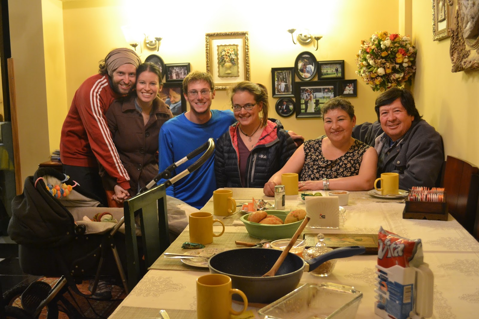
The road to Riobamba is almost completely downhill. It's a beautiful and speedy descent on pavement. Once in town we get some bread for a late lunch and find the place of the warmshowers hosts we contacted. In a short while we are welcomed into an amazing family, Borja, Nathalie, their adorable new baby, and Nathalie's parents Luci and Pubi. They welcome us in with hot showers, a washing machine, and later a delicious meal of traditional Ecuadorian food and chocolate. I think we are the luckiest people in the world.


July 24th
Rest day in Riobamba! Time for shopping, shoe fixing, bike cleaning, blog updating, route planning, and most importantly eating too much ice cream!

Ice cream with Luci


We found a zapatera to fix our worn-out shoes

Sunset over Riobamba
Route Notes:
- Zumbahua to Angamarca: Smooth, paved ascent out of town. Take a left near the top of the climb (it's signed for Angamarca) and find a scenic, well-surfaced dirt road topping out around 13,500 feet. There's a descent into a beautiful valley, another climb, then a bumpy downhill to the town.
- Angamarca to Cunuyacu: We took the squiggly but relatively direct road on Open Maps (MotionX Terrain), descending to the river on the route to El Corazon and hanging a left steeply uphill just before crossing the second bridge. The map indicates that the left next to the bridge links up with the desired road via nothing more than a narrow trail, but numerous people told us this was the way and indeed it was, an easy-to-follow road the whole way. At one point, as you near Simiatug, there's a fork; go left, uphill. At the second fork, really a T-junction at a switchback, take a right to descend to Simiatug or a left for Cunuyacu. The surface was generally good, though some parts had tons of large, loose rocks that made riding downhill a bit sketchy and demanded some pushing on the steep uphills. After the initial ascent out of the river next to Angamarca, the road surface got better. Cobbles on the last part of the descent into Cunuyacu, but it's worth it: hot springs await!
- Cunuyacu to Riobamba: Follow the Antigua Via Flores uphill until it meets up with the Ambato-Guaranda highway. Good shoulder on that road, some traffic but not overwhelming. A left into the park - there's a sign for Riobamba, 51 km - brings you up to a high pass then way down on the other side. All good pavement, the occasional car, and a lot of vicuñas.

Sunday, July 19, 2015

Off the Beaten Track, July 14-19

Quito-Sangolqui-Parque Nacional Cotopaxi-Lasso-Toacazo-Isinlivi-Yanaurcu Grande-Chugchilan-Lake Quilotoa-Zumbahua

Before the actual post, here are a few photos from our time in Mindo.
Rufous-tailed Hummingbird, Mindo

Cloud Forest

July 14th
It´s hard to say goodbye to our wonderful hosts who have provided a second home for us here in Quito, and to all our new friends at Construbicis.  We can´t thank you all enough!! 
For some bike-building photos, see here.

We end up leaving Quito around one in the afternoon after spending an educational morning with Carlos learning about a few important bike maintenance techniques. Despite the large size of Quito, the ride out of the city isn´t too bad.  We take a bike path down to the old town and then a busy road which fortunately has a shoulder for much of the way.  After a big descent on the Pan-Am, we turn off onto the old highway, which takes us through a collection of small towns and has much less traffic. Since it´s already getting late, we decide to stop in the town of Sangolqui, where the friendly firefighters let us stay at their station.  It´s the nicest station I have ever seen, with a huge tower for practicing rescues from high buildings, a volleyball and basketball court, and a massive dorm room that no one is using, except for, now, us.  Best of all?  Bakery and fruit store right across the street.

July 15th
We sleep in a bit, tired from a week of bike building and learning that was more exhausting than we expected. Out of town, our road is paved then turns into smooth cobbles, then into uneven stone cobbles. Slowly we begin to bump our way up into the high mountains. The road is beautiful, bordered by green farmland, river gorges, and the occasional large waterfall. The bumpy ride is improved by our new shocks and wide tires, but it´s still exhausting. Soon, after a quick lunch in a tiny town, we leave the farm land and enter high altitude paramo (grassland). From here the skyline opens up and views are incredible. On the right, a jagged caldera, on the left, a colorful rocky peak poking into the clouds, and in front, the immense, snow-covered volcano, Cotopaxi.


Volcan Sincholahua, en route to Cotopaxi

When we´re tired of climbing on the rough road, we start looking for somewhere to camp.  With a bit of unexpected luck we find the perfect spot.  In a few minutes the tent is set up on soft green grass next to a series of three waterfalls and a pool with a small pebbly beach. We´re bordered by rocky cliffs that block the wind and provide a breathtaking view of Cotopaxi when we climb to the top of them.  What an amazing place we are in.
Cotopaxi was a bit shy. This picture was taken from an altitude of around 12,000 feet, which gives some scale to just how big the volcano is.
July 16th
We wake up to sunshine and clearing clouds after a night of rain. Our campsite is blissfully warm and sunny, but once we´re back up on the road we feel the full force of the chilling wind. Thankfully the climb is gradual, and after a night of rest, I´m better prepared to tackle the sandy road. It´s not long before we reach the park entrance, where two friendly rangers greet us, take down our names and wave us through. We continue into a grassy wasteland strewn with boulders from an eruption long ago.  On closer observation, the area is quite beautiful, bursting with wildflowers.  I spot red paintbrushes, yellow asters, purple-blue lupines, and fragile geraniums. Flying around us are some andean lapwings and carunculated caracaras, both new species for us! Unfortunately, the huge volcano at our side is mostly hidden by clouds; you would hardly know it was there.

The Cotopaxi Plateau. I was riding on a trail next to the road, Tam on the road.

We stop for lunch behind a huge boulder sheltered from the wind and enjoy the landscape for a bit longer before decending out of the park.  The road turns to pavement part way down, which makes for an excellent, smooth ride. Near the bottom of the descent we turn off onto a smaller road that runs parallel to the Pan-Am. Here there is no traffic, and we are shaded by glorious eucalyptus trees on both sides.  After a little while we start passing huge greenhouses that are filled to the brim with long-stemmed roses. Apparently Ecuador is famous for these roses, the majority of which, wierdly, are exported to Russia.
After doing some shopping in Lasso, a town near the Pan-Am, we cross the huge road and start climbing into the mountains on the other side. Up and up we go, until around 11,000 feet I´m tired of climbing and we decide to stop for the night. A friendly guy we talk to gives us permission to camp in the yard of a local recreation center.  It´s a nice place, with a volleyball court, soccer field, and pool! Soft flat grass to camp on tonight.

July 17th
As we´re heading out in the morning, the family who lives on the property as caretakers bring us out a steaming bowl of soup.  We have barely spoken to them, and yet they thought to make us breakfast.  So generous! The soup, at first glance, looks good, filled with onions and potatoes, and it is good, filling our bellies with warmth. Unfortunately, at the bottom we discover huge pieces of chicken.  We determine that they´ve probably given us the choiciest bits because we can´t recognize what any of them are. A liver? A heart? We try to throw a few pieces to the dog when the family isn´t looking, and then give the rest back with the excuse that we´re not used to eating chicken in the morning. The small kids seem happy enough to eat what´s left. What a kind gesture!
Our first bit of riding is a paved climb, but soon we turn off onto a cobbled road for a scenic detour recommended by other cyclists.
Cobbles and Cotopaxi, route from Toacaso to Yanaurcu Grande

The cobbles are awful for riding, but happily, when our road begins to climb in earnest, it becomes paved. So begins an unbelievably spectacular ride, gentle switchbacks with little traffic, and amazing views of Cotopaxi across the valley as it finally starts to emerge from the clouds. 
At the top we find a tiny town where we buy some snacks. We notice that everyone here has toughened, reddened cheeks. I imagine that this is a result of cold wind chill and sunburn, the trials of living at such high elevation. Despite the tough environment, the ladies are incredibly fashionable. High heels are the norm. Pair this essential with tights, a fancy long pleated skirt, sweaters, carefully knitted shawls, and the characteristic felt hat, and you´re ready for life as an Andean lady. I don´t know how they manage to keep warm while looking so nice.
Fields and Cotopaxi
Ascending to 13,000 feet on ¡pavement!
The church in tiny Yanaurcu Grande

Out of town our road turns sandy and rocky, and the wind really picks up.  At one point it literally blows our bikes around. Most of the time I´m focused on the trials of the road, but when I do have occasion to look up, the scenery is fantastic. Surrounding us are green hillsides with long, fluffy white grasses blowing in waves with the wind, and huge jagged boulders.  Volcanic remnants perhaps?
Finally we reach the top of the pass and it is time to head down.  We stop multiple times as Danny helps me improve my mountain biking skills. I can ride all day and night on pavement, but I still need a lot of practice to feel confident on these rocky mountain roads. It´s worth the challenge for the amazing places we get to visit.
Once in the picturesque town of Isinlivi, we decide to splurge and pay to camp at a hostel.  We cook up a delicious dinner and enjoy talking to the lady who runs the place.  She gives us info for a shortcut we can take tomorrow!

More fields
July 18th
After a big oatmeal breakfast, we´re back on the road. Out of town we descend a ways down to a river valley, and then begin to slowly climb back up. We begin following the lady´s vague directions for the shortcut, and at first the road surface is good and climbs gradually up the cliff along the river.  When we reach a junction, we´re not sure where to go, but luckily a truck pulls up (the only car we have seen all day) and the friendly family inside gives us some road beta. We decide to head right and up to the main road.  Not quite as easy as it sounds.  The road turns extremely steep, with loose sections of rocks and sand.  We´re reduced to pushing our bikes in sections. Still, all things considered, when we reach the main road, we agree that the shortcut was faster, more scenic, and a better challenge than taking the main road out to Sigchos.


The back route to Chugchilan
More of the back route

Back on the main highway, we rejoice in easy grades and well packed dirt. Almost as good as pavement! Below are houses perched on cliffs, small green vertical farms, and the cliffs of the impressive river gorge.  I imagine that in the U.S. this would either be a National Park or these houses would be worth billions of dollars.
Hungry, we stop for lunch where some ladies are cooking things on the side of the road. Turns out they have fried potatos, eggs, huge avocados (for 30 cents), and mandarins. Paired with our bread and cheese, we couldn´t ask for a better lunch! 
Shortly after eating we´re back on our bikes and cruising into the town of Chugchilan. Here we discover that the rest of the road to Lake Quilotoa is paved! This will make our afternoon much easier! Even better, there are very few cars on the road, with the exception of a pack of driving school cars, mostly piloted by older men who I assume never had the chance to learn how to drive when they were younger. Many of them honk at us in greeting. Pretty much everyone we pass is friendly and waves in greeting.  At one point we encounter some kids who chase after us, asking us questions and helping us up the hill by pushing our bikes from behind as we ride. Nice to have a boost! Then they start asking us for money. This is a tough situation, and not the first or last time we will be stuck in it. Obviously we have more than these kids, but giving them a dollar isn´t going to fix anything; if anything it will only teach them to beg for money from other light-skinned people, and that certainly isn´t a formula for success in life. We want to help, though, so we give them a few bread rolls that we had in our bags for an afternoon snack. They eagerly snatch them, and we continue pedaling. We decide that from now on we´ll carry some cookies for this sort of situation.

The last part of the climb is the toughest. Workers have avalanche-proofed the hills on either side of the road by covering them with cement, creating a gray tunnel with nothing else to look at but the similarly gray sky above.  The wind starts blowing in our faces, and the air turns frigid. The road is steep and seemingly never-ending.  Around every turn I keep hoping for it to level off, but we keep climbing. Finally, what a joy it is to reach the top and put on our warm layers! From here it is a short descent into a small valley by the lake. Excited to see this world-famous destination, we ride our bikes up to the viewing platform. Spectacular! Such a reward for all our hard work today. A glistening blue-green lake far below, bordered by steep cliffs. There are no roads, just small trails and tiny villages. In every direction stretch more mountains, the sun highlighting some, clouds floating among others. It´s wild.
Lago de Quilotoa
A pensive dog

We ask some American tourists if they would mind taking a picture of us with our bikes.  They seem a bit embarrassed to admit that they came from Quito today via bus.
Back in the town of Quilotoa, a little collection of houses near the rim, we find a place to stay for $10. It´s freezing up here with the wind, so it´s worth it to pay for a bed inside tonight and a hot shower. The family who owns the place lets us use the kitchen to cook dinner, and afterwards the place warms up with a big fire in the wood stove and some flying, passionate, indigenous music.  Danny joins in with his ukulele. The littlest kids of the family stumble around trying to dance and are completely adorable.

July 19th
Jose: an artist, musician, and father in Quilotoa
My sore legs make me reluctant to get going in the morning. We sleep in a bit then have breakfast and spend some time with Jose, the owner of the hostel, helping him learn English.  He says that whenever English-speaking travelers come through he tries to learn a little, and he already has a notebook filled with some common phrases.  We help him with hostel-specific things, like how to say ¨$8 per person,¨ ¨we have rooms with private bathrooms,¨ ¨we have showers with hot water,¨ etc. Jose is also an artist, so we help him with some painting-specific vocabulary and he shows us around his artist workshop, a beautiful place filled with brilliant paintings of the local landscapes and indeigenous people. He tells us that his dream is to be able to exhibit some of his work internationally. I don´t know anything about art exhibitions, but if anyone reading this is interested in exhibiting or selling some spectacular Ecuadorian art abroad, let us know!

Inspired, I head up to the lake to do my own painting, and we do some people-watching.  This place is swarming with tourists taking selfies.
After lunch, we head out.  A short ride brings us to the town of Zumbahua where we find internet and groceries. The wonderful Father at the local church opens up the school dorm next to the church for us to spend the night.  We have bathrooms, beds, and wonderful thick blankets. Such kind people.

From here we´ll be heading south on some more back roads towards the volcano of Chimborazo and then Riobamba.  There is limited internet access in these areas but we´ll do our best to write another update soon.


Route Notes:
- Leaving Quito: We connected to the Pan-Am and turned right onto the old highway after bridge #8 (the bridges are clearly labeled). From here, ask for the old highway, a roughly paved road to Sangolqui. Not sure if this is the best route out of the city, but it wasn´t bad.
- Sangolqui to Cotopaxi National Park: follow the well-signed Calle Juan de Salinas southeast out of the city to a rolling climb on cobbles. After about 15 or 20 km, the road turns to dirt at the paramo.  Windy with loose rocks and sand in places, but always rideable and beautiful.
- Cotopaxi National Park to Lasso: We took the road on the west side of the volcano.  At first it is dirt, then it turns to washboarded gravel.  Partway down, the descent becomes paved.  Near the bottom you will pass a large mine. Take a left on the road here. This is beautiful dirt, running parallel to the Pan-Am for a few kms before turning to pavement and bringing you to a bridge to Lasso.
The other option for Cotopaxi is to do the Vuelta de Cotopaxi mountain bike route around the east side. Other bikepacking blogs have info on that; check theridesouth or whileoutriding. We heard upon arriving that it was a swamp and decided against it.
- Pan-Am to Toacazo: paved ascent, not too much traffic.
- Toacazo to Isinlivi: Look for a blue sign for Insinlivi along the main road.  The road starts as cobbles for a short, mostly flat section, then there is a paved switchbacking climb. After the town of Yanaurcu Grande, the road turns to dirt\gravel\sand. An incredible ride.
- Isinlivi to main road connecting Sigchos and Chugchilan: theridesouth has info on a direct route from Isinlivi to Quilotoa, but with phrases in the narrative like ¨the suffering is not yet over,¨ that route seemed a bit too masochistic for us. We still managed to find a decent shortcut to avoid going around to Sigchos. Follow the main road on a smooth dirt/gravel descent to the big river. About 100m after crossing, take a left. It´s a small road on Open Maps. Look for yellow splotches of paint on the rocks near the junction. There´s a smooth dirt climb up to another junction where there are two options (actually three, but one is a short path to some houses): 1) Staying left/straight, we learned, takes you down a road to the river, and then up a trail to the main road. Apparently you may need to push your bike in sections. Could be fun. Or 2) Veer right. (this is what we did). This is an extremely steep climb up to the main road, with loose sections. We pushed our bikes for parts.
- Main road to Chugchilan: well packed dirt with nice grades and little traffic, excellent riding.
- Chugchilan to Lake Quilotoa and then to Zumbahua: All nicely paved, not much traffic. Steep leading up to the lake. Entrance is $2 per person, and if you want to meet Jose and his family, his place is the handicrafts store on the left just after entering the little town.