Showing posts with label Antofagasta de la sierra. Show all posts

Wednesday, January 6, 2016

Mountains to Desert, December 20-22

Antofagasta de la Sierra-El Peñon-Barranca Larga-Villa Vil-El Eje-Belén

Leaving our little hostel in Antofagasta de la Sierra, the old lady who owns it asks us for 50 extra pesos to pay for the gas we used in the kitchen. The money isn't a problem (50 pesos is only about $4) but we're frustrated that she didn't tell us before when we settled on a price for the room and use of the kitchen. When we ask her to please inform future tourists that they need to pay extra for gas ahead of time, she gets angry and says that everyone already knows they have to pay for gas. Since we have never had to pay extra for gas, perhaps this is something that only happens in Argentina?
We learn an important lesson: don't assume that anything is included in the price, even if they say it's okay to use it. We pay the money and leave.

It's a bit of a rough start to the morning. We didn't want to cause problems with the owner, since she had been so nice, but sometimes cultural expectations can cause misunderstandings. We're happy to be on the road and spend the morning zooming by huge black volcanic rocks and the cones that spewed them out, talking about culture and communication. Our road is paved for the first time in a while, so we make great progress.

Cindery volcanos dot the landscape


Around lunch time we arrive in a small town, and when we stop to fill up water at a police station, the two friendly officers invite us to eat inside. What a welcome respite from the wind!

When we emerge outside once more, the wind is still howling but it's mostly at our backs. We travel up and down the undulations of the landscape, passing numerous valleys filled with golden grasses and matching vicunas and rheas. The princess in Rumplestiltskin should have brought the king here. Is this enough gold for you? It's beautiful.

It's hard to beat this landscape illuminated by the morning sun. Behind us is a 6000+ meter mountain with a long ridgeline decorated in ribbons of snow. Ahead is a mountain that appears to have a long glacier on it, but the "glacier" is actually just a crazy-looking rock formation. Our descent brings us into a steep canyon where we discover enormous sand dunes that have spilled over the rock walls in gentle waves.

Sand beats mountain

Before long we're out of the mountains and into the lowland desert. It's hot but surprisingly green. We stop under a lovely shady tree for lunch; how I've missed trees! As we eat we're approached by a local guy. He's thin, with his belt cinched tight around his waist and a lined, sun-worn face. When we inquire about what he does here he explains that his family has a farm, but they can't grow much right now because it's so dry and it hasn't rained in a long time. They used to have a lot of animals, but now all the kids have grown up and gone to the cities, and the community here is much smaller. It sounds like urbanization, and perhaps climate change, is slowly becoming the death of the northern Argentinian farmer.

Heading down the road we do see a good amount of livestock enjoying the cool mud and water in the rivers. It's our first sighting of the famous Argentinian beef! There are also tons of new birds down here. Our favorite? Several large and noisy flocks of burrowing parrots perched on a mottled sandstone cliff. What rambunctious birds!

Our chattering friends

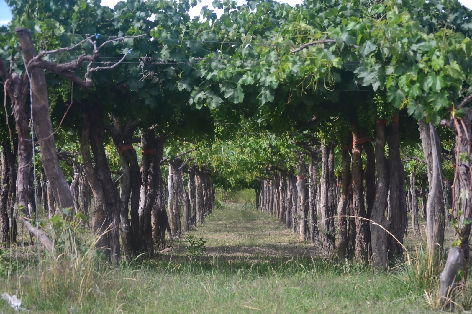
Our first vineyard sighting

A regal southern caracara

The next morning marks our first ride on Route 40. With a length of over 5,000 kilometers, this road is famous for being one of the longest roads in the world, and in fact, it would be easy for us to stay on it. We'd be in Ushuaia in less than two months! But of course, we're not doing that, as it would be far too boring. Instead we're planning on spending the next two weeks doing a remote, challenging, and beautiful loop in the mountains that will bring us little southerly progress!

Route notes:
As usual, the Pikes have got it covered here. In Belen, everything is a bit pricey except for ice cream; check out any of the many places around the main plaza.

Friday, December 18, 2015

Northern Argentina: Where Even the Singletrack is Washboardy, December15-18

Santa Rosa de los Pastos Grandes-Salar del Hombre Muerto-Abra Falda Cienaga-Antofagasta de la Sierra

We leave Santa Rosa in the morning with more water than we have ever carried on our bikes: 12 liters each! For our route south, we have only information the locals have given us (which will join with the andesbybike route in a couple days) and we don't want to take chances with water. Thus, the bikes are feeling a bit heavy, but that can't stop us from enjoying the scenery. We pass lagunas and salars with vibrant flamingos, and some not-so-vibrant flamingos. We wonder, why are two of them entirely brown?

Beautiful birds

We pedal through a canyon with incredible rock formations, huge rounded mounds of stone with odd protrusions.  I name one "the melting dinosaur." And let's not forget the vicuñas. They are everywhere.  Racing across the wide open plains, framed against the perfect blue sky and gentle greenish hills, they look like something straight out of a National Geographic special.

Perfect vicuña habitat

Sometimes you just have to stop and stare

Mining in the salar. Does anyone know what these parallel lines of rock are?

After lunch we stop a a mine close to the road, figuring that it wouldn't hurt to top off on water.  To our surprise, the guys are so friendly, they don't just top off our bottles, they send us off with six liters! Later in the afternoon, a mine vehicle stops and gives us 3 more liters of water! These guys are just too nice. We literally can't figure out what to do with all this water and all the bottles, on our normally lightly loaded bikes.

Drinking like a champ

Is it possible to have too much water? We later found another bottle stashed away in one of our bags.

It's hot and windy in the afternoon and the extra water is appreciated.  We also experience two of what I like to call "cloud moments," those wonderful seconds when a cloud sweeps across the sky and covers the sun, shielding you beneath it. Oh, what a fantastic and fleeting relief.
We are also entertained by a small aplomado falcon who is surprised by us as we go by, but as he attempts to fly off he is blasted back by the wind, bright feathers splayed wide. He ends up flying a bit farther down the road, where the same thing happens as we pass him again.

We camp behind a small abandoned house in a cloud of dusty goat poop. It's far from optimal, but it's the only windbreak out here that we can find and we're too tired to look for anything else.

We spend the next morning being entertained by the vicuñas. Inevitably, as we approach, they spook and run across the road in front of us. The challenge is to predict when they will begin to run, and then to get the camera out in time for the money shot... as you might notice, no pictures made it into this blog. Vicuña action photography is a work in progress.

Wild and remote

More climbing than we expect brings us  to the top of a beautiful pass with vistas of snowy peaks, and then down to the route we have notes on from andesbybike. We spend the rest of the afternoon climbing another pass and fighting with the wind. It is so frustrating to me how picture perfect the scenery appears. What you can't see is the invisible menace! The wind howling and whipping, and occasionally coating our sunscreened bodies in a layer of sand that simply sticks and forms the baselayer for tomorrows sunscreen coat.

We entered a new province today! Hello, Catamarca! For the night we find a windbreak behind an unmanned police checkpoint.

Setting out early we find smooth riding on a salt flat... and realize that we've missed the turn-off for the shortcut we meant to take. Our longer route takes us across the salar, then back around, and up a big hill. Immediately after leaving the salar, the road deteriorates and sets the tone for the rest of the day. Washboard, sand, and wind. My butt is far from happy.

The salar off the road is not quite so smooth, nothing like those Bolivian salars

Typical road surface...fun

 Slowly we climb up a mountain pass, and then undulate across a giant expanse of red rock.  We're tired but press on, because at this point we have limited water and need to make it to the next town early next morning.

Happily, late in the day we find an amazing rock formation which makes for a perfect windbreak, the only one we have found so far in Argentina. The wind is howling, and our tent is actually not moving. After a long day, it's such a relief to have such a great spot to sleep.

Sunset...

...and nightfall


Today we made it into Antofagasta de la Sierra! A big town! aka small collection of adobe houses. However, they do have free internet, shops, and places to stay. Best of all? Rest day tomorrow.

Meet Justin! He's from the UK, and has biked all around the world and back again!

Even the single track is washboardy

hmm, that's interesting

So many options for charging things here

Classic tacky artwork at our little hotel


Route notes:
Many cyclists who do the type of routes we do cycle the western side of this region from Tolar Grande through Antofalla. That route is presumably more difficult, but I´m not sure how, as our route had no water and difficult road conditions the whole way with plenty of ups and downs. Pertinent information can be found here. If doing Paso Socompa from Chile, it may simply be easier to head south from Tolar Grande. We went way east to climb Queva and, rather than backtracking to Pocitos and heading south from there, just headed straight south past a bunch of mines.

The mines route we took travels roughly 120 km before meeting up with the Pikes´ route at km 91 of their notes (we didn`t have an odometer, so all distances are approximate). Other than a few sandy spots we slid through, the biggest challenges, as is typical with the region, were wind and water. It`s possible to fill up your bottles at the mines, but after Mina Maggie, about 60 km from Santa Rosa, there`s nothing except one small house until the detour to the mine on the south side of the Salar del Hombre Muerto.

Even though the wind lessens at night, it`s necessary to find some sort of windbreak. There are some rock sculptures about 40 km in that might make a decent spot, a corral at about km 75, behind which we camped on loads of goat dung, and some stacks of tires at about km 95. The corral, along with a decrepit cemetery, are off to the left of the road after climbing away from the salars. It´s possible to freestyle down to them, dodging spiky plants, or you´ll pass an access road leading to them about 500 meters later. The corral is owned by the goatherd who lives in the nearby house with his dogs, but he told us it was fine to camp there. We thought it was abandoned originally. He may also be able to offer water, but we didn´t need any more so didn´t ask.
We marked a bunch of waypoints on the route, but I can`t figure out how to show them here on this map. Though the GPS track below was traced after the fact, not from an actual recording, it still accurately represents the route, and the waypoints (¨turn L¨, ¨High point¨, etc) may still be encoded in the GPS file. If not, and you would like them, send us an email and we´ll send you a gpx file with the waypoints in it.